Living shorelines: Somerset County pre-permit checklist
A shoreline project in Somerset County can look deceptively simple from the water: a line of marsh plants, coir logs, stone, or a low structure intended to slow erosion.
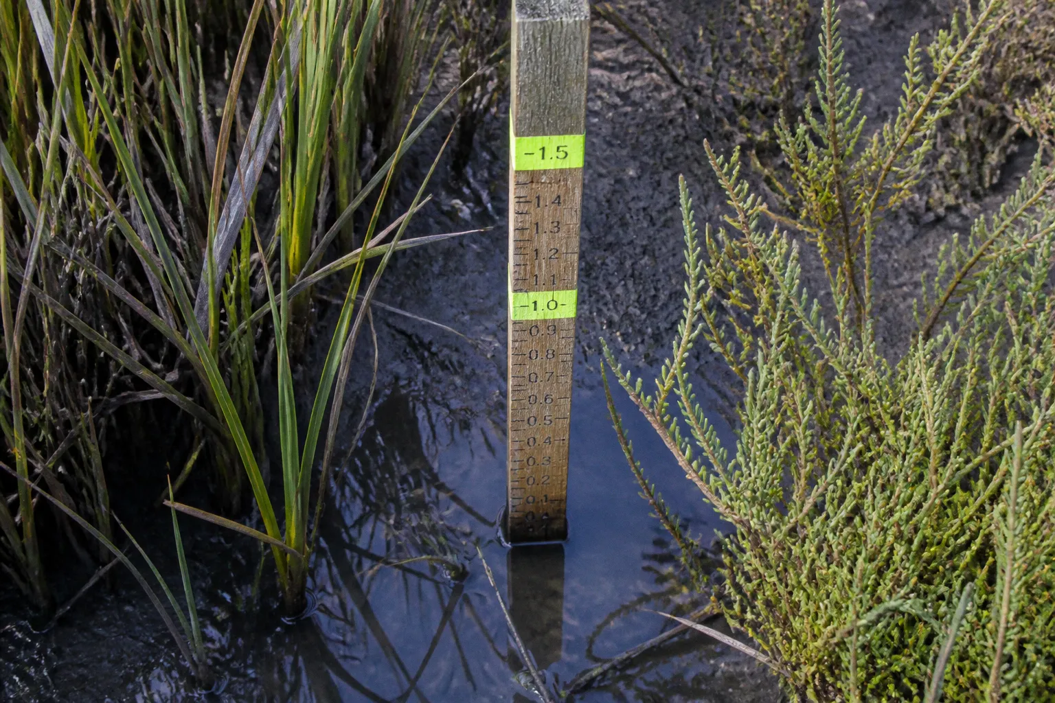
On paper, however, even a modest shoreline stabilization project may involve state tidal-wetland review, federal authorization, Critical Area requirements, and local permits. The order matters, because a design that seems reasonable on the property may not meet Maryland’s preferred approach to erosion control.
For homeowners, community associations, and landowners searching for the living shoreline permit Somerset County requirements, the first thing to understand is that the permit process begins before construction drawings are finalized. Maryland generally requires a nonstructural living shoreline for tidal erosion control unless the Maryland Department of the Environment approves a waiver based on documented site limitations.
That does not mean every waterfront property will receive the same treatment. Wave exposure, bank height, submerged aquatic vegetation, substrate, water depth, and the width of the shoreline all shape the review. The most useful preparation is therefore not collecting every possible form at once. It is building a clear picture of the site and using that information to guide the application.
Start with Maryland’s living shoreline requirement
Maryland’s Living Shorelines Protection Act, passed in 2008, established living shorelines as the primary method for controlling erosion along tidal shorelines. The approach favors techniques that work with natural coastal processes rather than replacing the edge of the water with a continuous bulkhead or other hard structure.
A living shoreline may combine native vegetation, biodegradable materials, carefully placed stone, marsh habitat, and other measures that reduce erosion while retaining ecological function. The exact design depends on the property. A broad, sheltered marsh edge will not be treated like a steep bank exposed to strong waves, and a narrow waterfront lot facing a deep channel may present constraints that a wider cove does not.
The practical consequence for Somerset County property owners is straightforward:
- Begin with a living shoreline concept, rather than assuming a bulkhead or revetment will be approved.
- Document the physical conditions that make the proposed approach suitable.
- If a structural design is necessary, be prepared to show why a nonstructural alternative cannot reasonably address the site.
- Do not begin shoreline construction while the required state, federal, and local authorizations are still pending.
Maryland’s tidal shoreline regulations apply across a very large coastal resource: the state has approximately 3,190 miles of tidal shoreline. The rule is statewide, but the project review is still highly specific to the individual property. What this means for your block is that a neighbor’s shoreline treatment is not necessarily a reliable model for your own permit application.
A nearby bulkhead may have been installed under different regulations, approved for different site conditions, or supported by a waiver that does not transfer to another property. Before treating an existing project as a precedent, we should first understand the shoreline in front of our own homes.
In Somerset County, the shoreline itself drives the permit strategy: the more clearly you document its conditions, the easier it is to explain why your design belongs there.
1. Build a site file before choosing the design
The strongest pre-permit package begins with site information, not a preferred construction method. If the first question is, “How do we get a bulkhead approved?” the project may be moving in the wrong direction. A better starting point is, “What is happening at this shoreline, and which treatment responds to those conditions with the least disturbance?”
The Maryland Shoreline Stabilization Mapper, developed by the Maryland Department of the Environment and the Virginia Institute of Marine Science, is one of the key tools for this first review. The mapper helps evaluate several conditions that affect the feasibility and design of shoreline stabilization:
- Wave exposure, or fetch: the distance across open water over which wind can generate waves before they reach the property.
- Bank height: the vertical or steepness-related challenge presented by the existing shoreline.
- Submerged aquatic vegetation, or SAV: underwater plant habitat that can affect project design and environmental review.
- Substrate conditions: the composition of the bottom and shoreline materials, such as mud, sand, gravel, or other material.
- General shoreline setting: whether the property sits along a sheltered cove, an open reach, a narrow waterway, or another coastal condition.
The mapper is not a substitute for a site-specific design or agency review. It is a way to make early decisions more informed. A property owner can use it to identify questions for a designer or reviewer before paying for a final plan that later needs substantial changes.
Your initial site file should also include photographs taken from several angles and, where possible, under different tidal or weather conditions. Photograph the shoreline from the landward side, along the water’s edge, and toward both neighboring properties. Include visible erosion, exposed roots, failing banks, standing water, existing drainage outlets, marsh vegetation, and any structures already near the shore.
A simple written record can be just as useful as photographs. Note where the bank appears to be retreating, where water concentrates during storms, and whether erosion is occurring along the entire property or only at a particular corner. This helps separate a shoreline-wide problem from a drainage or concentrated-flow problem that may need a different response.
A practical pre-permit site review
| Site question | Why it affects the project | What to gather |
|---|---|---|
| How exposed is the property to waves? | Greater wave energy can change the type and strength of stabilization needed. | Mapper results, shoreline orientation, photographs, notes on storm exposure |
| How high or steep is the bank? | A steep bank may require grading, planting, or additional stabilization measures. | Bank measurements, site photographs, preliminary survey information |
| Is submerged aquatic vegetation present? | SAV can affect the location, footprint, and environmental review of proposed work. | Mapper information and field observations |
| What is the shoreline and bottom material? | Substrate influences plant establishment, erosion behavior, and construction methods. | Soil or substrate observations and preliminary technical information |
| Is the project inside the tidal Critical Area? | Critical Area rules may require buffer planning and notification documents. | Property mapping, buffer information, and local review guidance |
| Are there existing drainage or shoreline structures? | Existing conditions can change how water moves through the site and how the proposal is reviewed. | Photographs, sketches, and records of existing improvements |
This stage is also where we should identify the limits of our information. The mapper can point us toward a feasible direction, but it cannot answer every engineering or permitting question. If the bank is actively failing, the property is exposed to strong waves, or the proposed work would alter tidal wetlands, professional help is usually more useful before an application is filed rather than after an agency requests revisions.
2. Schedule a pre-application conversation
Maryland environmental agencies recommend pre-application meetings with wetland reviewers before formal submission. For a Somerset County project, this conversation can help clarify the site constraints, the likely scope of review, and the documents that should accompany the application.
Bring preliminary drawings rather than waiting for a perfect final plan. The goal is to discuss the concept while changes are still manageable. A useful preliminary package may show:
- The property boundary and approximate shoreline;
- Existing buildings, decks, docks, bulkheads, or other structures;
- The location of visible wetlands or marsh areas;
- The proposed living shoreline footprint;
- Any proposed grading, fill, stone, planting areas, or access routes;
- The location of drainage features and nearby properties;
- Photographs that show the current condition of the bank.
A pre-application meeting is not an approval, and it does not eliminate the need for formal permits. It is better understood as a way to navigate the board before the board is reviewing a completed package. Questions raised at this stage can prevent a common and expensive mistake: commissioning detailed plans around a construction method that does not fit the site or the applicable rules.
When preparing for the meeting, bring specific questions. For example:
1. Does the proposed work affect a tidal wetland or tidal water area requiring the Joint Federal/State Application?
2. Is a Critical Area Buffer Management Plan required for this property?
3. Does the preliminary design appear consistent with a living shoreline approach?
4. What site conditions would need to be documented if structural stabilization is being considered?
5. Which portions of the project require local Somerset County or municipal authorization?
6. Will proposed access, grading, or material staging create a separate review issue?
This kind of conversation is especially useful when the property sits near a municipal boundary, a drainage outlet, an existing shoreline structure, or an environmentally sensitive area. Permit responsibilities can overlap, and a project that appears to be only a shoreline repair may also involve grading, sediment and erosion control, or Critical Area review.
3. Prepare the joint federal and state application
For a living shoreline project in Somerset County that requires tidal-wetland authorization, the core state and federal filing is the Joint Federal/State Application for the Alteration of Any Tidal Wetland in Maryland. This application is submitted for review by the Maryland Department of the Environment and the U.S. Army Corps of Engineers.
The joint application is more than a formality. It gives reviewers a shared description of the proposed work and allows the state and federal agencies to assess how the project may affect tidal wetlands, aquatic resources, shoreline habitat, and navigable waters.
Before submitting, make sure the application materials tell one consistent story. The dimensions, property location, project purpose, drawings, photographs, and environmental information should agree with one another. If the written description says the project is limited to a narrow eroding section but the plan shows work extending across the full waterfront, that inconsistency can lead to questions and revisions.
A clear application generally explains:
- Why stabilization is needed;
- Where erosion is occurring;
- What the existing shoreline looks like;
- What living shoreline measures are proposed;
- How the design responds to waves, bank conditions, vegetation, and substrate;
- Whether grading, fill, stone, access work, or temporary construction disturbance is involved;
- How the project avoids unnecessary impacts to wetlands and aquatic habitat.
Do not describe a project as “natural” and leave the explanation there. A living shoreline still has a footprint, may require materials or grading, and must be evaluated in relation to the tidal environment. Reviewers need enough detail to understand what will be placed, where it will be placed, and how the work will be carried out.
At the same time, early plans do not need to pretend that every design decision is settled when it is not. If a field survey or agency discussion is needed to confirm the location of SAV, the limits of wetlands, or the feasibility of a particular treatment, identify that issue rather than hiding it behind vague language.
4. Address the Chesapeake Bay Critical Area buffer
Many Somerset County waterfront properties fall within Maryland’s Chesapeake Bay Critical Area framework. The Critical Area includes land and water near the Bay and its tidal tributaries, where development and land disturbance are managed to protect water quality, habitat, and shoreline resources.
The pre-permit issue most likely to affect a shoreline project is the Critical Area buffer. A 100-foot Critical Area buffer zone can require local oversight and buffer management planning. The exact review path depends on the property and the proposed disturbance, but a project located in or near the buffer should be treated as a local planning issue from the beginning.
For a project within the tidal Critical Area, the pre-permit package must include:
- A proposed Critical Area Buffer Management Plan; and
- A signed Critical Area Buffer Notification Form.
The buffer plan should explain how the project relates to existing vegetation, the shoreline edge, structures, access areas, grading, and stormwater movement. It should not be treated as a decorative planting diagram added at the end of the permit package. The buffer is part of the site’s protective system, and the plan should show how the proposed work preserves or improves that function.
This is also where the connection between shoreline stabilization and watershed management becomes visible. A shoreline may be eroding because of waves, but runoff from an uphill driveway, roof, or poorly directed drainage feature can add another source of stress. A buffer plan that only shows plants without addressing concentrated runoff may miss part of the problem.
When reviewing the property, look for:
- Bare soil or ruts that send stormwater toward the shore;
- Downspouts discharging near the bank;
- Driveways or paths that cut across the buffer;
- Areas where vegetation has been removed;
- Standing water or channelized flow after rain;
- Existing landscaping that is difficult to maintain and leaves the soil exposed.
The purpose is not to turn a shoreline permit into a complete redesign of the property. It is to make sure that the stabilization project is not asked to solve a drainage problem created farther inland. Good shoreline planning connects the water’s edge to the land behind it, because that is how the community fabric of a watershed actually works.
A buffer plan is not paperwork added around the shoreline project; it is the part of the plan that explains how the land behind the shoreline will continue to protect the water.
5. Add local grading and sediment-control authorizations
State and federal tidal-wetland review does not replace local approvals. In Somerset County, applicants may also need local authorizations such as grading permits and sediment and erosion control permits.
The local requirements depend on the scope and location of the work. Proposed grading, soil disturbance, access routes, material staging, and changes to drainage can all affect which local reviews apply. The safest approach is to identify these requirements while the shoreline concept is still being developed, not after a state application has already been submitted.
A local permit package should align with the joint federal and state application. Use the same property information, project limits, dimensions, and proposed construction sequence unless there is a clear reason for a difference. Separate drawings that describe separate versions of the project make it harder for reviewers—and for you—to see what is actually being proposed.
A useful coordination list includes:
- Local grading authorization;
- Sediment and erosion control review;
- Municipal authorization, where the property lies within a municipality or local jurisdiction;
- Critical Area buffer materials;
- Any additional local drawings or site plans requested during review.
Specific county-level fee schedules and internal processing times should be confirmed directly with the relevant local office; they are not uniform facts we should guess at. Processing can also depend on whether the project requires revisions, whether multiple agencies are reviewing the same footprint, and whether the proposal raises questions about wetlands, drainage, or access.
Keep the construction sequence visible
Even a well-designed living shoreline can create temporary impacts during construction. Your drawings and narrative should explain how equipment and materials will reach the site, where soil will be placed, how disturbed areas will be protected, and how the shoreline will be restored after installation.
This does not mean adding technical detail for its own sake. It answers the practical questions that often determine whether a proposal feels workable:
- Will heavy equipment cross a vegetated buffer?
- Will access disturb a wetland?
- Could loose soil reach tidal water during rain?
- Are materials being placed in the water or only on the upland bank?
- How will newly planted areas be protected while they establish?
When we explain the sequence clearly, the project becomes easier to evaluate as a whole. The permit is no longer just a line on a map; it is a description of what will happen to the property, the water, and the neighboring shoreline during each phase of work.
6. If considering a bulkhead or revetment, document the constraint
Structural stabilization—such as a bulkhead or revetment—is not the default alternative to a living shoreline in Somerset County. To obtain a waiver, the property owner must use the MDE Living Shoreline Waiver Request Worksheet and demonstrate extreme site limitations.
Examples of potential limitations include:
- High wave energy;
- Excessive water depth;
- A narrow waterway;
- Other conditions that make a nonstructural living shoreline impractical for the specific site.
The waiver request should be treated as a technical argument supported by site evidence, not as a preference statement. Saying that a bulkhead is easier to maintain or that a neighbor has one does not establish that the property cannot support a living shoreline. The relevant question is whether the documented physical conditions create a genuine limitation.
This is why the early site evaluation matters so much. Mapper information, photographs, preliminary drawings, bank measurements, and professional observations can all help explain the site. If the proposed structural design is needed because of a narrow waterfront, unusually strong wave exposure, or significant depth close to shore, those conditions should appear consistently in the waiver worksheet, plans, and supporting materials.
Do not assume that submitting the worksheet authorizes construction. Structural stabilization cannot proceed unless the Maryland Department of the Environment approves the waiver and the project receives the other required authorizations. A waiver is one part of the review path, not a replacement for the tidal-wetland application, Critical Area materials, or local permits.
A Somerset County pre-permit checklist
Before submitting a living shoreline proposal, we should be able to answer yes—or identify the person responsible for answering—to the following:
1. Have we described the erosion problem rather than starting with a preferred structure?
The project purpose should explain where erosion occurs and what conditions contribute to it.
2. Have we reviewed the Maryland Shoreline Stabilization Mapper?
Record information about fetch, bank height, SAV, and substrate so the design conversation begins with site conditions.
3. Have we collected photographs and preliminary site information?
Include the shoreline, bank, neighboring edges, existing structures, vegetation, drainage features, and access conditions.
4. Have we considered a living shoreline as the primary approach?
The initial design should reflect Maryland’s regulatory preference for nonstructural stabilization.
5. Have we requested a pre-application meeting with the relevant wetland reviewers?
Bring preliminary drawings and a focused list of questions.
6. Have we determined whether a Joint Federal/State Application is required?
Tidal-wetland work may require submission to MDE and the U.S. Army Corps of Engineers.
7. Have we addressed the Critical Area buffer?
If the project is within the tidal Critical Area, prepare the proposed Buffer Management Plan and signed Buffer Notification Form.
8. Have we contacted the appropriate local office about grading and sediment control?
State and federal review does not remove local authorization requirements.
9. Have we coordinated all plans and descriptions?
The same project limits, dimensions, materials, and construction sequence should appear throughout the package.
10. If structural stabilization is proposed, have we documented the site limitation?
Use the MDE waiver worksheet and support the request with site-specific evidence.
The right first move is preparation, not construction
A shoreline permit process can feel complicated because it brings together several layers of public responsibility: tidal wetlands, federal waters, Critical Area protection, local grading, sediment control, and the long-term health of the Chesapeake Bay watershed. But the process becomes more manageable when we separate it into a sequence.
First, understand the shoreline. Then test the concept against Maryland’s living shoreline requirement. Next, talk with reviewers while the plan is still flexible. After that, assemble the joint application, Critical Area materials, and local authorizations as one coordinated package.
For homeowners and communities in Somerset County, this approach does more than reduce the risk of a rejected or incomplete application. It helps ensure that shoreline stabilization works with the property’s actual conditions instead of forcing every waterfront into the same template. What this means for your block is a project that protects the bank while respecting wetlands, habitat, neighbors, and the water system that connects them all.
The best pre-permit checklist is therefore not a stack of forms. It is a clear explanation of the shoreline, the problem, the proposed response, and the evidence showing why that response belongs on that particular piece of Somerset County waterfront.