Critical area buffer mistakes in Somerset County
The 100-foot Buffer does not negotiate. Neither does the possibility of a fine of up to $10,000 per day when Somerset County treats a Chesapeake Bay Critical Area Buffer violation as an ongoing offense.
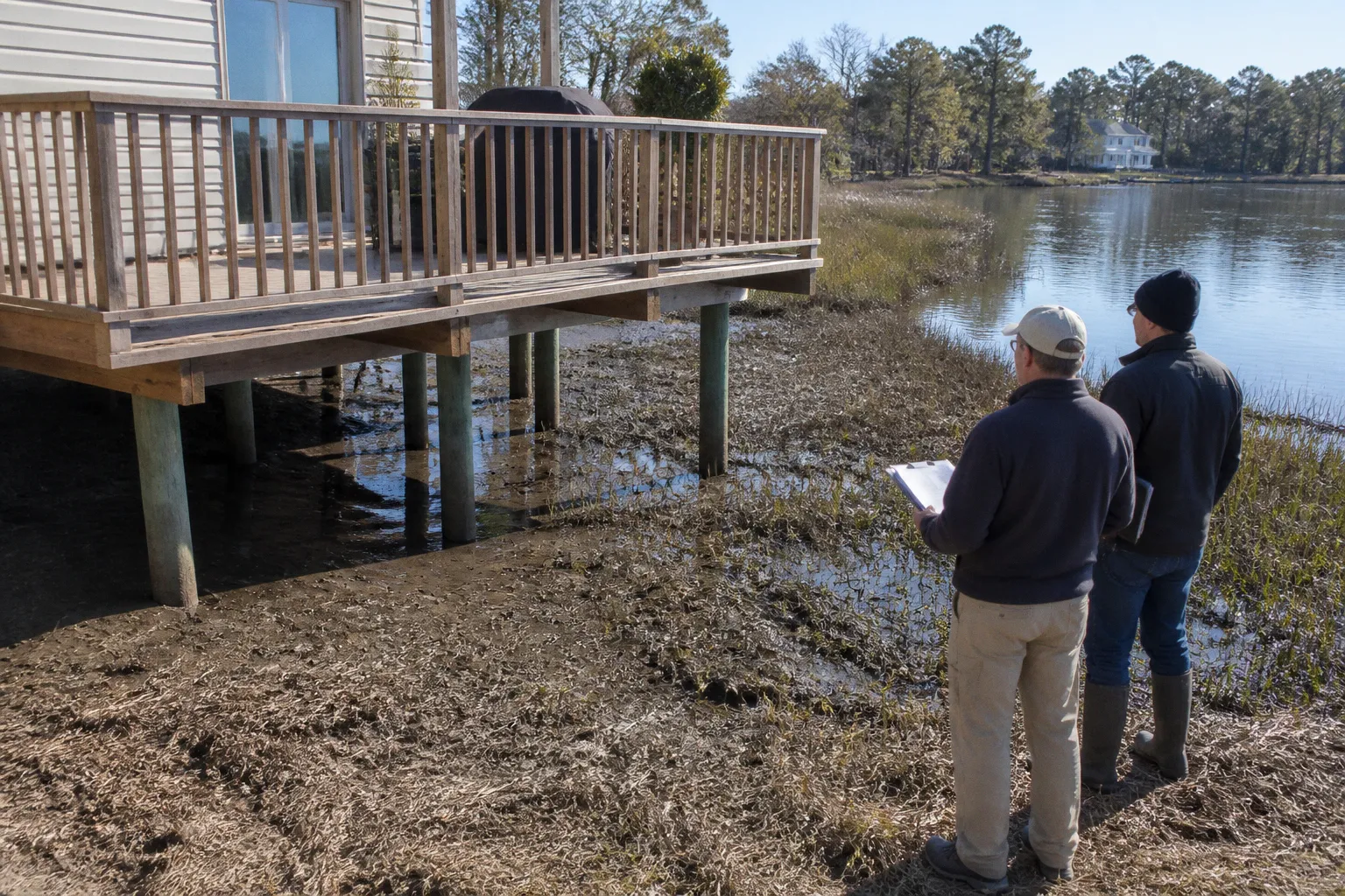
That is a statutory maximum, not an automatic invoice: the actual penalty depends on the county’s enforcement process, the facts of the violation, and what happens after the property owner is notified. But the number is large for a reason. A violation can remain open while the owner is arranging restoration, preparing a Buffer Management Plan, or disputing the scope of the disturbance.
Behind the dollar figure sits a physical reality many property owners underestimate: a vegetated strip, at least 100 feet wide in ordinary circumstances, where clearing a tree, grading soil, or running a bush-hog without an approved plan can trigger restoration and mitigation requirements. The financial exposure does not end when the machinery leaves the site. It can continue until the disturbed ground is restored and the county accepts the corrective work.
The Buffer is the load-bearing wall of shoreline protection in Somerset County. Cut into it without the required paperwork, and the regulatory structure around you does not bend — it breaks your budget. The rules are not new: the Maryland Critical Area Act dates to 1984, and the Atlantic Coastal Bays were added to the state’s Critical Area framework in 2002. What has changed for many landowners is the practical cost of treating the Buffer as ordinary yard, pasture, or developable ground.
Understanding what the Buffer actually is, what activities create a violation, and which mitigation plan applies is the difference between a project that moves cleanly and one that turns into a restoration order, daily penalties, and a difficult title problem.
Defining the 100-Foot Buffer and Its Expansion Triggers
The Buffer is a measured strip of land, not an abstract setback line painted on a plat. In Somerset County, the ordinary minimum is 100 feet landward from the Mean High Water line of tidal waters, tributary streams, and tidal wetlands. That measurement begins at the water, not at the property line. It follows the shoreline as the shoreline actually runs.
A creek meandering through the back of a parcel pulls the Buffer with it. Every bend matters. A property owner who measures a straight 100-foot line from one point on the bank may end up working inside the regulated area at another point where the creek curves, widens, or meets a wetland.
The 100-foot distance is the floor, not always the ceiling. The Buffer can expand, up to 300 feet, where adjacent land includes steep slopes or highly erodible soils. The expansion is tied to soil classifications, slope conditions, and county mapping. It is not something a buyer can waive in a contract or negotiate away after closing.
A parcel with a slope draining toward a tidal creek may therefore have a regulated envelope that reaches well beyond the visible shoreline vegetation. The landowner’s informal boundary — “the trees stop here,” “the lawn has always ended there,” or “the creek is still farther down the hill” — is not the legal boundary. Clearing or grading inside the expanded area can be treated just like work inside the standard 100-foot strip.
A 100-foot Buffer tracks the water, not the property line. A creek in the back forty means Buffer in the back forty.
The broader Critical Area extends 1,000 feet landward from tidal waters and tidal wetlands. That larger boundary governs land use, development intensity, habitat protection, and other activities across the rest of the parcel. The Buffer is the inner ring of that Critical Area, and it carries the strictest vegetation and disturbance controls because it performs the most immediate physical work:
- It filters runoff before sediment and nutrients reach the water.
- It holds bank soil in place against tidal erosion and stormwater flow.
- It provides habitat and a transition zone between upland activity and the shoreline.
- It removes or slows nitrogen and phosphorus that would otherwise move directly into the Bay and connected tidal waters.
That is why a tree removal request is not treated solely as a landscaping decision. The county is looking at the function of the vegetation, the slope, the soil, the distance to water, and the effect of the disturbance on the rest of the site.
Why the boundary is easy to misread
On the ground, the Buffer rarely announces itself. There may be no fence, painted stripe, or permanent marker at the 100-foot point. The Mean High Water line may not correspond to the edge of mowed grass, the top of a bank, or the place where a landowner usually launches a boat.
The boundary may also cross several types of ground on the same parcel:
- An existing lawn near the house.
- A band of shrubs and young trees.
- A steep bank leading toward a creek.
- A tidal wetland or low area that changes with water conditions.
- A previously disturbed area that still remains subject to restoration rules.
Before clearing near tidal water, a landowner should have the boundary located on the actual site rather than relying on a rough tape measurement from an aerial image. The cost of checking the line before work begins is usually modest compared with the cost of reconstructing it after a violation notice.
Common Violations: Why Bush-Hogging and Clearing Are Prohibited
The most common Buffer violations are often the least dramatic from the operator’s seat: clearing brush, cutting saplings, grading a path to the water, burning a brush pile, or running a bush-hog through the understory. Those activities may look like ordinary property maintenance. Inside the Buffer, they are disturbances.
The distinction matters because the county does not evaluate the work only by its purpose. “I was improving access,” “I was removing storm damage,” or “I was cleaning up invasive growth” does not automatically authorize mechanical work. The method, location, extent, and effect of the work all matter.
The list of activities that can create a violation includes:
- Clearing trees, shrubs, or native understory.
- Cutting vegetation that is not part of an existing maintained lawn.
- Burning or piling cleared material inside the Buffer.
- Grading soil for a path, driveway, pad, or drainage change.
- Bush-hogging or using other mechanical clearing equipment.
- Expanding turf or replacing native vegetation with lawn.
- Disturbing soil while installing an unapproved structure or access route.
A single removed sapling can matter. So can a mower pass that exposes soil, clips native regeneration, or expands a maintained lawn into an area that was previously vegetated. The county is not required to treat a small disturbance as harmless simply because the disturbed area is small.
The bush-hog problem
Bush-hogging receives particular attention because it is fast and indiscriminate. A rotary cutter does not reliably distinguish between invasive phragmites, multiflora rose, native shrubs, and young trees that are contributing to the Buffer’s structure. It cuts the entire surface, often leaves bare or compacted soil, and can make a previously continuous vegetated strip look like a field edge.
That creates several problems at once. The owner may have removed vegetation without approval, disturbed soil, altered habitat, and created a restoration obligation. The fact that the work was completed in a single afternoon does not make it routine maintenance.
Inside the Buffer, bush-hogging is not a matter of weighing convenience against a recommendation to be careful. Unless the work falls within an approved plan or a specific exception, the machinery itself can create the violation.
Invasive-species removal is narrow, not open-ended
Invasive species removal is the exception most likely to be misunderstood. If phragmites, multiflora rose, or another invasive plant is displacing native vegetation, removal may be allowed under a Simplified Buffer Management Plan. But that does not turn the Buffer into a mechanical clearing zone.
The permitted approach is limited. The work may require:
- Hand tools or a backpack sprayer rather than a tractor or commercial mower.
- An approved Simplified Buffer Management Plan.
- A defined treatment area.
- A schedule for replanting native species.
- Follow-up maintenance to prevent the cleared area from becoming bare or reinvaded.
Bringing a bush-hog into the Buffer because the invasive growth is extensive is not automatically justified by the environmental purpose. Mechanical removal can be the same violation as clearing native vegetation if it is not specifically authorized.
The plan should also distinguish between removing the invasive canopy and leaving the soil unprotected. A successful project is not merely one in which the unwanted plant is cut down. It is one in which the site is stabilized and replanted so the Buffer can perform its filtering and erosion-control functions again.
Existing lawn and routine gardening
Routine gardening and mowing of an existing lawn are treated differently from the creation of new lawn or the clearing of native vegetation. The practical question is whether the turf was already established and maintained before the relevant Buffer restrictions applied.
If a lawn has long been maintained as lawn, continuing to mow it does not necessarily require a new Buffer plan. But the exception has limits. It does not authorize:
- Expanding the lawn into native vegetation.
- Clearing a new strip to make mowing easier.
- Replacing native plants with ornamental turf.
- Grading or filling to improve the lawn.
- Using the existing-lawn exception as cover for a broader landscaping project.
The safest assumption is that maintenance of the existing footprint is different from enlargement of the footprint. Once new ground is broken, the owner may be dealing with a regulated disturbance rather than ordinary yard work.
Navigating Buffer Management Plans: Simplified, Minor, and Major
Land disturbance or vegetation removal in the Buffer generally requires a county-approved Buffer Management Plan unless it falls within a recognized exception. The plan is not decorative paperwork. It tells the county what will be disturbed, why the work is necessary, how the site will be protected, and how the Buffer’s functions will be restored or maintained.
The practical mistake is filing a plan after the work has begun. Approval is meant to precede the disturbance. A plan submitted after clearing has already occurred may be treated as part of corrective action rather than as ordinary project approval, with a different mitigation burden and a more difficult enforcement posture.
Somerset County’s plan process is commonly understood through three tiers:
| Plan tier | Scale of work | Review path | Typical application |
|---|---|---|---|
| Simplified BMP | Small, limited work with relatively low impact | Planning Office | Hand removal of invasives, native plantings, or a limited tree-related request |
| Minor BMP | Limited disturbance requiring additional technical detail | Planning Office with technical review | Small paths, limited grading, or accessory work near the Buffer edge |
| Major BMP | Significant, permanent, engineered, or commercial-scale work | Planning Commission | Permanent shoreline structures, substantial regrading, habitat replacement, or major commercial work |
Simplified Buffer Management Plans
The Simplified BMP is the workhorse for many residential parcels. It is suited to narrow, defined projects such as hand-removing invasive vegetation, planting native species, or addressing a limited hazard-tree issue where the work can be tightly described.
A strong simplified application does not rely on broad language such as “clean up the shoreline” or “remove overgrowth.” It identifies the area, the species or vegetation involved, the tools to be used, the restoration method, and the plants that will be installed afterward.
The county is more likely to understand and approve a plan when the proposed footprint is narrow and the work method is controlled. Hand tools, limited access, and a clear planting schedule show that the applicant is trying to preserve the Buffer rather than convert it into a more convenient landscape.
Minor Buffer Management Plans
The Minor BMP addresses work that touches the Buffer but does not fundamentally reshape the site. It may involve a small access path, limited grading, or an accessory use close enough to the Buffer to require technical review.
This tier brings more attention to slope, soil, drainage, and habitat impacts. The applicant may need to show how runoff will be controlled, how construction access will avoid unnecessary clearing, and how the final site will be stabilized.
A project can become more complicated even when the disturbed area is not large. A narrow path placed across a steep slope may present more erosion risk than a larger project on stable ground. The county’s concern is not simply the number of square feet; it is what the work does to water movement and vegetation continuity.
Major Buffer Management Plans
The Major BMP is reserved for substantial, permanent, engineered, or commercial-scale work. Permanent shoreline structures, significant regrading, habitat replacement, and larger commercial proposals fall into the category of projects that require a more comprehensive review.
Major plans may involve engineered drawings, construction sequencing, erosion and sediment controls, habitat analysis, and a detailed mitigation schedule. They may also require review by the Planning Commission rather than only an administrative review through the Planning Office.
For approved permanent disturbances, the mitigation ratio described in the draft regulations is 2:1. That is different from the 3:1 ratio generally associated with unauthorized disturbance. The lower ratio does not mean permanent work is freely permitted; it reflects the distinction between a project that was reviewed and approved before construction and one that was cleared first and explained later.
The MD-413 bike path is an example of the type of approved permanent impact for which a 2:1 mitigation ratio may apply. The relevant point for a private landowner is not that every project receives the same treatment. It is that approval, engineering, and mitigation planning can materially change the obligations attached to a disturbance.
Why plans are rejected
A plan can fail even when the proposed project has a legitimate purpose. Common problems include:
- A disturbance footprint wider than the work actually needs.
- A planting list that omits native species or fails to meet county requirements.
- No adequate analysis of slope, soils, drainage, or habitat.
- A proposed access route that creates unnecessary additional clearing.
- Restoration that is described in general terms without timing or maintenance details.
- Mechanical clearing proposed for work that could be completed with hand tools.
- A plan that treats the Buffer as a blank canvas instead of an ecological system.
The fastest applications are not necessarily the shortest. They are the ones that show the applicant has walked the site, drawn the footprint tightly, selected a workable access route, and matched the restoration schedule to the actual conditions on the property.
The county is not asking whether the project is convenient. It is asking whether the Buffer can still do its job when the project is finished.
The Financial Reality of Non-Compliance and 3:1 Mitigation
The 3:1 mitigation ratio is the rule that often changes a small clearing project into a substantial obligation. For unauthorized disturbance inside the Buffer, the owner may be required to plant three approved native trees or shrubs for each tree or mature shrub removed, subject to the applicable species, size, installation, and survival requirements.
A property owner who bush-hogs a 50-foot by 100-foot patch and removes twenty mature trees does not simply replace twenty trees. Under a 3:1 requirement, the obligation could be sixty replacement plantings, along with installation, maintenance, monitoring, and any additional restoration needed to stabilize the disturbed ground.
The ratio is only one part of the cost. The owner may also have to pay for site preparation, erosion control, replacement of improperly selected plants, replanting after mortality, professional plan preparation, and legal or consulting assistance during enforcement.
The ratios described in the county framework differ by context:
| Mitigation context | Ratio | Practical meaning |
|---|---|---|
| Unauthorized disturbance inside the Buffer | 3:1 | Three approved native plantings for each applicable tree or mature shrub removed |
| Approved permanent disturbance inside the Buffer | 2:1 | Two native plantings for each applicable removal under an approved plan |
| Tree clearing outside the Buffer but within the Critical Area | 1:1 | One native planting for each applicable removal |
| Invasive removal under a Simplified BMP | As specified in the plan | Replacement plantings and maintenance follow the approved schedule |
These ratios should not be treated as a simple buyout. Planting the required number of trees does not necessarily erase the disturbance. The county may still require the original area to be replanted, the soil to be stabilized, and the site to be monitored.
Daily fines: maximum exposure is not an automatic bill
Civil penalties can add a second layer of risk. The county may seek fines of up to $10,000 per day for an ongoing violation, with the precise amount and duration depending on enforcement action and the facts of the case. A notice, corrective order, appeal, partial compliance, or other procedural development may affect how penalties are assessed.
That qualification matters. It is inaccurate to say that every thirty-day lapse automatically produces a $300,000 penalty with no exceptions. The correct way to understand the exposure is that, at the statutory maximum, thirty days of an ongoing violation could represent up to $300,000 in civil penalties, but the actual amount is determined through enforcement rather than imposed as a fixed formula in every case.
The potential arithmetic is still serious. Even a penalty below the maximum can become significant when the violation remains unresolved. And the fine is not a substitute for restoration.
The fine is only one part of the bill. Restoration and mitigation are separate obligations.
Paying a civil penalty does not necessarily restore the disturbed site, satisfy the mitigation requirement, or close the enforcement file. The owner may still need to return the area to compliance, install the required native plantings, and maintain them through the county’s monitoring period.
Those obligations run on parallel tracks. A penalty addresses the enforcement consequence. Restoration addresses the condition of the land. Mitigation addresses the ecological loss. One does not automatically pay off the others.
The cheaper path is usually the approved path
An approved Simplified BMP involving hand removal of invasives and a native planting plan may cost a few hundred to a couple thousand dollars, depending on the parcel, the species, and the scope of work. That is not a universal quote, but it illustrates the difference between planning the work and correcting it later.
Unauthorized clearing can add:
- A 3:1 mitigation obligation.
- Restoration of the original disturbance.
- Erosion and sediment controls.
- Plant installation and replacement.
- Monitoring and reporting.
- Professional fees.
- Potential civil penalties while the violation remains open.
The approved path may require patience and paperwork. The unauthorized path turns ordinary maintenance into an open-ended liability. It also creates a record that can complicate refinancing, sale negotiations, insurance questions, and a buyer’s due diligence.
Regulatory Updates: Ordinance 1220 and Commercial Encroachment Limits
Somerset County has been narrowing commercial workarounds in sensitive areas through a series of recent ordinances. Ordinance 1220, approved February 24, 2026, is the latest move described in the county’s regulatory direction. It restricts new commercial retreats in the Resource Conservation Area to parcels that were already improved as of December 31, 2025.
An unimproved parcel after that cutoff cannot simply be treated as an available site for a new retreat. The ordinance also prohibits retreat construction from encroaching on the Critical Area Buffer. The proposed use cannot occupy the Buffer, and it cannot expand into it as the project changes.
Ordinance 1207, approved March 11, 2025, amended Critical Area regulations addressing commercial activity in the Resource Conservation Area. Taken together, the ordinances point in one direction: less room for new commercial development in the most environmentally sensitive areas and fewer ways to treat the Buffer as flexible development space.
A wooded RCA parcel with no existing structure, established clearing, or current commercial use may not qualify as the site for a new commercial retreat under Ordinance 1220. A parcel improved before the cutoff may still qualify for a new retreat, but the project remains subject to the prohibition on Buffer encroachment.
The relevant date is the date of improvement, not the date of sale or contract. Buying the parcel after the cutoff does not create a new development history. A deed may transfer ownership, but it does not manufacture the prior improvement needed to satisfy a land-use condition.
Commercial use does not create a Buffer exception
Commercial activity can make the review more complicated, but it does not create permission to disturb the Buffer. The same basic questions remain:
- Where is the Mean High Water line?
- Does slope or soil condition expand the Buffer?
- What vegetation would be removed?
- Would grading alter runoff or drainage?
- Is the proposed use temporary or permanent?
- What mitigation and restoration would be required?
- Does the project qualify under current RCA restrictions?
A commercial applicant may have more resources for engineering and mitigation, but that does not eliminate the geographic restriction. The Buffer remains the first constraint, not an afterthought to be addressed after the building footprint is designed.
For any parcel touching tidal water or a tidal wetland, the working assumption should be that the Buffer controls the early design. Not just the zoning. Not just the land-use category. The Buffer. Every clearing decision and commercial proposal should be screened against it before a site plan becomes expensive to revise.
What the Working Landowner Should Know
The gap between knowing the Buffer exists and knowing how to work near it is where many enforcement cases begin. The following practical points are less dramatic than a penalty notice, but they prevent the mistakes that produce one.
Locate the boundary before moving equipment
The Buffer boundary is not always visible, and a rough measurement from the house or property line is not enough. It begins at the Mean High Water line, follows the shoreline, and may expand because of slope and soil conditions.
On a flat parcel with gentle grades, the 100-foot line might run through a stand of loblolly pine. On a sloped parcel, the expanded Buffer may reach 200 or 300 feet and sit well behind the tree line that a landowner assumed marked the edge.
Before work begins, review the survey and county mapping, then confirm the actual site conditions. If the proposed work is close to the water or crosses uncertain terrain, a surveyor or qualified professional is cheaper than a restoration dispute.
Do not confuse a complaint with the start of enforcement
The county can learn about a disturbance through a neighbor complaint, aerial imagery, a site visit, or review of a permit-related matter. A landowner who believes that “no one will notice a few trees” is making a poor calculation.
A cleared strip can be visible in comparison imagery. Fresh stumps, bare soil, pushed brush, and altered turf are visible during an inspection. A complaint can also bring attention to older work that the owner assumed had disappeared into the landscape.
The absence of an immediate letter does not make the work authorized. It only means enforcement has not yet reached the property.
Treat the enforcement process as sequential
An enforcement matter commonly develops through documented stages: a notice of violation, a corrective action order, a deadline, and potential civil penalties if the violation remains unresolved. The exact process depends on the case, but ignoring the first notice usually makes the later stages more expensive.
The fine clock does not automatically pause for a weekend, holiday, vacation, or change in ownership. At the same time, the maximum daily figure should not be presented as an automatic penalty in every case. The county must apply its enforcement authority to the facts, and the actual penalty depends on what the county alleges, how long the violation continues, and how the owner responds.
The prudent response to a notice is immediate documentation and professional review:
1. Stop additional disturbance unless the county directs otherwise.
2. Photograph the site without altering evidence.
3. Gather prior surveys, permits, plans, invoices, and contractor communications.
4. Identify when the work occurred and who performed it.
5. Ask the county to clarify the alleged disturbance and required corrective action.
6. Prepare a restoration and mitigation response rather than assuming a fine alone will close the matter.
Know the difference between the Buffer and the broader Critical Area
The Buffer is the most restrictive part of the Critical Area, but work outside the Buffer may still be regulated within the broader 1,000-foot Critical Area boundary. A landowner cannot conclude that an activity is unrestricted simply because it is more than 100 feet from the water.
Tree clearing, grading, construction intensity, stormwater movement, and land-use classification can remain relevant elsewhere in the Critical Area. The mitigation ratio may change outside the Buffer, but the regulatory analysis does not disappear.
This distinction is especially important on larger parcels. The work area may be outside the mapped Buffer but still within the Critical Area, or the Buffer may expand into what appears to be ordinary upland. A site plan should identify both boundaries rather than labeling the entire question “a 100-foot issue.”
Put the plan before the project
The best time to ask whether a Buffer Management Plan is needed is before the equipment arrives. That means reviewing the project while it is still flexible enough to shrink the disturbance, change the access route, preserve a mature tree, or use hand tools instead of machinery.
The county is more likely to work with an applicant who approaches the Buffer as a constraint to design around. It is much harder to explain a project after the trees are down and the soil has been graded.
The central mistake is treating the Buffer as ordinary property
Most critical area buffer mistakes in Somerset County begin with a reasonable-sounding assumption: the land belongs to the owner, so ordinary maintenance should be the owner’s decision. That assumption fails because the Buffer is regulated for the work it performs beyond the property line.
A tree in the Buffer is not only a tree on private land. A vegetated bank is not only part of a yard. The strip slows runoff, filters nutrients, holds soil, and protects tidal water from the consequences of upland activity. The county’s rules are built around those functions, which is why apparently minor actions — a mower pass, a path, a pushed brush pile, a line of cleared saplings — can carry more weight than the landowner expects.
For Somerset County property owners, the safest working rule is simple: locate the Buffer, assume that mechanical clearing needs approval, and get the plan in place before disturbing the site. If work has already occurred, do not reduce the problem to the headline fine. The financial exposure may include a penalty of up to $10,000 per day depending on enforcement, but the larger task is usually restoring the land, meeting the applicable mitigation ratio, and bringing the property back into compliance.
The Buffer does not move because a buyer missed it, a contractor misunderstood it, or a commercial plan was drawn too close to the shoreline. The earlier the boundary and the work method are addressed, the more likely the project remains a manageable permitting question instead of becoming an enforcement file.