Critical area buffer plants: choosing the right species
The Maryland Chesapeake Bay Critical Area Program establishes a regulated land-use zone extending 1,000 feet landward from the mean high water line of tidal waters and from the landward edge of tidal wetlands.
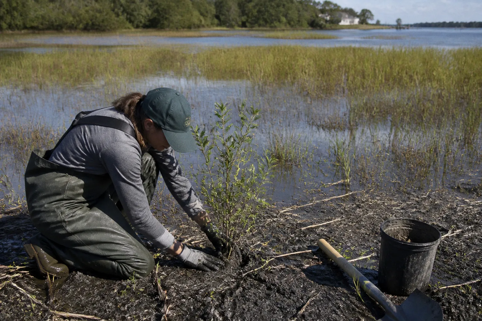
Within that zone, a minimum 100-foot buffer of natural or planted vegetation is generally required. The rule applies directly to shoreline stabilization, runoff filtration, habitat protection, and vegetation removal decisions in Somerset County.
The relevant question is not which plant has the highest ornamental value. It is whether the proposed planting satisfies buffer-management requirements, matches the site’s hydrology and salinity, and provides a stable vegetated transition between developed land and tidal water. A planting plan that ignores soil saturation, erosion exposure, or the existing buffer condition can fail both technically and administratively.
The 100-foot buffer is a regulated land area
The buffer is measured landward from the mean high water line of tidal waters, tributary streams, and tidal wetlands. It is not simply a landscaped strip adjacent to a visible shoreline. Its width can extend beyond the standard 100 feet where sensitive environmental features are present.
The expanded buffer may reach up to 300 feet when it incorporates contiguous areas such as:
- Steep slopes that accelerate surface runoff and soil movement.
- Hydric soils with recurring saturation or poor drainage.
- Highly erodible soils.
- Sensitive wetland or shoreline features connected to the required buffer.
- Other areas identified through the applicable Critical Area review.
The physical boundary therefore requires site-specific confirmation. A parcel owner should not assume that the buffer ends 100 feet from the water at every point on the property. The effective boundary may follow topographic or environmental conditions rather than a uniform parallel line.
The buffer’s vegetation performs several regulatory functions:
1. Runoff filtration. Vegetation slows overland flow and retains sediment and nutrients before they reach tidal waters.
2. Erosion control. Root systems reinforce soil and reduce the velocity of runoff on exposed slopes.
3. Habitat continuity. A natural or planted buffer provides cover and movement corridors for wildlife.
4. Shoreline protection. Trees, shrubs, and herbaceous plants reduce soil loss where wave action and stormwater affect the bank.
5. Thermal and hydrologic regulation. Vegetated cover limits direct solar exposure and improves infiltration where soil conditions allow.
A planting proposal that provides only visual coverage but does not control runoff or stabilize soil is functionally incomplete.
The correct buffer plant is determined by site conditions and statutory compliance, not by appearance alone.
Chesapeake Bay Critical Area planting options by site function
The most reliable selection process begins with the function required at the planting location. A shoreline edge, a saturated depression, and an upland buffer margin should not receive the same species mix.
The table below compares practical planting categories. The listed examples are candidate Maryland native species or groups commonly associated with buffer conditions. They are not a substitute for a Somerset County-specific approved planting plan, soil assessment, or local planning and zoning review.
| Planting category | Primary function | Candidate native examples | Main site limitation |
|---|---|---|---|
| Tidal or frequently saturated edge | Bank reinforcement and wetland transition | Black gum, red maple, river birch, buttonbush, selected wetland grasses and sedges | Prolonged inundation, salinity, wave exposure |
| Wet depression or poorly drained soil | Runoff absorption and soil retention | Swamp milkweed, cardinal flower, soft rush, sedges, winterberry | Standing water, compacted soil, limited oxygen |
| Mid-buffer shrub layer | Dense filtration and habitat structure | Buttonbush, inkberry, winterberry, serviceberry, bayberry where appropriate | Salt exposure, deer pressure, excessive shade |
| Upland buffer margin | Long-term canopy and slope stability | White oak, willow oak, swamp white oak, sweetgum, tulip poplar where site conditions support them | Drought, shallow soil, overhead utilities |
| Exposed slope | Rapid cover and erosion reduction | Native warm-season grasses, sedges, low-growing shrubs, compatible herbaceous perennials | Mowing pressure, concentrated runoff |
| Agricultural transition area | Sediment and nutrient filtration | Native grasses and herbaceous cover selected for the farm operation | Equipment access and crop-management conflicts |
Plant selection should follow a layered structure rather than a single-species row. A functional buffer normally benefits from a combination of canopy trees, shrubs, herbaceous plants, and ground-level cover. The precise ratio depends on the existing vegetation and the purpose of the planting.
Canopy trees
Trees provide long-term root reinforcement and vertical structure. They are most useful where sufficient soil depth, rooting space, and setback from structures exist. Large trees should not be placed where mature roots will interfere with septic systems, drainage infrastructure, utility corridors, or recorded easements.
Potential candidates include native oaks, red maple, black gum, river birch, and other species suited to the site’s moisture regime. However, a species appropriate for inland moist soil may fail on an exposed saline shoreline. The planting plan must therefore distinguish between tidal influence, freshwater drainage, and ordinary upland moisture.
Tree selection also requires consideration of mature canopy size. A small nursery specimen does not remain small. Setback requirements from buildings, access drives, septic components, and overhead lines must be evaluated at mature dimensions.
Shrubs
Shrubs often provide the most useful intermediate layer in a buffer. They occupy space below the canopy, intercept runoff close to the ground, and can be installed in areas where large trees would create infrastructure conflicts.
Buttonbush is associated with wet conditions. Winterberry can support wetland and seasonally wet settings. Inkberry may be suitable in certain acidic, well-drained or moderately moist soils. Bayberry may tolerate coastal exposure in appropriate conditions. These are not universal recommendations. Salinity, drainage, soil acidity, deer browsing, and existing shade determine whether a species is technically suitable.
Shrub placement should avoid creating a continuous obstruction over drainage structures or limiting access required by an easement. A buffer remains regulated land, but it can also contain lawful access routes and utility infrastructure. The planting design must reconcile both conditions.
Herbaceous plants, grasses, and sedges
Herbaceous vegetation is critical where runoff reaches the buffer as sheet flow or where soil needs rapid surface coverage. Native grasses and sedges can reduce exposed soil between larger plants. Wetland herbaceous species can occupy depressions that are unsuitable for upland shrubs.
A native seed mix is not automatically compliant merely because it is labeled native. The mix should correspond to the site’s moisture, sunlight, and salinity conditions. Invasive plants should not be introduced or retained as a substitute for native buffer establishment. The plan should identify the expected mature cover and the method for controlling competing vegetation during establishment.
The 25-foot vegetated filter strip associated with active agricultural areas is a separate minimum requirement from the broader 100-foot Critical Area buffer. Agricultural operations may involve additional management constraints, including equipment movement and crop access. The two requirements should not be treated as interchangeable.
How to compare candidate planting plans
A planting plan should be evaluated against measurable site conditions. A simple preference for flowering plants or evergreen cover does not establish regulatory adequacy.
The following sequence is more reliable:
1. Locate the mean high water line and tidal wetlands. The buffer measurement begins from the regulated water or wetland boundary, not from a convenient property feature.
2. Map the 100-foot area. Identify the standard buffer across the full shoreline or tributary frontage.
3. Check for expansion conditions. Steep slopes, hydric soils, and highly erodible soils can extend the regulated area toward the 300-foot maximum.
4. Document existing vegetation. Healthy native trees and established natural vegetation may already satisfy part of the buffer function.
5. Identify disturbance areas. Include proposed grading, patios, buildings, drainage work, access routes, tree removal, and utility installations.
6. Separate planting zones by moisture and exposure. Tidal edge, wet depression, slope, and upland margin require different plant communities.
7. Check infrastructure conflicts. Review septic reserve areas, stormwater facilities, access easements, drainage easements, and utility corridors.
8. Specify maintenance methods. The plan should state how invasive species and competing growth will be controlled without prohibited clearing.
9. Submit the appropriate plan for approval. Where vegetation removal or land disturbance affects the buffer, local planning and zoning authorities must review the required Buffer Management Plan.
The plan should show more than a list of plant names. It should establish the relationship between the proposed vegetation and the physical site. A reviewer needs to determine whether the planting will remain viable and whether it will perform the filtration, stabilization, and habitat functions required by the Critical Area framework.
Buffer Management Plans control vegetation removal
Vegetation removal within the 100-foot buffer, or within an expanded buffer, is regulated. The restriction applies to trees, shrubs, and other natural vegetation. A property owner cannot treat the buffer as ordinary lawn area simply because the vegetation is located on private land.
A Buffer Management Plan is generally required where the proposed work involves:
- Removal of trees or natural vegetation.
- Grading or other land disturbance.
- Clearing for a structure, driveway, patio, or utility installation.
- Removal of invasive or noxious species.
- Mitigation planting intended to replace disturbed buffer vegetation.
- Work within an expanded buffer associated with sensitive environmental features.
Removal of invasive or noxious species may qualify for a Simplified Buffer Management Plan, but the simplified process does not eliminate the need for compliance. The removal method is also restricted. Manual removal or a backpack sprayer is required under the stated conditions. Mowing and bush hogging are not acceptable substitutes for the authorized removal method within the Critical Area Buffer.
The distinction is operationally significant. A parcel owner may regard invasive vegetation as undesirable, but an unapproved mechanical clearing operation can remove beneficial understory, expose soil, and create a new buffer disturbance. The regulatory issue is not limited to whether the removed plant was native. It includes the method, extent, timing, and resulting site condition.
Mitigation is not an after-the-fact planting exercise
When buffer vegetation is removed or disturbed, mitigation must be addressed through an approved Buffer Management Plan. The replacement planting should restore the buffer’s functional characteristics, not merely replace the number of plants removed.
A technically adequate mitigation design considers:
- The area and type of vegetation disturbed.
- The slope and erosion risk of the cleared ground.
- The distance from tidal water or wetlands.
- Existing canopy and understory conditions.
- Soil moisture and drainage.
- Native species suitability.
- Maintenance access.
- Long-term survival and replacement of failed plants.
- Potential conflict with easement delineations or public infrastructure.
A plan that specifies ornamental shrubs without addressing runoff pathways is weak. A plan that plants large trees under utility lines is defective. A plan that proposes species unable to tolerate the site’s salinity or saturation is unlikely to provide durable mitigation.
Prohibited practices and common compliance failures
Several recurring practices create direct conflict with Critical Area requirements.
Clearing healthy vegetation to create a water view
The removal of healthy trees or natural vegetation solely to create or improve a scenic view of the water is prohibited. The private ownership of the parcel does not override the buffer restriction. Selective pruning may also require review if it materially alters the buffer or involves regulated vegetation removal.
View management must therefore be distinguished from authorized hazard removal, invasive-species control, infrastructure work, or approved mitigation. These categories are not interchangeable.
Bush hogging or routine mowing
Mechanical clearing can remove native regeneration, disturb soil, and convert a natural buffer into lawn. Bush hogging is specifically unsuitable for invasive-species removal within the buffer under the stated requirements. Routine mowing should not be used as the default maintenance method unless the applicable authority has expressly approved the treatment for a specific condition.
The absence of visible trees does not mean the area is unregulated. Herbaceous cover and low shrubs may perform essential filtration and erosion-control functions.
Installing non-native or ornamental mitigation plants
A plant can be attractive, commercially available, and unsuitable for buffer mitigation. Non-native and ornamental species should not be treated as equivalent to native vegetation. The mitigation objective is a functioning native or appropriately approved plant community adapted to local conditions.
A Maryland native plant list is useful only when filtered through site-specific factors. A general statewide list cannot establish suitability for every Somerset County shoreline, marsh edge, or inland drainage swale.
Treating the entire buffer as one planting zone
Uniform planting is a design failure when the site includes multiple hydrologic conditions. Salt exposure at the shoreline, saturated soils near a wetland, and dry compacted soil near a residence require different treatments.
The most defensible plan divides the property into functional zones and assigns species by tolerance. It also identifies areas where existing vegetation should remain undisturbed rather than being replaced with new nursery stock.
Ignoring the expanded buffer
The 100-foot measurement is a baseline, not an automatic maximum. A steep or highly erodible slope can continue the regulated area farther inland. Hydric soils can also connect the buffer to a broader sensitive area. Clearing up to an assumed 100-foot line can therefore produce unauthorized disturbance.
Somerset County planting plans require local review
A property-specific critical area planting plan in Somerset, Maryland must be aligned with state Critical Area requirements and the applicable local planning and zoning process. The exact submission format, review sequence, fees, and processing times are not established by the available factual record and should not be inferred.
The administrative file should be internally consistent. The site plan, vegetation inventory, buffer boundary, proposed disturbance, mitigation area, and planting schedule should describe the same project. Discrepancies between a grading plan and a Buffer Management Plan create avoidable review problems.
Before submission, the applicant should verify:
- The location of the mean high water line or tidal wetland edge used for measurement.
- The mapped 100-foot buffer and any proposed expansion.
- Existing natural vegetation that will remain.
- Every area of proposed clearing or disturbance.
- The purpose and method of any invasive-species removal.
- The native status and site tolerance of proposed mitigation plants.
- Conflicts with septic systems, stormwater facilities, utilities, and recorded easements.
- The maintenance method after installation.
- The authority responsible for approval of the plan.
This is not a landscaping permit in substance. It is a land-use and environmental compliance review affecting a regulated area.
Selecting plants for shoreline stability and runoff filtration
Species choice should reflect the failure mode the planting is intended to address.
Where runoff is concentrated, surface cover and root density are primary. Where wave action undermines the bank, plant selection alone may not resolve the problem. Structural shoreline measures, grading controls, or other approved stabilization methods may be required. A planting plan cannot compensate for a bank that is actively collapsing if the underlying hydraulic condition remains unaddressed.
Where the primary concern is nutrient and sediment movement, a multilayer buffer is generally more effective than isolated trees. Herbaceous plants intercept flow at the soil surface. Shrubs slow and distribute runoff. Trees reinforce deeper soil layers and provide long-term canopy.
Where the site is exposed to salt or brackish conditions, species tolerance must be confirmed before installation. A plant that survives freshwater wetland conditions may fail near a tidal shoreline. Conversely, a salt-tolerant coastal species may be poorly suited to an inland, shaded, saturated depression.
The planting objective should be stated in functional terms:
- Stabilize a bank subject to sheet erosion.
- Filter runoff from a lawn or impervious surface.
- Reconnect fragmented natural vegetation.
- Replace approved buffer disturbance.
- Control invasive growth without broad mechanical clearing.
- Reinforce a wetland transition.
- Maintain a vegetated corridor around a tributary stream.
Once the objective is defined, species selection becomes a technical comparison rather than a decorative preference.
The definitive compliance position
For Somerset County properties within the Chesapeake Bay Critical Area, the minimum 100-foot vegetated buffer is a regulated environmental feature. It may expand to as much as 300 feet where sensitive slopes, hydric soils, or highly erodible soils are contiguous with the standard buffer. The appropriate planting design depends on hydrology, salinity, soil stability, sunlight, mature plant size, and infrastructure constraints.
The correct sequence is fixed:
1. Establish the regulated boundary.
2. Map existing vegetation and proposed disturbance.
3. Identify expansion conditions.
4. Divide the site into functional planting zones.
5. Select native species suited to each zone.
6. Prepare the required Buffer Management Plan where removal or disturbance is proposed.
7. Use approved removal and maintenance methods.
8. Obtain local planning and zoning approval before regulated work begins.
Native plants are necessary to a compliant buffer in many mitigation contexts, but the label alone is insufficient. Compliance depends on the complete relationship between the plant community, the landform, the water, and the approved management plan.