Chesapeake Bay buffer plan: Somerset County filing steps
A project can be modest in physical size and still fall under Maryland’s Chesapeake Bay Critical Area rules.
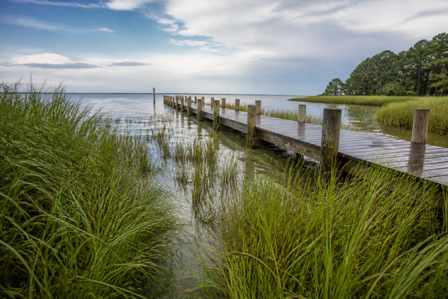
A new access path, shoreline work, tree removal, grading, utility connection, or addition may require a Buffer Management Plan when the activity affects the protected area beside tidal waters, tidal wetlands, or tributary streams.
For Somerset County property owners, the central filing question is not simply whether the parcel is near the Bay. It is whether the proposed work is inside the Critical Area, inside the required buffer, or within an area where the buffer has been modified under a specific provision. The answer determines which documents are needed, which office receives the application, and whether the Maryland Critical Area Commission must review the proposal.
Maryland’s Critical Area law is codified in Title 8, Subtitle 18 of the Natural Resources Article of the Maryland Code. The state framework is implemented through local Critical Area programs and regulations in the Code of Maryland Regulations, including COMAR 27.01.09.01 through.03, with the Buffer Management Plan criteria identified in COMAR 27.01.09.01-3. Somerset County’s local regulations and administrative procedures determine how an applicant assembles and files a plan in practice.
Work should not begin merely because an owner has submitted an application or discussed the project with county staff. Where a Buffer Management Plan is required, the plan and any associated approvals or authorizations must be in place before the disturbance starts.
Defining the Critical Area and Buffer Zones
The Chesapeake Bay Critical Area generally extends 1,000 feet landward from the mean high water line of tidal waters, tidal wetlands, and tributary streams, together with the corresponding tidal waters and wetlands covered by the state program. In Somerset County, that boundary is applied through official mapping and the county’s local Critical Area program.
The 1,000-foot boundary is the larger regulatory area. It is not the same thing as the Critical Area Buffer.
The Critical Area Buffer is the more restrictive zone immediately adjacent to tidal waters, tidal wetlands, and tributary streams. The standard buffer is at least 100 feet measured landward from the edge of the applicable water, wetland, or stream. On some properties, however, the regulated buffer is wider because additional sensitive features extend the area that needs protection.
Those features can include:
- Steep slopes or unstable terrain that increase erosion risk
- Highly erodible, poorly drained, or otherwise sensitive soils identified through applicable soil information
- Natural drainage courses and pathways that carry runoff toward tidal waters
- Shoreline areas, wetlands, and habitat features that require additional protection
- Other site-specific resources recognized by the local Critical Area program
Under the state regulatory framework, the buffer may extend beyond the standard 100 feet and, in applicable circumstances, reach as much as 300 feet. The exact measurement is a site question. A parcel’s location on a general county map does not by itself establish the precise limit for a proposed disturbance.
That distinction matters when a property owner measures from a house, an existing lawn, or the edge of a visible bank. The relevant starting point may be the mean high water line, the edge of tidal wetland, or the edge of a tributary stream, depending on the resource involved. A field condition can also differ from what appears on a basic property survey. If the location is unclear, the applicant should resolve the boundary with Somerset County Planning and Zoning before finalizing the plan.
The buffer is designed to perform several functions at once. Vegetation slows and filters stormwater runoff before it reaches the water. Roots help hold soil in place. Trees and shrubs provide shade, wildlife habitat, and continuity along the shoreline. A proposal that appears small when viewed as a construction footprint may still remove the vegetation or interrupt the drainage pattern that makes the buffer effective.
Activities that may trigger review include:
- Clearing or removing vegetation
- Cutting trees, particularly where removal creates an opening in the buffer
- Moving soil or changing grades
- Installing a structure, addition, driveway, walkway, or utility
- Constructing or repairing shoreline stabilization
- Creating a path or access route to the water
- Conducting development, redevelopment, or other work that affects runoff or habitat
Routine maintenance may be treated differently from new disturbance, but the distinction should not be assumed. Mowing an established lawn, maintaining an existing garden, removing a confirmed hazard tree, and clearing invasive plants are not automatically interchangeable activities. The method, location, scale, and effect on the buffer can change the applicable review requirements.
The first filing decision is a boundary decision: identify the Critical Area and the actual buffer on the site before choosing a plan category.
A buffer determination should be documented rather than left to an informal estimate. For a residential project, that may mean showing the resource line, buffer measurement, existing improvements, proposed disturbance, and restoration area on a site plan. For a larger project, the same information may need to be integrated into engineering, stormwater, grading, and environmental materials.
Categorizing Your Buffer Management Plan
The state criteria in COMAR 27.01.09.01-3 distinguish among Buffer Management Plan categories. The category is based on the proposed activity and its likely effect on the buffer, not on the applicant’s preferred level of paperwork.
Somerset County staff can help identify the appropriate category during pre-application review. That conversation is useful, but it does not replace the formal submission or any review required by the Maryland Critical Area Commission.
Simplified Buffer Management Plan
A Simplified plan is intended for limited, lower-impact activities that fit the applicable state and local thresholds. The draft scope should be described precisely. A plan that begins as a small maintenance request can move into a more demanding category if the work involves greater clearing, grading, chemical treatment, access construction, or a larger number of trees.
Examples of activities that may fit the simplified framework include:
- Removal of a limited number of dead or hazardous trees
- Manual removal of invasive vegetation
- Construction of a narrow shoreline access path, where the applicable width and site conditions qualify
- Other minor activities recognized by the state criteria or local Critical Area program
The application should identify the location and nature of the work, the condition of existing vegetation, the equipment or methods to be used, and any measures that will protect soil and drainage during the activity. If trees are involved, the plan should distinguish between dead, hazardous, diseased, and live trees rather than describing all removals generally as maintenance.
A site sketch may be sufficient for a genuinely limited proposal, but it still needs to be usable. It should show property lines or a clear reference to them, nearby water or wetlands, the buffer, existing structures, access routes, the proposed work area, and any area that will be replanted or restored.
Minor Buffer Management Plan
A Minor plan applies when the work exceeds the simplified scope but remains within the applicable limits for a smaller disturbance. The draft should state the amount and location of disturbance rather than relying on a general description such as “minor grading” or “a small addition.”
This category may cover:
- Residential additions or accessory structures that extend into the buffer
- Utility work and connections
- Limited grading or site improvements
- Planting, restoration, or other buffer work below the threshold for enhanced documentation
- Projects that require more than a sketch but do not have the scale or impact of a major development proposal
A Minor plan commonly requires a more complete site plan and a clearer account of existing conditions. Depending on the proposal, the package may need to show:
- Existing trees, shrubs, lawn, exposed soil, and other vegetation
- The resource line and measured buffer
- The proposed disturbance in square feet and its relationship to existing development
- Construction access, staging, and equipment routes
- Erosion and sediment controls
- The area and method of restoration
- A planting schedule or landscape plan where replacement vegetation is required
- The sequence and timing of the work
A professional site plan may be required when the proposal involves grading, structures, engineering, or a boundary that cannot be reliably established by a simple sketch. The applicant should ask the county what level of plan is expected before paying for a document that omits information needed for review.
Major Buffer Management Plan
A Major plan is used for larger or more consequential disturbances, including work that exceeds the applicable area threshold or creates a substantial effect on the buffer’s functions. It may apply to subdivision and site-plan development, large shoreline projects, institutional or commercial construction, or proposals involving extensive clearing and restoration.
A Major plan generally requires a coordinated package rather than a single narrative. Depending on the site and activity, the submission may include:
- A detailed boundary and topographic survey
- Existing and proposed conditions
- A vegetation inventory
- Grading and drainage information
- Stormwater and erosion-control measures
- An assessment of impacts on wetlands, waterways, habitat, and buffer continuity
- A mitigation and restoration plan
- Construction sequencing and protection measures
- Long-term maintenance or monitoring commitments
The area threshold is important, but it is not the only consideration. A smaller project in a particularly sensitive location may receive more scrutiny than a larger project on an already disturbed site. A project can also require coordination under other environmental, zoning, stormwater, building, or shoreline rules. A Buffer Management Plan does not automatically replace those approvals.
| Plan category | Typical scope | Core submission materials | Review considerations |
|---|---|---|---|
| Simplified | Limited tree or vegetation work, a qualifying narrow access path, or another low-impact activity | Site sketch, activity description, protection and restoration information | Whether the work stays within the simplified criteria |
| Minor | Smaller structural, utility, grading, or restoration disturbance beyond the simplified scope | Site plan, existing vegetation information, disturbance description, restoration narrative | Area, location, alternatives, construction effects, and local requirements |
| Major | Larger disturbance, development-related work, or a proposal with significant ecological impact | Detailed site and environmental materials, impact analysis, mitigation and restoration strategy | Full coordination and any state review required under the Critical Area program |
The table is a starting point, not a substitute for the current county form or state criteria. The safest approach is to describe the work accurately and let the applicable provisions determine the category.
Navigating the Submission and Approval Workflow
For a Somerset County filing, the applicant’s first contact is generally the Somerset County Planning and Zoning Department. County staff can confirm whether the parcel is mapped within the Critical Area, identify the relevant buffer, explain local submission requirements, and indicate whether the proposal appears to fit a Simplified, Minor, or Major plan category.
A practical filing sequence looks like this.
1. Confirm the resource boundary. Determine whether tidal water, tidal wetland, or a tributary stream is present and where the applicable measurement begins. Do not rely only on the edge of maintained grass or the apparent high-water mark.
2. Describe the proposed disturbance. Identify every part of the work: clearing, tree removal, grading, foundations, access, utilities, shoreline work, staging, and restoration. Omitting temporary disturbance can make the plan inconsistent with the work that will actually occur.
3. Request pre-application guidance. Provide the county with a parcel identifier, a sketch or survey, photographs, a description of the work, and an estimate of the area affected. Ask which Buffer Management Plan category and supporting approvals apply.
4. Prepare the plan. The applicant or a qualified professional prepares the drawings, narrative, vegetation information, erosion controls, mitigation measures, and restoration materials required for the project. Larger or technically complex work may require coordination among a surveyor, engineer, landscape professional, environmental consultant, or forester.
5. File with Somerset County. The county is the local intake point for the application. The submission should be complete, internally consistent, and based on the same project description used for zoning, stormwater, building, or other related applications.
6. Respond to county comments. County staff may request revised drawings, a clearer buffer measurement, additional planting details, an explanation of alternatives, or information about construction methods. A response that changes the project’s footprint may require a revised review rather than a simple clarification.
7. Coordinate state review where required. The Maryland Critical Area Commission is the named state body responsible for administering and overseeing the state Critical Area program. It is not a county-level Critical Area Commission. Where a project, local program amendment, or other matter requires state review, Somerset County coordinates the required submission to the Maryland Critical Area Commission.
8. Receive the applicable approval and conditions. Approval may include limits on clearing, construction timing, restoration, plant survival, maintenance, monitoring, or follow-up documentation. Those conditions are part of the authorization and should be provided to the contractor before work begins.
The Maryland Critical Area Commission has used a centralized Project and Program Amendment Submission Portal for submissions by local jurisdictions. That system is a back-end channel for jurisdiction staff and is not a substitute for filing a private property owner’s Buffer Management Plan directly with the county. An applicant should not assume that access to a state webpage constitutes permission to upload a project independently.
County filing and state oversight are connected, but they are not the same step. Somerset County receives and processes the local application; the Maryland Critical Area Commission is the relevant state review body when state review is required.
The county’s role is therefore practical and essential: it receives the application, checks it against local regulations and procedures, coordinates comments, and transmits materials when state involvement is required. The Maryland Critical Area Commission’s role is the state-level review and oversight established by Maryland’s Critical Area law and regulations. The precise division of action depends on the type of project and the applicable local program.
Applicants should also separate the Buffer Management Plan from other permits. A plan may address the Critical Area buffer while the project still requires approvals for zoning, grading, stormwater, erosion and sediment control, building, septic systems, wetlands, or shoreline construction. Approval under one program should not be treated as approval under all others.
What to include before filing
A complete package usually begins with a clear site record. At a minimum, the applicant should assemble:
- The property address and parcel identification
- A current survey or site plan appropriate to the project
- The location of tidal waters, wetlands, tributary streams, and the measured buffer
- Existing structures, driveways, utilities, vegetation, and disturbed areas
- A written description of construction and clearing methods
- The area of permanent and temporary disturbance
- A plan for erosion control, runoff protection, and construction access
- Proposed mitigation, replacement planting, and restoration
- Photographs that show existing site conditions
- Any relevant deed, plat, prior approval, or lot-history information
The most common weakness in a buffer filing is not a missing adjective in the narrative. It is a mismatch between the narrative, the plan sheet, and the work shown to the contractor. If the drawing shows a ten-foot access route but the narrative describes a three-foot path, or if the restoration area is counted as undisturbed in one document and disturbed in another, the county cannot evaluate the proposal cleanly.
Fees and processing times can change through county procedures or ordinance updates. Applicants should obtain the current fee schedule and filing instructions from Somerset County Planning and Zoning when the application is ready. A project that requires state coordination may also take longer than a routine local review because the state materials must be complete before the Maryland Critical Area Commission can evaluate them.
Special Provisions for Modified Buffer Areas
A Modified Buffer Area, or MBA, is not a general exemption from the Critical Area Buffer. It is a limited regulatory provision for certain constrained properties where full compliance with the standard buffer would make reasonable development or redevelopment impracticable.
The provision is associated with qualifying lots of record created on or before December 1, 1985. The date is therefore a threshold issue, not a detail to be addressed at the end of the application. A property owner claiming MBA eligibility should be prepared to document when the lot was created through recorded plats, deeds, subdivision records, or other materials accepted by the county.
An old house is not, by itself, proof that the lot qualifies. The relevant question is the status and creation date of the lot, together with the other conditions governing a Modified Buffer Area. A parcel that was created or subdivided after the applicable cutoff does not become eligible simply because it contains an older structure.
An MBA may allow a reduced buffer in a constrained location, but it does not erase the resource, eliminate all setbacks, or authorize unrestricted clearing. The applicant must show why the proposed development cannot reasonably be located outside the standard buffer and what measures will preserve the buffer’s remaining functions.
The review should address:
- The lot’s documented creation date
- Existing improvements and the physical constraints of the parcel
- Alternative locations considered outside the buffer
- The amount by which the buffer would be reduced
- Existing vegetation and the vegetation that would be removed
- Replacement planting and habitat protection
- Stormwater and erosion-control measures
- The relationship between the modified area and nearby water, wetlands, slopes, and drainage paths
- Construction access and the potential for temporary disturbance
The standard for alternatives matters. A proposal should not be placed in the buffer merely because that location is cheaper, more convenient, or preferred for design reasons if a reasonable alternative exists elsewhere on the lot. The applicant’s explanation should compare the available locations and identify the physical or regulatory constraint that makes the alternative infeasible.
Vegetation replacement and stormwater management remain central to the MBA analysis. Reducing the width of the buffer can increase the importance of the area that remains. A plan should therefore show how the retained vegetation will be protected during construction and how cleared or degraded areas will be restored.
Formal approval is required through the applicable Critical Area review process. County staff may determine whether the submission is complete and whether it meets local requirements, but the state framework and any required state review remain controlling. An MBA is not created by a private agreement, a contractor’s interpretation, or an informal statement that the lot is “grandfathered.”
Professional Requirements for Commercial Harvesting
Commercial timber harvesting inside the Critical Area Buffer follows a different path from ordinary residential maintenance or a small tree-removal request. The scale of the operation, the use of heavy equipment, the number and condition of trees, and the potential for soil disturbance require a plan that addresses the harvest as a managed forestry activity.
A commercial harvest buffer management plan should be prepared by a qualified, registered professional forester as required by the applicable Maryland rules and local procedures. The forester’s role is not limited to marking trees. The plan should explain how the operation will protect the buffer during harvesting and how the site will recover afterward.
Depending on the operation, the plan may address:
- Species composition and the condition of the stand
- Tree inventory and the volume or type of material proposed for removal
- The proposed silvicultural or harvest method
- Equipment routes, landings, stream crossings, and access points
- Measures to minimize rutting, compaction, and soil exposure
- Protection of riparian areas and sensitive drainage features
- Retention of appropriate vegetation within the buffer
- Erosion and sediment controls
- Slash management and site cleanup
- Post-harvest stabilization, revegetation, and monitoring
The harvest plan should be coordinated with the county before equipment enters the site. A landowner should not treat a commercial operation as a collection of individual tree removals simply because the trees will be cut in phases. The county and state reviewers may evaluate the operation as a whole, including the cumulative disturbance created by access, staging, and repeated entries.
The forester should also identify what work is outside the proposed harvest and what work may require a separate approval. New roads, widened access routes, stream crossings, grading, shoreline stabilization, or conversion of forest to another use can introduce issues beyond the harvesting plan itself.
Somerset County remains the local filing point, while state Critical Area requirements and any required Maryland Critical Area Commission review continue to apply. The existence of a forestry plan does not remove the need to comply with other applicable permits or local conditions.
Getting the Somerset County filing right
The strongest Somerset County critical area buffer plan submission is specific about three things: where the buffer is, what will disturb it, and how the site will be protected and restored. A short application can be adequate for a genuinely limited project, but a vague one creates avoidable questions.
Before filing, the applicant should be able to answer:
- What resource establishes the buffer measurement?
- Has the buffer been shown on a current plan or sketch?
- Does the site contain slopes, soils, wetlands, drainage features, or other conditions that expand the protected area?
- What is the total permanent and temporary disturbance?
- Which trees and vegetation will be removed, and by what method?
- Where will equipment, materials, and construction access be located?
- What reasonable alternatives outside the buffer were considered?
- What will be replanted, maintained, or monitored after construction?
- Does the project involve a qualifying lot of record and a possible Modified Buffer Area?
- Does commercial harvesting require a professional forestry plan?
- Are separate zoning, stormwater, erosion, building, wetlands, or shoreline approvals also necessary?
Those questions are not a substitute for the county’s forms or the state regulations. They are a way to keep the application aligned with the actual project.
The legal foundation is Maryland’s Critical Area law in Natural Resources Article, Title 8, Subtitle 18, together with the implementing COMAR provisions. For Buffer Management Plans, the relevant criteria are found in COMAR 27.01.09.01-3, not in the provisions previously attributed to COMAR 27.01.09.01 through.03 as a single plan-preparation rule. The local county program supplies the filing route and local standards; the Maryland Critical Area Commission, rather than a nonexistent county Critical Area Commission, is the named state reviewer when state review is required.
In practice, that means an applicant should begin with Somerset County Planning and Zoning, prepare the correct plan category, and allow time for any state coordination. The county submission is the front door, but it is not permission to bypass the state framework. Work should wait until the required approval is issued and its conditions are understood.
For landowners, the main risk is treating the buffer as a line on a map rather than as a regulated system. A project that protects the resource boundary, limits disturbance, documents alternatives, and includes credible restoration is easier to review and easier to build lawfully. A project that starts with clearing and tries to explain the disturbance afterward may face stop-work action, restoration obligations, or other enforcement consequences.
The filing sequence is therefore straightforward even when the project is not: establish the boundary, classify the work, prepare the supporting materials, file through Somerset County, address state review where required, and do not disturb the buffer before approval.