Resource Conservation Areas: Somerset County RCA rules
If you've stood on your own property here on the Eastern Shore and tried to make sense of the shaded strip running along the water's edge — or watched a neighbor three miles inland build a project…
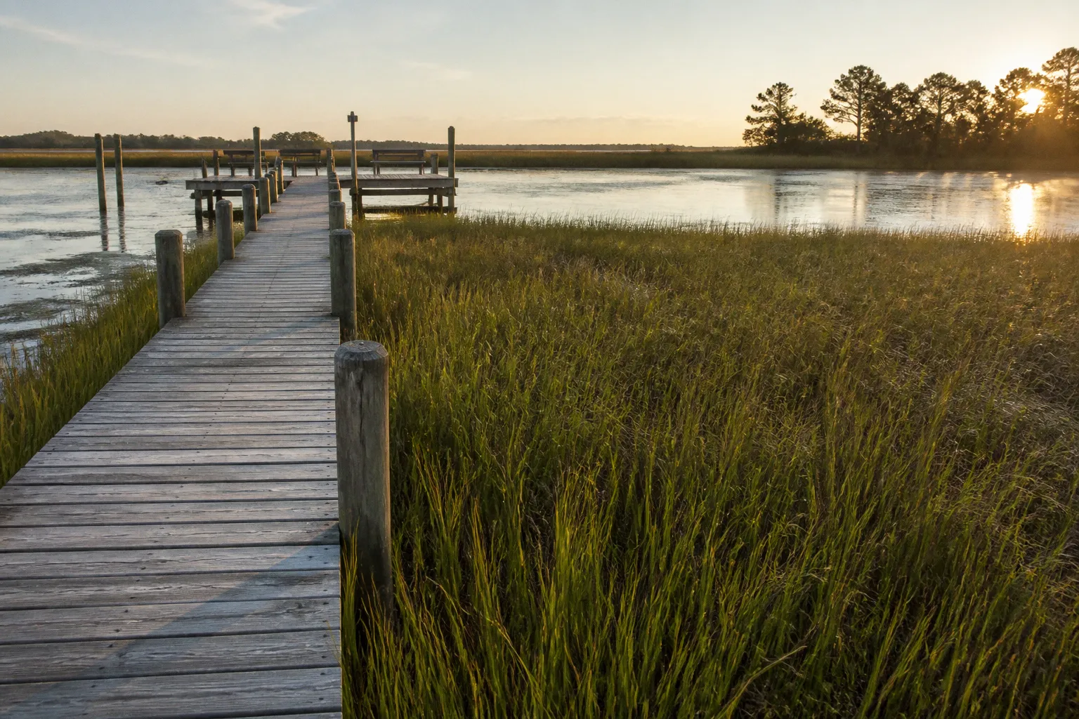
Resource Conservation Areas in Somerset County: What the Rules Actually Mean for Your Land
If you've stood on your own property here on the Eastern Shore and tried to make sense of the shaded strip running along the water's edge — or watched a neighbor three miles inland build a project you wouldn't be allowed to build on your own parcel — you've already met the Resource Conservation Area, even if you didn't know its name. The RCA is the most protected tier of Somerset County's Chesapeake Bay Critical Area program, and it shapes everything from how many homes can sit on a piece of land to whether you can host a backyard wedding, run a small restaurant, or open a retreat venue on your waterfront acreage. Once you understand the why behind the density caps and the buffer lines, the rules stop feeling like obstacles and start feeling like the architecture of a community that has decided, over decades, to live next to the Bay without losing it. That, to me, is what this all comes down to — what it means for your block, for the water your grandchildren will inherit, and for the kind of place Somerset County remains when the next storm rolls up the Chesapeake.
Defining the Resource Conservation Area: Density and Buffer Mandates
Let's start with the basics, because almost every other rule you'll encounter grows out of these two numbers.
A Resource Conservation Area is land that Somerset County has designated for long-term protection of water quality, plant habitat, and the forested wetlands that act as the Bay's first line of defense against runoff, erosion, and storm surge. It's defined by what it doesn't allow: intensive development. In practical terms, residential density in the RCA is capped at one dwelling unit per 20 acres. If you own 40 acres in the RCA, the math is straightforward — two dwellings, full stop. If you own 5 acres, you have a single building right, and that right was likely established when the Critical Area program first mapped the parcel decades ago. For many smaller RCA parcels, that single right is already taken by the home that's on the land today, which is why "Can I build a second house?" is one of the most common questions we hear from owners trying to plan a family compound or a multi-generational transition.
The 1-per-20 density rule isn't a number pulled from a hat. It's the density that lets the land still act like land — filtering runoff, holding habitat together, and absorbing the next storm instead of pushing it straight into the Bay.
The second pillar is the 100-foot Critical Area Buffer. This is the strip of land that must remain in its natural state — trees, shrubs, and native ground cover — extending 100 feet landward from the mean high water line of tidal waters, tributary streams, and tidal wetlands. You can't pave it. You generally can't mow it into a lawn. You can, in many cases, walk through it, plant native species in it, or remove invasives from it — but it functions as a living filter between whatever happens on the developed portion of your lot and whatever is happening in the water downstream. If your project would disturb the buffer, you're looking at a separate, more rigorous approval path through the Critical Area Commission rather than a quick county permit. And it's worth knowing that the 100-foot buffer is your starting line, not always your finishing one: certain agricultural uses and new growth allocation areas can require larger setbacks on top of the buffer, so the right move is to confirm the actual setback that applies to your specific parcel before you commit to a site plan.
These two rules — density and buffer — are the foundation. Almost every question a resident asks ("Can I build a second house?", "Can I cut a path to the water?", "Can I put a gazebo near the creek?") traces back to one of them.
Navigating the 300-Foot Setback for New Development
Here's where the rules get more nuanced, and where a lot of well-meaning projects run into trouble.
If you're proposing a brand-new Intensely Developed Area (IDA) or Limited Development Area (LDA) within an RCA — say, carving out a small commercial node or a cluster of homes inside an otherwise conservation-oriented parcel — the county and the Critical Area Commission require that those new development areas sit at least 300 feet landward of the edge of tidal wetlands or tidal waters. The 300-foot number isn't a soft suggestion. It's a hard setback, and it exists to keep the most disturbed portions of a project well away from the sensitive edges of the Bay and its tributaries, where impervious surfaces, septic fields, and intensive human activity would otherwise drive nutrient and sediment loading straight into the water.
The one realistic path around that 300-foot line is alternative water quality and habitat enhancement measures that the Critical Area Commission approves in writing. In plain English: if you can demonstrate, with engineered plans and often a financial commitment to long-term monitoring, that your project will produce better water quality and habitat outcomes than the 300-foot setback would have on its own, the Commission has discretion to allow a closer siting. That's not a loophole — it's an earned exception, and the bar is high. We've seen these approvals go through, but they go through because the applicant brought real science and a real monitoring commitment to the table, not because they asked nicely.
If you're a homeowner thinking about an accessory structure, a shed, or a small expansion on a parcel that is already in an LDA or IDA, the 300-foot setback typically doesn't re-apply to you. The 300-foot rule is principally a siting requirement for new development areas being established within a conservation landscape. Knowing which category your project falls into — new LDA or IDA inside an RCA versus infill on an already-developed lot — is often the difference between a smooth review and a months-long delay. When in doubt, this is exactly the kind of question that pays off to bring to the planning office before you draw a single line on a site plan.
Ordinance #1207: Regulations for Temporary Special Events
Now to the rule change that surprised a lot of us when it landed in March of 2025.
Ordinance #1207, approved by the Somerset County Commissioners on March 11, 2025, formally allows Special Events as a use in the Resource Conservation Area — but only under tight conditions that reflect just how much the county values the conservation intent of these lands. If you've been thinking about hosting a wedding, a family reunion, a fundraiser, a yoga retreat weekend, or a similar gathering on your waterfront property, here's what the ordinance actually requires:
- 20 days a year, maximum. Across the calendar year, special events on a single RCA lot cannot exceed 20 total days. Think of it as an annual budget of event days that you spend deliberately, not a rolling allowance you can stretch.
- 72 hours per single event. No single gathering can run longer than three consecutive days. The ordinance is explicit about this — it's built around the idea of temporary, not residential-scale, activity.
- No permanent structures. You can't build a permanent event barn, an anchored dance floor, or any fixed facility in support of an RCA special event. Tents, portable stages, rented restrooms, and similar temporary infrastructure are the expectation.
- All lot coverage must remain outside the Critical Area Buffer. This is non-negotiable. If you set up a tent, a parking area, a generator, or a portable restroom, every piece of it has to sit outside the 100-foot buffer. Any coverage that intrudes into the buffer puts the project in violation of the Critical Area program itself, which is a different (and stiffer) regulatory regime than the county zoning ordinance.
There's also an implicit compliance layer here that isn't written into #1207 but absolutely lives next to it: noise, traffic, waste handling, and neighbor notice remain live issues under county code, and your event will be more successful — and far more likely to stay below the threshold of complaints — if you plan them. Think portable sanitation scaled to guest count, parking laid out so it doesn't spill onto neighboring driveways, and a clear start-and-end window that respects the working week of the families who live around you. The ordinance sets the floor; good neighborliness sets the ceiling.
Ordinance #1220: Operational Standards for Restaurants and Retreats in the RCA
In February 2026, the County Commissioners took the next step with Ordinance #1220, which permits Restaurants and Retreats as approved uses inside the Resource Conservation Area. This was a meaningful shift — for the first time, the county explicitly recognized that some property owners in the RCA want to run small, low-impact hospitality businesses on their conservation lands, and the ordinance gives them a path to do that legally. It also locks in firm limits so that those uses don't quietly turn the RCA into something it was never meant to be.
Here's how the two uses compare on the dimensions that matter most:
| Standard | Restaurants in the RCA | Retreats in the RCA |
|---|---|---|
| Lot coverage cap (within RCA portion of lot) | 15% of total lot area | 15% of total lot area, or 20,000 sq ft, whichever is less |
| Variance to exceed the cap | Not permitted | Not permitted |
| Climate resilience assessment | Required | Required |
| Emergency evacuation plan | Required | Required |
| Permanence expectation | Operating use, tied to coverage limits | Operating use, tied to coverage limits |
The 15% lot coverage cap is the headline number for both uses. If your lot has 10 acres inside the RCA, you're working with roughly 65,000 square feet of allowable coverage across all your buildings, paved areas, and other impervious surfaces — and that 65,000 is your ceiling, not your starting point. For retreat operators, the additional 20,000-square-foot backstop matters because on smaller parcels, 15% can actually exceed 20,000 square feet, and the ordinance pulls the cap down to the lower number. On a 3-acre RCA parcel, for example, 15% is roughly 19,500 square feet — just under the backstop — so the 15% rule is what binds. On a half-acre RCA parcel, 15% is far less than 20,000 square feet, and again 15% is the operative number.
Variance is not an option here. Somerset County wrote these ordinances so that the coverage caps are real caps, not opening bids in a negotiation.
The no-variance clause is worth lingering on, because in most zoning contexts, "lot coverage" is exactly the kind of number that property owners expect to be flexible about. Not here. Ordinance #1220 is explicit: no variance may be granted to exceed the 15% (or 20,000-square-foot) cap for either Restaurants or Retreats in the RCA. If your business plan doesn't fit inside the coverage envelope, the answer is to scale the plan, not the rule. This is also why the climate resilience and evacuation requirements sit alongside the coverage cap — they're part of the same logic. The county is saying, in effect, if you can run a thoughtful, low-impact operation within these numbers, you have a real path; if you can't, this isn't the right place for that business.
The climate resilience assessment and emergency evacuation plan requirements reflect where the county's regulatory thinking has moved. RCA lands are, by definition, on the front line of Eastern Shore sea level rise and increasingly intense storm events. A small restaurant or a retreat venue on these lands has to demonstrate, in its operational planning, that it can function safely under those conditions — not just today, but across the useful life of the structure. For property owners thinking about applying under #1220, budgeting for a qualified resilience consultant and an evacuation planner at the front end of the project is the kind of decision that prevents expensive rework later.
Compliance, Climate Resilience, and Where to Start
Somerset County has been regulating Critical Area lands since September 10, 1988, originally through its general Zoning Ordinance and then, starting in 2014, through a dedicated Critical Area Ordinance that pulled all of these rules into one place. That long history matters when you're trying to understand your own parcel, because a lot of the rights, restrictions, and grandfathered conditions on your land were established against versions of the rules that have since been amended. The county's recent ordinances — #1207 in 2025 and #1220 in 2026 — sit on top of that foundation, and they reference the older standards rather than replacing them. When you're navigating the board, the older ordinance is the spine; the newer ones are the new chapters.
One timing detail that has come up frequently in community conversations: December 31, 2025 served as the cut-off date for certain existing structures and parcels to qualify for the new RCA provisions. If you have a structure or use that you believe should be recognized under the updated ordinance framework, and it pre-dates that cut-off, the time to document and apply is now — not after the fact. That deadline has passed, but the question of how your existing use fits into the post-2025 framework is still very much a live one for many owners.
For residents who are trying to navigate this for the first time, here's the order of operations I'd suggest — the same one I'd walk you through if we were sitting across the kitchen table:
1. Pull your parcel map and identify whether any portion of your land sits in the RCA. Somerset County's planning office and the Maryland Department of Natural Resources both publish mapping tools that show Critical Area tiers. If your parcel touches tidal water or a tributary stream, the answer is almost certainly yes for at least part of it.
2. Confirm whether your parcel's existing development rights are tied to a 1-per-20-acre density or a previously established allocation. The number of dwelling units your land is entitled to is not always a clean function of acreage, especially for parcels mapped before 1988 or with older subdivisions.
3. If you're considering a special event under #1207, count your days. Twenty days a year, no event over 72 hours, no permanent structures, no coverage inside the 100-foot buffer. These are bright lines, and bright lines make compliance easier when you plan around them rather than discover them.
4. If you're considering a restaurant or retreat under #1220, run the coverage math first. If 15% (or 20,000 square feet, whichever is less) doesn't accommodate your building and operational footprint, the project isn't going to pencil out — and there is no variance path that changes that.
5. Engage the Critical Area review process early. For anything that touches the buffer, proposes a new LDA or IDA inside an RCA, or triggers a climate resilience review, the Critical Area Commission is a real participant in your approval, not a background agency. Bringing them in at schematic design is faster and cheaper than bringing them in at the permit stage.
What I want you to take away from all of this is straightforward: the RCA has rules, the rules have real numbers behind them, and the numbers exist because the land and the water are doing important work that none of us can replace with concrete. The 1-per-20 density, the 100-foot buffer, the 300-foot setback, the 20-day event cap, the 72-hour single-event cap, the 15% coverage ceiling — those aren't bureaucratic trivia. They're the shape of a community that has chosen to stay on the water without losing the part of the water that brought us here. When you plan around them at the start, instead of at the end, you'll find that Somerset County's RCA rules aren't in your way. They're working exactly the way they were written to — protecting the community fabric that holds this place together, one shoreline at a time.