Coastal resilience: what it means for Somerset County
If you are looking for a practical coastal resilience definition for Maryland’s Eastern Shore, start with the roads, homes, marshes, and working waterfronts of Somerset County.
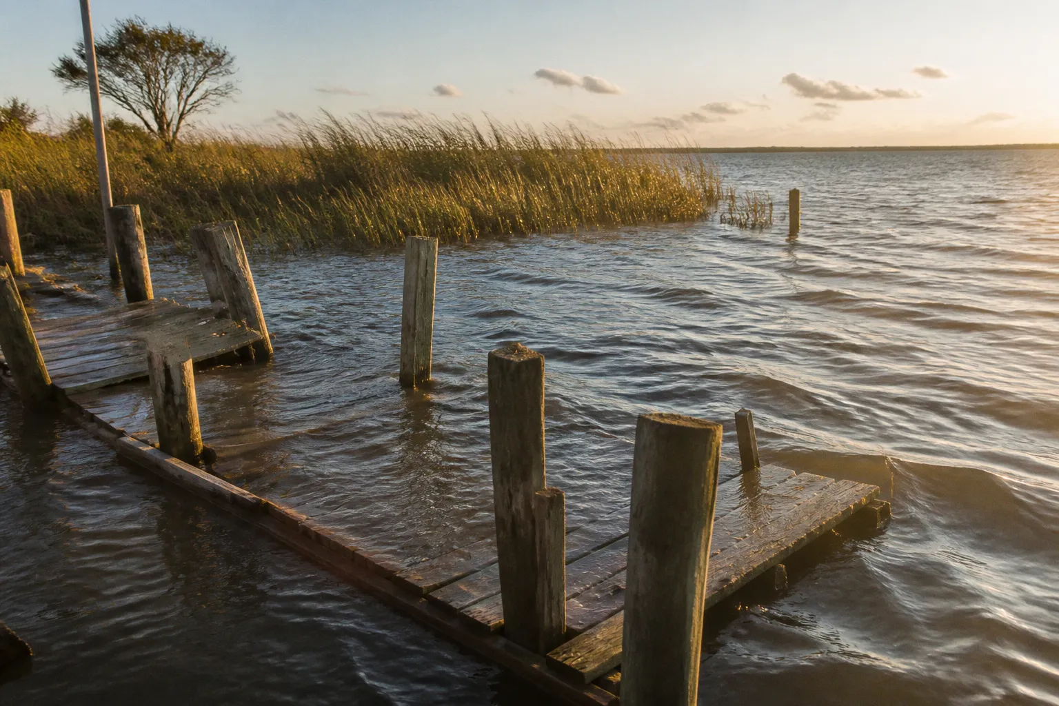
Here, flooding is not a distant possibility that belongs only in a future planning document. More than a foot of sea-level rise has already occurred along Maryland’s shoreline over the past century, and the county’s low elevation means that even modest changes in water levels can affect daily life.
For our community, coastal resilience means more than building a higher wall along the water. It means helping neighborhoods, public works systems, natural shorelines, and local economies withstand flooding and severe storms, recover when damage occurs, and make sound decisions about growth before risks become more expensive and more disruptive.
That definition matters because Somerset County is not dealing with a single problem. A flooded road can become an access problem for residents, an emergency-response problem for public agencies, and a business problem for local employers. A damaged marsh can mean more wave energy reaching a shoreline. A development decision made without drainage or elevation in mind can add pressure to infrastructure that is already vulnerable.
The goal of resilience planning is to see those connections clearly and act before each issue has to be handled as a crisis.
The geography of risk: why Somerset County faces unique challenges
Somerset County sits on Maryland’s Lower Eastern Shore, a region shaped by tidal rivers, marshes, creeks, bays, and the broader Chesapeake Bay system. That geography supports fishing, farming, recreation, and close-knit communities, but it also leaves much of the county exposed to tidal flooding, storm surge, heavy rain, and erosion.
Only about 10% of the county’s land lies above 20 feet in elevation. About 58% of Somerset County’s 329 square miles falls within a FEMA-designated flood zone. Those figures do not mean every property in a flood zone faces the same level of danger, nor do they predict exactly when a particular road or home will flood. They do show why flood risk has to be part of ordinary community planning rather than treated as a specialized concern for waterfront property owners.
Maryland’s Eastern Shore is considered the third most vulnerable region in the United States to sea-level rise, after the Mississippi Delta and South Florida. The reason is not simply that water levels are rising. The land itself is also subsiding in parts of the region, which makes the relative rise of the water more consequential for roads, drainage systems, septic infrastructure, homes, and shorelines.
For you, this may show up in ways that do not initially look like climate adaptation:
- A road that becomes difficult to use during high tide or after a storm.
- A culvert or drainage ditch that cannot move water quickly enough after heavy rain.
- A shoreline where erosion gradually narrows the margin between waves and a public road.
- A home, pump, electrical system, or septic field located too close to flood-prone ground.
- A public facility that remains technically usable but loses reliable access during extreme weather.
- A new development that changes how stormwater moves through neighboring properties.
This is what the broader phrase “coastal resilience” means at the neighborhood level. It is the difference between a community that absorbs disruption and one in which a single damaged connection—one road, one drainage crossing, one utility point—creates a much wider problem.
In Somerset County, resilience is not about making the water disappear. It is about giving people, infrastructure, and natural systems more room to withstand it.
A working definition of coastal resilience
The term can sound abstract when it appears in a plan, grant announcement, or public meeting agenda. A useful definition is more grounded:
Coastal resilience is the ability of a community, its infrastructure, and its natural systems to withstand, adapt to, and recover from coastal flooding, sea-level rise, erosion, and severe storms.
Each part of that definition points to a different kind of work.
Withstand
A resilient shoreline may reduce wave energy before it reaches a road or structure. A resilient home may be elevated above expected flood levels. A resilient drainage system may be designed to handle heavier rainfall and higher downstream water levels. The point is not to eliminate all damage, which is rarely realistic, but to reduce the force and frequency of avoidable damage.
Adapt
Adaptation means changing the way we design, maintain, and use places as conditions change. That may include updating elevation standards, protecting flood-storage areas, reconsidering where critical facilities are located, or incorporating future water levels into transportation and public works decisions.
Adaptation can also be gradual. A community may first improve drainage, then elevate a vulnerable structure, then restore marsh habitat that provides additional protection. The most effective approach is often a series of connected decisions rather than one dramatic project.
Recover
Recovery is not only the repair that follows a storm. It includes the ability to reopen roads, restore public services, communicate with residents, and help households and businesses return to ordinary routines. A community with a recovery plan is better positioned to avoid repeating the same damage after every major event.
Protect natural systems
Tidal marshes, dunes, coastal forests, and other shoreline features are not decorative additions to a resilience project. They can slow waves, hold sediment, reduce erosion, support infiltration, and provide habitat. When natural features are healthy and connected to the shoreline, they can perform some of the protective work that would otherwise fall entirely to engineered structures.
That does not mean nature-based strategies work everywhere or solve every problem. A narrow shoreline beside a heavily used road may require a combination of living shoreline elements, structural protection, elevation work, and ongoing maintenance. The practical question is not whether a solution is labeled “natural” or “engineered.” It is whether the design matches the water, the land, the infrastructure, and the community’s needs.
Nature-based defense: living shorelines, marshes, and dunes
One of the clearest examples of coastal resilience in Somerset County is the use of nature-based shoreline protection. A living shoreline typically combines native vegetation with carefully selected structural elements to stabilize the edge of the land while preserving ecological function.
Depending on the site, a project may include marsh plantings, low-profile dunes, offshore rock structures, beach nourishment, or other features that reduce wave energy and help hold sediment in place. These designs are different from a hard vertical wall, which can reflect wave energy and may shift erosion pressure to adjacent areas if it is not carefully planned.
The choice of strategy depends on several conditions:
- Shoreline exposure: A protected creek edge has different wave conditions from a shore facing Tangier Sound.
- Available space: Marsh and dune features need room to function, while developed areas may have very little space between the water and a road or building.
- Sediment movement: A project must account for how sand and silt move along the shoreline instead of treating the project site as an isolated point.
- Existing habitat: Marshes, submerged vegetation, and coastal forests may already provide valuable protection that should be preserved.
- Access and maintenance: Residents, emergency vehicles, working waterfront users, and maintenance crews may all need to reach the shoreline.
- Adjacent properties: A project should not simply transfer erosion or drainage problems to the next parcel.
Somerset County has already seen this approach in practice. In June 2022, a 1,100-linear-foot shoreline project at the end of Crowell Road on Deal Island was completed with low-profile dunes, marsh plantings, and offshore rock structures. The design was intended to reduce wave energy from Tangier Sound while strengthening the shoreline’s natural defenses.
In July 2025, the Maryland Department of Natural Resources awarded grant funding to Somerset County to design another living shoreline project. The proposed design includes a headland, beach nourishment, a vegetated dune, and beneficial use of dredged material to help protect Deal Island Road infrastructure and the Fisher of Men Foundation.
These projects illustrate an important point about resilience work: protection is often about keeping a public connection open. When a road serves homes, community facilities, or emergency access, the shoreline beside it becomes part of the transportation network. The shoreline project is therefore not separate from infrastructure planning. It is infrastructure planning that uses natural processes as part of the design.
Why marsh restoration belongs in a public works conversation
Marsh restoration is sometimes discussed as an environmental project, while road repairs and drainage improvements are treated as infrastructure. In a low-lying county, those categories overlap.
A healthy marsh can slow water, absorb wave energy, and help stabilize sediment. It may also provide room for water to spread without immediately reaching a road or structure. Preserving that function can be less disruptive and more durable than trying to force every drop of water into a pipe or channel.
This does not remove the need for conventional public works. Somerset County still needs well-maintained roads, culverts, drainage systems, bridges, and access routes. Nature-based resilience works best when it is connected to those systems, not used as a substitute for maintaining them.
Infrastructure adaptation: protecting access, homes, and community assets
A resilience plan becomes meaningful when it answers a basic question: what must remain accessible and functional during flooding?
That answer will differ from one part of Somerset County to another. In one location, the priority may be a road serving a small group of homes. In another, it may be a route used by emergency responders, school transportation, public works crews, or people traveling to jobs and services. Elsewhere, the most vulnerable asset may be a home, a wastewater component, a community building, or a shoreline facility.
Roads and transportation connections
Transportation planning is especially important in rural coastal communities because there may be few alternate routes. If one low-lying road floods, residents may not have a convenient parallel street. A detour can be longer, more difficult for emergency vehicles, or impossible for people who depend on public or community transportation.
When we talk about Maryland climate adaptation planning, transportation should therefore be considered in terms of access and reliability, not only pavement condition. A road that is open most days but regularly cut off during high water may be a more urgent resilience concern than a road with visible surface wear.
Useful planning questions include:
1. Which roads provide the only practical access to homes or community facilities?
2. Which routes are used for emergency response or evacuation?
3. Where do tidal flooding and heavy rainfall create overlapping problems?
4. Are culverts, ditches, and outfalls sized and maintained for current conditions?
5. Could a shoreline or drainage project protect the road more effectively than repeated emergency repairs?
6. If a route becomes temporarily impassable, what realistic alternatives exist?
This kind of analysis turns a general concern about sea-level rise into a transportation conversation residents can participate in.
Homes and private property
Home elevation is one established tool for reducing flood damage, particularly where the structure can be safely raised and access can be maintained. But elevation is not a universal answer. It does not solve a flooded road, protect a septic system automatically, or make a neighborhood immune to storm impacts.
Property-level decisions also need to fit the larger landscape. If a home is elevated but surrounding drainage is poor, residents may still face serious access problems. If one parcel builds a barrier that redirects water, neighboring properties may experience new impacts. That is why individual resilience measures benefit from clear local guidance and coordination with county and state programs.
Residents often encounter the planning system through a permit notice, a flood map, a zoning question, or a proposed project nearby. The most useful response is not to assume that every new project is harmful or that every resilience project will affect every property in the same way. Instead, ask how the proposal changes elevation, drainage, access, shoreline movement, and the community fabric around it.
Public facilities and working landscapes
Resilience planning must also account for the places that support everyday life: community buildings, public works facilities, water and wastewater systems, farms, marinas, and working waterfronts. These assets may not all be located directly on the shoreline, but they can still be affected by access problems, power interruptions, saltwater exposure, or repeated flooding.
A strong plan connects individual projects to broader priorities:
| Resilience concern | Practical planning response | What this means for your block |
|---|---|---|
| Tidal flooding near roads | Elevation analysis, shoreline protection, improved access planning | Fewer interruptions on the routes residents depend on |
| Shoreline erosion | Living shorelines, marsh plantings, dunes, and carefully designed structural elements | More stable edges and less wave energy reaching nearby infrastructure |
| Heavy rainfall and poor drainage | Culvert maintenance, stormwater planning, and protection of natural flood-storage areas | Less standing water and fewer drainage problems after storms |
| Vulnerable homes | Elevation, flood-resistant retrofits, and site-specific assistance | Lower risk of repeated damage, while recognizing that roads and utilities still matter |
| Loss of marsh or coastal habitat | Restoration and preservation of natural systems | More natural protection, improved habitat, and stronger shoreline function |
| Limited transportation alternatives | Prioritizing critical routes and planning for temporary closures | Better emergency access and clearer decisions about which connections need investment |
The table is not a replacement for site-specific engineering or permitting. It is a way to see how the pieces fit together before we discuss individual projects.
How residents can navigate the planning process
Public participation is most effective when it begins before a project reaches the final approval stage. That can be difficult because local planning often uses unfamiliar terms and spreads information across meeting agendas, notices, maps, and agency documents. You do not need to become a coastal engineer or land-use attorney to ask useful questions.
Start with the location. Identify the road, shoreline, neighborhood, drainage area, or public facility affected by the proposal. Then ask what type of risk the project is addressing: erosion, tidal flooding, stormwater, access, structural damage, habitat loss, or some combination.
As you navigate the board or attend a public meeting, listen for the difference between a project’s immediate purpose and its wider effects. A shoreline project may be designed to protect a road, but it can also influence habitat, sediment movement, property access, and maintenance obligations. A development proposal may add homes or commercial space, but it may also change drainage patterns and traffic on nearby roads.
A useful set of questions includes:
- What problem is the project intended to solve?
- What conditions were used to design it?
- Does the proposal account for both tidal flooding and heavy rainfall?
- What natural features currently reduce risk at the site?
- How will construction affect neighboring properties or public access?
- Who will maintain the project after installation?
- What happens if the shoreline, marsh, or drainage pattern changes over time?
- Is the project protecting a critical connection, or is it enabling new development in a high-risk location?
- How does the proposal fit with county plans and Maryland’s broader adaptation goals?
These questions keep the conversation specific and constructive. They also make it easier for residents with different priorities to participate in the same discussion. Someone focused on road access, someone concerned about wetlands, and someone worried about property damage may be looking at different parts of one resilience problem.
Common mistakes in public discussions
Several patterns can make coastal planning harder than it needs to be.
Treating flood maps as a complete prediction. Maps are essential, but they do not capture every drainage issue, access problem, or future condition. Local knowledge about where water collects and which roads become difficult to use adds important context.
Assuming one project can solve a regional problem. A living shoreline can be highly valuable at a specific site, but it cannot protect every road or property in the county. Resilience is a network of decisions.
Separating environmental protection from infrastructure protection. Marshes, dunes, and coastal forests can serve both ecological and public safety purposes. Removing them may increase pressure on engineered systems.
Focusing only on the property line. Water does not stop at a parcel boundary. Shoreline work, grading, drainage, and access decisions can affect neighbors and downstream areas.
Waiting for certainty before acting. The exact timing and location of future impacts will always contain uncertainty. That is not a reason to ignore known vulnerabilities, particularly when more than a foot of sea-level rise has already occurred along Maryland’s shoreline.
The most useful resilience question is not “Can we stop every flood?” It is “Which people, places, and connections must keep working—and what combination of natural and built solutions gives them the best chance?”
Balancing growth with rising water levels
Somerset County’s future will not be shaped only by storms or sea-level rise. It will also be shaped by ordinary choices about housing, roads, public services, commercial activity, shoreline use, and conservation. That is why coastal resilience belongs in comprehensive planning and community development, not only in emergency management.
Growth can increase the number of people and assets exposed to flooding if it takes place without adequate attention to elevation, drainage, transportation, and natural buffers. At the same time, a thoughtful development pattern can place new investment where services are easier to maintain, preserve flood-storage areas, and reduce pressure on vulnerable shorelines.
The question is not whether Somerset County should stop changing. Communities need homes, businesses, public facilities, and economic opportunity. The question is whether growth strengthens the places people already depend on or adds new obligations in locations where flooding and erosion will make public services increasingly difficult to provide.
A practical resilience framework for future decisions can follow five connected principles:
1. Direct new investment toward safer, serviceable locations. The cost of a project includes the future cost of roads, drainage, emergency response, and maintenance.
2. Protect natural buffers before they are lost. Marshes, dunes, and coastal forests are difficult to replace once development or erosion removes their function.
3. Design infrastructure for changing conditions. A road, culvert, or public facility should be evaluated against the water levels and rainfall patterns it may face over its useful life.
4. Keep critical routes and services connected. A resilient system considers not just individual assets but the routes and networks that link them.
5. Include residents early. People who live along a road or shoreline often know where water moves, where access fails, and which community connections matter most.
The 2008 Somerset County Rising Sea Level Guidance is part of the county’s longer history of recognizing this challenge. The need has become more immediate as Maryland’s shoreline continues to experience rising water levels and as local projects move from general awareness toward specific designs and investments.
The path forward for Somerset County
There is no single coastal resilience project that will make Somerset County safe from every storm or eliminate the effects of sea-level rise. The more realistic—and more durable—path is a layered one: maintain public works, protect and restore natural shorelines, elevate or retrofit vulnerable structures where appropriate, improve drainage, plan transportation routes carefully, and give residents a meaningful role in decisions that affect their homes and neighborhoods.
That work will require patience because resilience projects often cross agency boundaries and take time to design, fund, permit, build, and maintain. It will also require clear communication. Residents should be able to understand what a project protects, why a particular design was selected, how it affects nearby properties, and what responsibilities will remain after construction.
For you and your neighbors, the central issue is tangible: what this means for your block. Will the road remain passable? Will a marsh or dune continue to buffer the shoreline? Will a new project manage its stormwater without shifting the problem elsewhere? Can emergency services reach the people who need them? Will public investment support the community fabric rather than reinforce avoidable vulnerability?
Those are not abstract planning questions. They are the foundation of a working coastal resilience definition for Maryland’s Eastern Shore—one rooted in the places we live, the infrastructure we share, and the natural systems that have protected Somerset County long before the language of climate adaptation entered the planning vocabulary.