Stormwater management plan: Somerset County approval steps
Somerset County, Maryland averages under five feet of elevation across most of its landmass, and roughly a third of the county sits inside the Chesapeake Bay Critical Area.
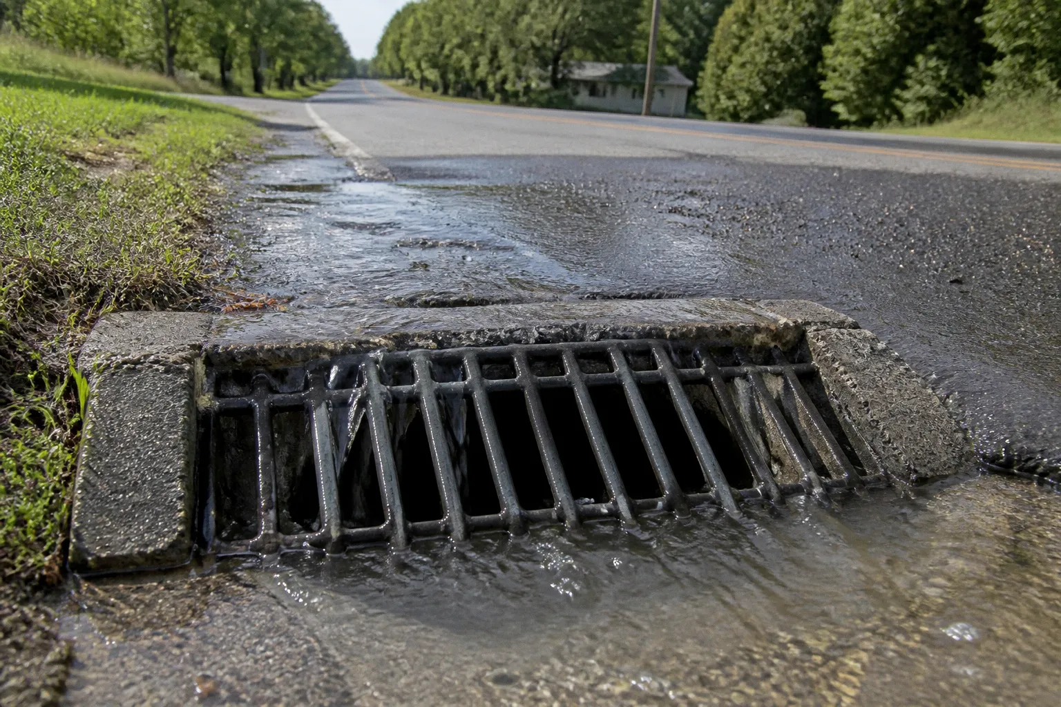
The county is also one of the lowest-lying jurisdictions on the Eastern Shore, with most of its drainage flowing through tidal channels into Tangier Sound and the Pocomoke River. After a two-inch rain on saturated ground, those numbers stop being geography and start being a drainage problem. Standing water shuts down intersections along Route 13, backs up roadside ditches near Westover, and pushes nutrient-loaded runoff straight into the bay. Every acre of impervious surface a developer adds — a parking lot, a poultry house pad, a subdivision road — tilts that equation a little further into the flood zone. The Somerset County stormwater management plan approval process is the mechanism the county uses to put a stop sign in front of that tilt.
The county doesn't run the program on its own. It answers to the Maryland Department of the Environment (MDE), the Chesapeake Bay Critical Area Commission, and the Somerset County Soil Conservation District. Three desks, three sets of standards, one engineer on the hook for making sure the drawings on the desk match what gets poured in the field. Here's how to navigate that stack without sending the project back to square one.
Regulatory Framework: Aligning Local Plans with Maryland Standards
Three agencies, three sets of standards, one drainage plan. Get any one of them wrong and you're back at the drawing board.
The legal architecture sits on three legs. Cut any one of them and the submission stalls.
The first leg is state law. Maryland's Stormwater Management Act of 2007 — built on the earlier 2000 framework — required every county to adopt a local program that meets or exceeds the state's standards. Somerset County codified this in Chapter 126 of the county code, the Stormwater Management Ordinance, and enforces the 2000 Maryland Stormwater Management and Sediment Control Manual (with current revisions). The Manual mandates Environmental Site Design (ESD) as the first option for handling runoff on every project. ESD means using the site's natural features — sheet flow, vegetated buffers, micro-bioretention, rain gardens — before any structural BMP is sized.
The second leg is the federal Clean Water Act, enforced through the National Pollutant Discharge Elimination System (NPDES) program. Maryland runs its own NPDES permit under delegation from EPA. Somerset County is a non-municipal county, so it operates under a single county-wide NPDES permit for stormwater discharges from its MS4 (Municipal Separate Storm Sewer System). That permit ties the county — and by extension, any new development feeding into the county's drainage — to the Chesapeake Bay Total Maximum Daily Load (TMDL) for nitrogen, phosphorus, and sediment. If your project's runoff exceeds the approved loads, the bay's overall TMDL budget slips.
The third leg is the Chesapeake Bay Critical Area Act, which places a 1,000-foot buffer around tidal waters and the bay itself. Inside that buffer, the Critical Area Commission imposes additional restrictions on impervious surface limits, forest cover, and BMP placement. Somerset County carries more Critical Area frontage than almost any other county on the Eastern Shore, which means a large share of new projects trip this third layer.
| Plan layer | Issuing authority | Key document | What it controls |
|---|---|---|---|
| Local stormwater | Somerset County Dept. of Technical Services | Chapter 126 ordinance; adopted MDE Manual | On-site drainage, ESD, BMPs |
| State stormwater | Maryland Dept. of the Environment | Erosion & Sediment Control, Stormwater Management Manual | Plan review thresholds, water quality |
| Critical Area | Chesapeake Bay Critical Area Commission | 10% Rule, buffer criteria | Lot coverage, setbacks, habitat |
| Federal NPDES | EPA / delegated to MDE | County MS4 permit; Bay TMDL | Discharge limits, nutrient loads |
A project that disturbs more than 5,000 square feet of land and adds more than 5,000 square feet of impervious surface triggers the full technical review. Anything smaller usually falls under a simplified plan path, but the file still has to be submitted.
Technical Requirements for Erosion and Sediment Control Submissions
The Somerset County review desk isn't checking plans for aesthetics. It's checking whether the numbers add up on the ground. Three documents drive the technical review: the erosion and sediment control (E/S) plan, the stormwater management (SWM) plan, and, if applicable, the Critical Area compliance package.
The E/S plan must show how the developer keeps soil on the site during construction. It starts with a grading plan and a sequence of construction — when to clear, when to stabilize, when to seed. Somerset County enforces the 2011 Maryland Standards and Specifications for Soil Erosion and Sediment Control, which dictate silt fence placement, stabilized construction entrances, and temporary sediment basin sizing. The basin sizing calculation is the one that trips most contractors. The required storage volume is 134 cubic yards per acre of disturbed area, or the volume derived from the 10-year, 24-hour storm, whichever is greater. Get that wrong and MDE bounces the submission.
The SWM plan shows where the water goes after construction. ESD comes first. That means demonstrating the use of sheet flow, sheet flow to a vegetated area, micro-bioretention, and similar practices before any structural BMP is considered. Only when ESD can't meet the required channel protection and water quality volume does the designer move to a structural BMP — typically a bioretention facility, a grass swale, or a sand filter.
Required submittals for a complete technical package:
1. Existing and proposed drainage area maps at no smaller than 1" = 200' scale.
2. A geotechnical report with NRCS soil mapping and on-site soil borings wherever infiltration is proposed.
3. Hydrologic and hydraulic calculations (TR-55 is standard for rural Somerset County sites) showing pre- and post-development peak flows for the 1-, 10-, and 100-year storm events.
4. An ESD feasibility narrative — a written explanation of why each practice was or wasn't used.
5. Structural BMP sizing and details, including a maintenance access easement and a recorded maintenance agreement.
6. A long-term inspection and maintenance schedule for every BMP on the site.
The last item is the one that gets ignored until the project is already built. Somerset County takes the maintenance agreement seriously — it runs with the land, not the owner. If the BMP fails an inspection five years out, the county can hold the current owner responsible for the fix.
Navigating the Somerset County Review and Approval Workflow
The county's workflow is linear on paper. In practice, it crosses desks that don't share a calendar, and knowing the order matters more than knowing the form.
Step 1 — Pre-application meeting. Schedule this with Somerset County Technical Services before any drawings get drafted. Bring a sketch plan, a soils map (NRCS Web Soil Survey), and a rough drainage area. The county will tell you which standards apply (Critical Area or not), the impervious surface cap, and whether the site flags known issues — tidal wetlands, forest stand, FEMA floodplain. The meeting is free and saves months.
Step 2 — Preliminary SWM/E/S review. Submit a complete package to the county. The county's contracted engineer does the first technical pass. Expect comments on drainage area splits, ESD opportunities that weren't used, and missing soil data. This round usually takes 30 to 45 days.
Step 3 — Critical Area Commission review. If the site is inside the 1,000-foot buffer, the county forwards the package to the Critical Area Commission. Commission review can run 60 to 90 days and frequently requires habitat assessments, forest stand delineations, and buffer mitigation plans. Build this time into the schedule.
Step 4 — Soil Conservation District sign-off. Most Somerset County projects require approval from the Somerset County Soil Conservation District for the E/S portion. The District checks the sediment control design against state standards and issues its own approval letter.
Step 5 — MDE permit. Projects disturbing more than one acre generally need an MDE General Permit for Stormwater Associated with Construction Activity. The county won't issue its final approval until the MDE Notice of Intent is submitted and a permit number is in hand.
Step 6 — Final approval and bonding. The county issues the SWM permit, typically with a performance bond covering the BMPs and a separate maintenance bond held for two years after construction.
The full timeline, when executed correctly, runs four to six months for a standard residential or commercial project. Anything inside the Critical Area, or anything above the 10-acre disturbance threshold, pushes it past nine. Where it falls apart: skipping the pre-application meeting, or finding out about the Critical Area designation after the plans are half-drafted.
Addressing Environmental Constraints in Coastal Development Zones
Somerset County's waterfront isn't a perk. It's a constraint that determines whether the project gets built at all.
The Critical Area 100-foot buffer is the first line. No new impervious surface, no new structures, no clearing of forest or vegetation inside that buffer. The buffer is measured landward from the mean high water line of tidal waters or the edge of adjacent tidal wetlands. If the lot has any tidal shoreline, that line goes on the plan first, and the rest of the site gets drawn around it.
Behind the buffer sits the 1,000-foot expanded buffer, where the Critical Area Commission's 10% impervious rule applies. Inside that expanded area, a grandfathered lot can be developed, but the impervious cap is 10% of the lot area or 25% of the existing impervious surface, whichever is less. Once that threshold is exceeded, every additional square foot of impervious surface requires mitigation — typically through forest creation or a fee-in-lieu payment into the Critical Area fund.
Tidal and nontidal wetlands are a separate layer. MDE's Wetlands and Waterways Program regulates any work below mean high water or in wetlands adjacent to tidal waters. A project that dredges, fills, or alters a wetland needs a joint state/federal permit — a Maryland Tidal Wetlands License plus a Section 404 permit from the U.S. Army Corps of Engineers. Permit time for that runs six months to a year minimum, and the application has to be in long before the SWM plan is finalized.
Sea level rise is the variable that doesn't fit on a standard site plan. NOAA's 2022 sea level rise projections put the Eastern Shore at roughly 1.3 to 1.6 feet of additional rise by 2050 under the intermediate scenario. For a county where the highest point is about 18 feet and the bulk of the land sits under five, that's not a future concern — it's a present-day grading problem. Freeboard on any structural BMP, tail water elevation on any outlet structure, and the building finished floor elevation all need to account for the next 30 years of tide, not the last one.
Somerset County reviewers have started asking how the design handles a 2050-condition 10-year storm under a 2050 tide. If the answer is "we'll deal with it later," the answer is no.
Common Compliance Pitfalls During the Permitting Lifecycle
Most projects don't fail at the design desk. They fail two years after the last ribbon is cut, when the BMP clogs and nobody on the deed knows whose problem it is.
Five pitfalls account for the majority of failed inspections, resubmissions, and enforcement actions in Somerset County.
1. Missing the Critical Area in deed research. Buyers close on a lot, start clearing, and discover the back 200 feet sits inside the 1,000-foot buffer. The buyer eats the loss. Pull the Critical Area map and the deed's metes-and-bounds before the site plan gets drawn.
2. Treating ESD as a checkbox. The state's review looks for demonstrated use of sheet flow, bioretention, and infiltration on every feasible site. If the SWM narrative just says "ESD not feasible because the soils are clay" without a site-specific soil test and contour analysis, the county rejects it. Many Somerset County clay soils can still infiltrate if the design works with the native soil structure and stays above the seasonal high water table.
3. Mis-sized sediment basins. The 134 cubic yards per acre number is the floor. Many Somerset County sites also need a skimmer and a dewatering device, because the water table sits high and the basin fills with groundwater during construction. A basin that holds the design volume on paper will overflow in the field.
4. BMPs designed without a real maintenance plan. The county records a maintenance agreement against the property. If the BMP clogs, fails, or overtops, the current owner — not the developer — gets the violation notice. The plan needs a named responsible party, an inspection schedule, and a budget figure for annual maintenance.
5. As-built surveys that don't match the design. The final as-built must verify that the BMP is built per the approved plan, that the grading matches, and that the contributing drainage area hasn't shifted. A small change in the roof line or the parking lot edge can change the drainage area split and the BMP sizing. The county will not release the maintenance bond until the as-built confirms the design intent.
Final
The Somerset County stormwater management plan approval process is a coordination job, not a paperwork job. The state writes the standards, the county enforces them, the Critical Area Commission layers on additional restrictions, and the Soil Conservation District signs off on the erosion side. The plan that gets approved is the one that treats each of those desks as a real reviewer with real standards, not a rubber stamp.
The cheapest hours in the whole process are spent before the design is drawn. Pull the Critical Area map, walk the site during a rain, get the soil borings, and show up to the pre-application meeting with more information than the county asks for. That work doesn't show up on the engineering invoice, but it's what keeps a project from drowning in resubmissions — and keeps another acre of runoff from hitting Tangier Sound.