Somerset County flood mitigation: five steps for homeowners
Somerset County adopted a FEMA-approved 2022 Multi-Hazard Mitigation Plan, preceded by its 2021 Flood Mitigation Plan and followed by a 2024 Nuisance Flood Plan. The sequence is material.
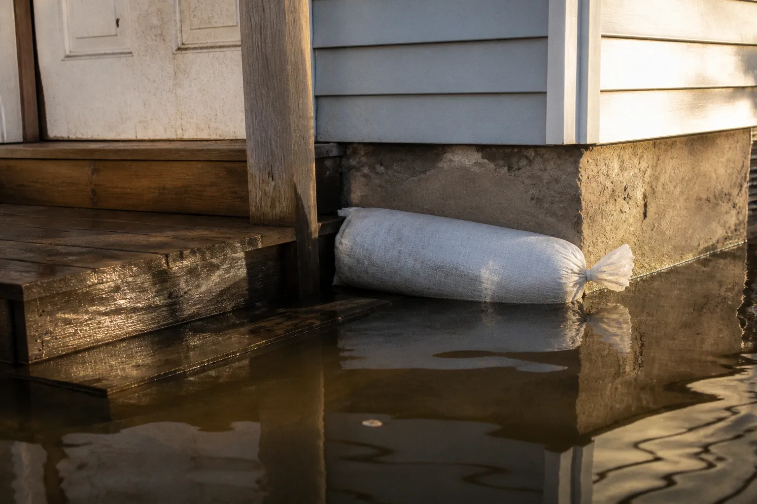
It confirms that coastal, tidal, and nuisance flooding are not isolated emergency events. They are recurring land-use and infrastructure conditions that require property-level action.
The correct Somerset County flood mitigation steps begin with exposure verification, not construction. A property owner must establish the applicable flood zone, determine the structure’s elevation relative to the Base Flood Elevation, identify vulnerable utilities, and confirm the insurance position before selecting a retrofit. A drainage improvement without elevation data is incomplete. A flood policy purchased after a storm warning may not provide immediate coverage. A utility relocation performed without permit review can create a separate compliance problem.
The following five steps provide a practical order of operations for residential properties in Somerset County, including areas exposed to tidal flooding, coastal surge, heavy rainfall, and localized nuisance flooding.
1. Establish the property’s flood exposure
A flood zone designation is a screening tool. It is not a complete risk assessment.
The first task is to review the current FEMA flood mapping for the parcel and compare it with the actual site conditions. The owner should identify:
- The mapped flood zone affecting the lot.
- The Base Flood Elevation, where one is established.
- The elevation of the lowest occupied floor.
- The elevation of electrical equipment, HVAC systems, water heaters, fuel systems, and other critical utilities.
- The location of crawl spaces, basements, garages, accessory structures, septic components, and drainage outlets.
- Evidence of prior tidal, stormwater, or overland flooding that may not be apparent from the map.
The term “high-risk flood zone” is frequently treated as a boundary between safe and unsafe property. That interpretation is incorrect. FEMA research indicates that approximately 40% of National Flood Insurance Program claims originate outside high-risk flood zones. A property outside a Special Flood Hazard Area can still experience surface-water flooding, tidal backflow, drainage failure, or storm-related inundation.
A flood map also has a defined technical purpose. It does not model every nuisance-flood pathway, blocked ditch, undersized culvert, low driveway, or local drainage obstruction. Somerset County’s 2024 Nuisance Flood Plan reflects this distinction by addressing recurrent flooding conditions that may affect roads, properties, and access routes outside the most obvious mapped hazard areas.
For a defensible site assessment, the owner should obtain the elevation information available for the structure. A survey or elevation certificate may be necessary where the relationship between the building and the BFE is unclear. The relevant comparison is not simply whether the parcel is near water. It is whether the structure and its critical systems are positioned above or below the applicable flood elevation and whether water has a defined route to the building.
A flood-zone label establishes regulatory exposure. It does not establish the full physical exposure of the property.
The map review should also include surrounding infrastructure. A home may remain dry while the access road floods. That condition still creates a functional vulnerability if emergency services, school transportation, employment access, or utility repair crews cannot reach the property.
2. Secure flood insurance before a loss occurs
Standard homeowners insurance typically does not cover flood damage. Flood coverage must generally be purchased through the National Flood Insurance Program or a private insurer.
This distinction is central to Somerset County flood mitigation. A homeowner who relies on a conventional policy may have coverage for certain wind-related losses but no coverage for damage caused by rising water, tidal inundation, or surface water entering the structure. The precise policy language controls, but the general assumption that a home policy covers flood damage is not reliable.
NFIP policies generally have a 30-day waiting period before coverage takes effect. The waiting period can vary under defined circumstances, but a property owner should not treat a forecast, evacuation notice, or approaching storm as an effective insurance deadline. Once a flood threat is visible, the available coverage options may already be restricted by the waiting period or underwriting conditions.
The insurance review should address four separate questions:
1. Is the building insured, or only the contents?
Structural coverage and contents coverage are distinct. A policy that protects one does not automatically provide the other.
2. What exclusions apply to the specific property?
Basements, below-grade areas, detached structures, landscaping, vehicles, temporary housing, and certain mechanical equipment may receive limited treatment or be excluded.
3. What is the replacement-cost or actual-cash-value basis?
The settlement method affects the amount available after a covered loss.
4. Does the policy reflect the current structure and occupancy?
Additions, conversions, finished lower levels, rental use, and relocated utilities can affect underwriting and claims handling.
Insurance does not replace mitigation. It transfers part of the financial risk after a covered event. Elevating utilities, improving drainage, and protecting building openings reduce the probability and severity of damage. FEMA has reported an average nationwide return of $6 in avoided disaster losses for every $1 spent on flood mitigation projects. That figure is a national average, not a guaranteed return for an individual Somerset County property. It nevertheless establishes the economic logic of preventive work.
The owner should retain the flood-zone determination, elevation documentation, policy declarations, photographs, receipts, and contractor records. Those documents support future insurance review, permit documentation, grant applications, and post-loss claims.
3. Elevate and protect critical building systems
Flood damage often becomes more severe because essential equipment is installed at or below the level where water enters the building. The building may be structurally sound, but one submerged furnace, electrical panel, or water heater can make it uninhabitable.
Somerset County and FEMA identify elevation and protection of utilities as core property-level measures. The target is to position critical electrical and mechanical equipment above the applicable Base Flood Elevation where site conditions and regulatory requirements permit.
The systems requiring review commonly include:
- Electrical service panels and disconnects.
- Heating, ventilation, and air-conditioning equipment.
- Water heaters.
- Boiler and fuel systems.
- Well pumps and pressure controls.
- Backup generators and transfer equipment.
- Communications, alarm, and monitoring systems.
- Sump pumps and associated electrical controls.
The correct solution depends on the structure. A water heater may be relocated to an elevated platform. An HVAC unit may be installed on an elevated support. Electrical equipment may require relocation above the expected flood level, with wiring routes modified to avoid creating new entry points for water.
Elevation work is not merely a matter of placing equipment on a higher surface. The support must resist buoyancy, floodwater flow, impact from debris, and corrosion. Electrical components require appropriate protection from water intrusion. Fuel tanks and generators require anchoring and adequate separation from ignition sources and occupied areas. Each intervention must be coordinated with electrical, mechanical, building, and floodplain requirements.
Basement waterproofing also has a limited function. It can reduce seepage and moisture intrusion, but it does not convert a below-grade space into a flood-safe occupied area. Drainage systems, sump pumps, backflow protection, sealants, and coatings must be selected for the actual water pathway. A coating applied to an interior wall will not resolve hydrostatic pressure, foundation movement, blocked discharge, or groundwater entering through slab joints.
The order of work should follow the vulnerability hierarchy:
1. Remove or elevate equipment whose failure would terminate heat, power, water, or communications.
2. Protect electrical and mechanical penetrations.
3. Control water entry at doors, foundation openings, and service penetrations.
4. Anchor tanks, generators, and other buoyant equipment.
5. Confirm that discharge points remain functional during heavy rainfall and elevated water conditions.
Any structural alteration, elevation project, enclosure change, electrical modification, or substantial repair should be reviewed under the applicable local permitting and floodplain procedures before construction begins. Regulatory compliance is not an administrative afterthought. It determines whether the finished work can be documented, insured, financed, and recognized in a future loss assessment.
4. Correct site drainage and reduce water entry
Drainage work must be based on flow direction. Adding a drain at the lowest visible point is not automatically a solution. It can move water toward a neighboring parcel, overload a ditch, interfere with a septic system, or discharge into a route that is already affected by tidal conditions.
The property owner should document how water behaves during heavy rainfall and high-water events. The assessment should identify:
- Roof runoff and downspout discharge points.
- Surface grades toward the foundation.
- Low points in driveways, walkways, and yards.
- Ditches, swales, culverts, and roadside drainage structures.
- Clogged or undersized conveyance features.
- Locations where tidal water or stormwater backs up.
- Connections between roof drainage and sanitary or stormwater systems.
- Septic tanks, drain fields, wells, and other water-sensitive infrastructure.
The practical objective is to keep ordinary rainfall away from the structure while preserving a lawful and stable discharge route. Downspouts should not discharge directly against the foundation. Grading should direct water away from walls without concentrating flow on adjacent properties. Drainage improvements should not block public rights-of-way, fill regulated areas, or alter a watercourse without the required review.
In coastal Somerset County, drainage cannot be analyzed separately from tidal conditions. A pipe or ditch that performs adequately during a normal rainfall event may drain slowly when downstream water levels are elevated. That creates a backwater condition: rainfall continues to arrive, but the receiving system loses hydraulic capacity. A private pump may move water from one location to another, but it does not eliminate the downstream constraint.
Nature-based measures can supplement conventional drainage. Vegetated swales, rain gardens, stabilized shorelines, permeable surfaces, and properly designed storage areas can slow runoff and reduce the volume reaching a constrained drainage system. Their effectiveness depends on soil, groundwater, maintenance, slope, and connection to the wider drainage network. They are not universal substitutes for culvert replacement, site regrading, or structural floodproofing.
A property owner should distinguish between three categories of work:
| Work category | Primary function | Principal limitation |
|---|---|---|
| Drainage correction | Moves or stores rainfall before it reaches the building | May fail when the receiving system is tide-locked or undersized |
| Floodproofing | Reduces water entry through openings and building components | Does not eliminate hydrostatic or structural loads |
| Elevation | Places the structure or utilities above expected flood levels | Can require engineering, permits, access changes, and substantial capital |
The selection should follow the physical cause of flooding. Drainage correction addresses runoff. Floodproofing addresses entry points. Elevation addresses the vertical position of the structure or its systems. Treating one category as a substitute for the others produces incomplete mitigation.
5. Monitor localized flooding and document recurring conditions
The final step is operational. Flood conditions change, and the county’s planning record depends partly on evidence from affected locations.
Somerset County emergency management uses the MyCoast Maryland platform to receive photographs and data on tidal and nuisance flooding. Residents can submit localized observations through the platform. This is not a replacement for emergency reporting, engineering inspection, or a formal insurance claim. It is a method for documenting timing, depth, location, roadway impact, and recurrence.
A useful flood record should contain:
- The date and approximate time.
- The rainfall or tidal context, if known.
- Photographs taken from a stable reference point.
- The location of standing or moving water.
- The depth relative to a fixed feature, such as a curb, step, utility box, or road edge.
- Whether the water entered the structure.
- The duration before the site returned to normal conditions.
- Any blocked culvert, failed ditch, overtopped road, or damaged drainage component.
- Effects on access, utilities, septic systems, and neighboring parcels.
Repeated observations are more useful than a single image without context. A series of records can establish that a roadway floods under moderate conditions, that a drainage outlet remains submerged during high tide, or that a low area repeatedly threatens a structure even when the parcel is outside a high-risk mapped zone.
The documentation also supports communication with public works, emergency management, municipal officials, insurers, engineers, and potential grant administrators. It provides a factual record for distinguishing a private drainage defect from a broader infrastructure constraint.
Residents should not enter moving floodwater to obtain photographs. Roadway flooding can conceal washouts, open drainage structures, electrical hazards, and contaminated water. Documentation must not create a separate safety incident.
How the five steps fit together
The steps are sequential, but they are not independent.
- The flood-zone and elevation review defines the exposure.
- The insurance review establishes the financial protection available after a covered loss.
- The utility assessment identifies the components that require immediate elevation or protection.
- The drainage review addresses water movement around the site.
- The monitoring process tests whether the selected measures correspond to actual conditions.
A property owner should avoid beginning with a contractor’s preferred product. A flood barrier, sump pump, coating, or elevated platform may be appropriate in one setting and ineffective in another. The controlling question is the source, depth, velocity, duration, and pathway of the water.
The same principle applies to funding. Maryland climate adaptation grants and other public programs may support eligible resilience work, but availability, applicant eligibility, matching requirements, and current funding levels vary. Exact county-level grant amounts for private homeowner elevation are not established by the available record. Owners should therefore treat grant funding as a potential financing source, not as an assumed project component.
For properties in or near municipal areas such as Crisfield, the review may involve overlapping county, municipal, state, and federal requirements. The applicable authority depends on the work. Floodplain development, building alterations, septic modifications, shoreline activity, road access, and stormwater discharge may not be governed by the same approval process.
The governing principle
Somerset County flood mitigation is effective when the property owner treats flooding as a land-and-infrastructure problem rather than a single insurance event. The property’s elevation, drainage connections, utility placement, access route, and mapped exposure must be assessed together.
The minimum defensible sequence is clear:
1. Verify the flood exposure and structure elevation.
2. Obtain dedicated flood insurance before the waiting period becomes an issue.
3. Elevate or protect critical utilities.
4. Correct drainage and water-entry pathways.
5. Record and report recurring tidal and nuisance flooding.
The county’s 2021, 2022, and 2024 mitigation documents establish the planning context. The individual property owner must translate that context into site-specific action. A map review without elevation data is insufficient. Insurance without structural mitigation leaves avoidable damage potential. Drainage work without a lawful discharge route can transfer the problem rather than solve it.
For Somerset County homeowners, statutory compliance and physical performance are the same operational requirement: the mitigation measure must be permitted where required, suited to the actual flood mechanism, and documented before the next loss occurs.