Chesapeake Bay Critical Area: how the zone works
A development notice, a request to clear trees, or a new driveway proposal can look like an ordinary zoning matter—until the property is near tidal water.
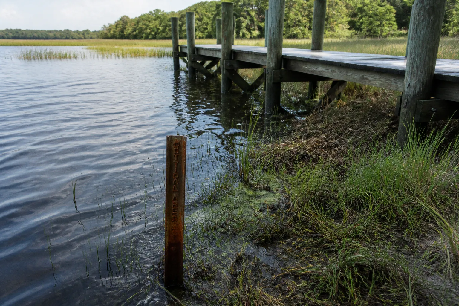
In Somerset County, land within the Chesapeake Bay Critical Area is subject to an additional layer of land-use rules designed to protect water quality, shoreline habitat, and the communities that depend on the Chesapeake Bay and its tributaries.
For property owners, neighbors, farmers, builders, and anyone trying to understand what a proposed project means for their block, the first question is usually simple: Is this property inside the Critical Area, and if so, what classification and buffer rules apply? The answer can shape where development may occur, how much vegetation must remain, and which local approvals are needed before work begins.
What the Chesapeake Bay Critical Area covers
The Chesapeake Bay Critical Area generally extends 1,000 feet landward from tidal waters or from the landward edge of adjacent tidal wetlands. The boundary also encompasses the associated tidal waters themselves. In Somerset County, that means the Critical Area can reach well beyond the visible shoreline and into neighborhoods, working landscapes, roadsides, and privately owned lots.
This distance is not meant to suggest that every parcel within 1,000 feet is treated identically. Instead, the boundary identifies an area where local land-use decisions must follow the Critical Area framework established under Maryland law. Within that area, the county applies classifications, buffer standards, development limits, and other requirements through local ordinances aligned with state oversight.
The framework began with Maryland’s Chesapeake Bay Critical Area Act, enacted by the General Assembly in 1984. Its coverage was later expanded in 2002 to include the Atlantic Coastal Bays. Somerset County has regulated local Critical Area lands since September 10, 1988, and the county adopted its Critical Area Ordinance in 2014.
That history matters because Critical Area zoning is not a temporary program created for one development dispute. It is an established land-use system that has shaped how Maryland counties approach shoreline growth, stormwater runoff, habitat protection, and the relationship between private property and shared waterways.
The 1,000-foot boundary is the starting point, not the final answer. The property’s land-use classification and shoreline conditions determine what the rules mean on the ground.
Why the boundary matters beyond the shoreline
Runoff is one of the central concerns behind the Critical Area program. Rain that falls on roofs, driveways, parking areas, compacted soil, and cleared land can carry sediment and nutrients toward streams, wetlands, and tidal waters. Once those pollutants enter the watershed, the effect is not limited to the parcel where the clearing or construction occurred.
Vegetation plays a practical role in slowing that movement. Roots help hold soil in place, while plants absorb water and reduce the speed at which runoff reaches nearby waterways. Along the Eastern Shore, where low-lying land, drainage patterns, wetlands, and tidal influence meet, those small changes on individual properties can become part of a much larger community pattern.
That is why a project that seems modest—removing trees for a larger yard, placing a shed near a wetland, expanding a driveway, or building a new home—may receive more review inside the Critical Area than a similar project farther inland.
The three Critical Area land-use classifications
The Critical Area framework divides land into three primary classifications:
- Intensely Developed Area, or IDA
- Limited Development Area, or LDA
- Resource Conservation Area, or RCA
These classifications are not interchangeable labels. They reflect different existing development patterns and different expectations for future land use. The classification assigned to a parcel can affect whether development is anticipated, how much disturbance may be allowed, and how closely a proposal must work around environmental features.
Intensely Developed Areas: established development with environmental limits
An IDA is generally associated with places where development and public infrastructure are already concentrated. These areas may include established communities, commercial settings, neighborhoods, and other locations where buildings, roads, utilities, and other improvements form a substantial part of the landscape.
The IDA designation does not remove Critical Area review. A parcel in an intensely developed setting is still subject to the framework’s environmental protections, including buffer requirements and local approval procedures. The classification recognizes the area’s existing development pattern; it does not create a blanket exemption for new construction, land clearing, or shoreline alteration.
For a resident, this distinction can be especially useful when a project is described as occurring in an already developed neighborhood. The fact that houses are nearby does not by itself answer whether a proposal can proceed as designed. A project may still need to address its relationship to a tidal wetland, tributary stream, steep slope, or other sensitive feature.
Limited Development Areas: growth shaped by the existing landscape
LDAs are areas where development exists but is less concentrated than in an IDA. They often represent a middle ground: land that may support additional development, but where the pattern and intensity of that development must remain compatible with environmental protection goals.
In an LDA, the question is not simply whether a parcel is vacant or whether a neighboring lot was developed years ago. Review may focus on the amount of land disturbance, the location of buildings and driveways, the retention of vegetation, and the way stormwater will move after construction.
This is where the phrase “same zoning district” can become misleading. Two parcels may share a general zoning designation while having different Critical Area classifications, buffer conditions, or development constraints. The wider zoning map is only one piece of the land-use picture.
Resource Conservation Areas: the most protective land-use setting
RCAs are intended to conserve areas with significant agricultural, natural, or habitat value. They may include farming landscapes, wetlands, forests, shorelines, and other lands where the preservation of ecological functions is a central planning goal.
An RCA designation does not mean that every form of activity is prohibited. It does mean that development expectations are more limited and that proposals must be evaluated carefully against the purpose of the classification. The practical question becomes how a proposed use can fit the land’s environmental and agricultural role, rather than how much additional development the parcel might accommodate.
For anyone reviewing a proposal in an RCA, the classification is a signal to look beyond the footprint of the building. Access roads, septic areas, utility connections, grading, tree removal, drainage changes, and the cumulative effect of nearby development may all matter.
A quick comparison
| Critical Area classification | General setting | What it means for land-use review |
|---|---|---|
| IDA | More intensely developed communities and infrastructure areas | Development may be more consistent with the existing pattern, but Critical Area protections and local review still apply |
| LDA | Areas with some development but lower intensity | New work is evaluated against the existing landscape, vegetation, runoff, and the amount of proposed disturbance |
| RCA | Agricultural, natural, habitat, or otherwise conservation-oriented areas | Development opportunities are more limited, with stronger emphasis on resource protection and compatibility |
The table is a useful starting point, but it cannot replace a parcel-specific determination. A property’s classification is only one part of the review. The exact location of tidal waters, wetlands, streams, slopes, soils, existing development, and recorded approvals can change the practical result.
The 100-foot vegetated buffer
The Critical Area Buffer is one of the most visible and consequential parts of the rules. Maryland’s framework establishes a minimum 100-foot vegetated buffer adjacent to tidal waters, tidal wetlands, and tributary streams. The buffer is intended to filter runoff, stabilize shorelines, protect habitat, and create a transition between developed or cultivated land and sensitive waterways.
On a property map, 100 feet can look like a clean line. On the ground, the buffer often follows a complicated landscape: a wetland edge may curve around a low area, a tributary may cross a parcel at an angle, or the boundary may be affected by existing vegetation and topography. That is why measuring from the water’s visible edge with a tape measure is not a reliable substitute for official review.
The buffer may be expanded to 300 feet in sensitive conditions, including areas with steep slopes or highly erodible soils. This expanded distance recognizes that runoff and erosion risks are not uniform. A flat, already disturbed area and a steep, unstable slope do not pose the same risk to a nearby waterway, even if they are the same distance from the shore.
What the buffer means for common property projects
The buffer can affect more than a building’s foundation. A complete proposal may need to account for:
- Tree and vegetation removal
- New homes, additions, decks, and accessory structures
- Driveways, parking areas, and access routes
- Grading, fill, and soil disturbance
- Septic systems and utility connections
- Shoreline stabilization or other work near water
- Stormwater management features
- Changes to drainage patterns
The central concern is not simply whether a structure is attractive or whether the owner has enough acreage. It is whether the proposed disturbance would weaken the buffer’s ability to slow runoff and protect the shoreline or stream corridor.
Land clearing and tree removal inside the buffer should not be treated as routine yard work. Depending on the circumstances, county approval or a Buffer Management Plan may be required before work begins. A property owner who clears first and asks questions later may create a violation that is more difficult and expensive to resolve than an early conversation with county staff.
A buffer is not unused space waiting for a better project. It is working infrastructure: living vegetation that helps protect water, soil, and the community downstream.
How the Somerset County Critical Area map fits into the process
Maps are essential to Critical Area zoning, but they are also one of the places where residents can become confused. A parcel may appear close to the shoreline without being entirely inside the Critical Area, or it may be within the mapped area even when the water is not visible from the property. In some locations, the boundary can pass through a parcel rather than placing the entire property under the same treatment.
In February 2024, the Somerset County Board of County Commissioners adopted updated Critical Area maps that replaced the older boundary with newly generated state base maps. The update followed the statewide mapping direction associated with House Bill 1253, enacted in 2008.
A map update does not necessarily mean that a property owner has changed the way the property is used overnight. It does mean that the official map used for planning and review may now reflect updated base information. If you are preparing a purchase, subdivision, building project, or land-clearing plan, the current county map is more useful than an old listing, a hand-marked survey, or a screenshot from a prior application.
What to do if the map seems wrong
Mapping questions should be handled early, before a design is finalized or a contractor schedules work. Start by identifying the parcel precisely, then compare the current Critical Area map with the property survey and the visible site conditions.
A productive review usually includes these steps:
1. Confirm the parcel identification.
Use the correct address, tax account, parcel number, or recorded description. A nearby parcel can have a different Critical Area classification or buffer condition.
2. Locate the tidal feature or tributary.
Determine whether the relevant feature is tidal water, a tidal wetland, or a tributary stream. The ordinary edge of standing water may not be the same as the regulatory reference point.
3. Check the classification.
Find out whether the land is mapped as IDA, LDA, or RCA. If the map shows more than one classification, identify which one applies to the proposed work area.
4. Compare the map with a current survey.
A survey can help connect the mapped boundary to property lines, buildings, easements, driveways, and proposed improvements.
5. Ask the county about disputed or unclear features.
If the map and the site do not appear to match, request clarification before clearing vegetation, grading, or submitting a final construction plan.
The goal is not to win an argument with the map. It is to establish which information the county will use when reviewing the project and whether additional documentation is needed.
Local enforcement: who administers the rules?
The Critical Area program is rooted in state law, but it is not administered solely from a state office. Somerset County enforces the framework locally through county ordinances that operate within Maryland’s broader Critical Area program and oversight structure.
For residents, that means the county is often the practical first stop for questions about a parcel, a proposed activity, a buffer, or a permit. Local staff can help explain which application path may apply and whether the project requires review beyond ordinary zoning or building approvals.
The county’s Critical Area Ordinance, adopted in 2014, provides the local structure for implementing these requirements. The Board of County Commissioners also adopted updated map materials in 2024. On March 25, 2025, the county adopted Ordinance No. 1207, another example of how local legislative action can update or refine the rules governing Critical Area lands.
This local role is valuable because the rules must be applied to real places. A general state standard does not show where a particular wetland begins, how a proposed driveway would affect drainage, or whether a parcel contains an existing buffer disturbance. Those questions require local records, maps, site information, and communication with the reviewing authority.
The most common process mistake
The most common mistake is treating Critical Area review as something that happens after a project has already been designed. By then, the house location may be fixed, the driveway may be committed to a particular route, and trees may already be marked for removal. If the plan conflicts with the buffer or classification, changes can become costly.
A better sequence is:
- Check the current Critical Area status before purchasing or designing.
- Identify the classification and likely buffer area.
- Discuss the proposal with the county before clearing or grading.
- Build environmental constraints into the first site plan.
- Keep records of maps, surveys, approvals, and any Buffer Management Plan.
- Confirm that contractors understand which areas must remain undisturbed.
This approach is not about making development impossible. It is about avoiding preventable redesign and protecting the community fabric that depends on clean water, stable shorelines, and functioning wetlands.
What this means for neighbors and community participation
Critical Area decisions affect more than the person filing the application. A new driveway can change drainage toward a neighboring lot. Tree removal can increase erosion on a slope. A shoreline project can alter habitat or the movement of water. A cluster of individually modest approvals can gradually change the character and performance of an entire watershed.
That is why residents should read development notices carefully and ask specific questions rather than relying on general statements such as “the project is already zoned” or “the lot is outside the flood area.” Floodplain rules, ordinary zoning, subdivision standards, and Critical Area requirements can overlap without being the same thing.
When navigating the board or attending a public hearing, useful questions tend to be concrete:
- Which Critical Area classification applies to the property?
- Where is the 100-foot buffer shown on the plan?
- Has the buffer been expanded because of slope or soil conditions?
- What vegetation will be removed?
- How will stormwater move after construction?
- Are wetlands or tributary streams located near the proposed disturbance?
- Does the project require a Buffer Management Plan or another county approval?
- Has the current Somerset County Critical Area map been used?
These questions keep the conversation focused on the physical effects of the proposal. They also help residents participate without needing to become land-use attorneys or environmental engineers.
A practical way to read a Critical Area proposal
When reviewing plans, begin with the site rather than the building. Look at the relationship among water, wetlands, streams, slopes, vegetation, roads, and proposed disturbance. A building footprint may be small, but its access and supporting infrastructure can create the larger environmental effect.
Then separate three questions that are often blended together:
1. Is the parcel inside the Critical Area?
2. Which land-use classification applies?
3. What specific environmental features and buffer standards affect the proposed work?
The first question concerns the 1,000-foot framework. The second concerns IDA, LDA, and RCA. The third brings the rules down to the parcel level, where the 100-foot minimum buffer, possible 300-foot expansion, wetlands, streams, soils, slopes, and existing disturbances become decisive.
That sequence gives our community a clearer way to discuss development. It replaces a vague question—“Can anything be built here?”—with a more useful one: “What kind of work can fit this site while protecting the water and meeting the county’s rules?”
The bottom line for Somerset County property decisions
The Chesapeake Bay Critical Area in Somerset County is a land-use system built around proximity to tidal waters and wetlands, but its effects reach far beyond the shoreline. The 1,000-foot boundary identifies the area of review. The IDA, LDA, and RCA classifications describe different development contexts. The vegetated buffer protects the connection between land and water, with a minimum width of 100 feet and the possibility of a wider buffer in sensitive conditions.
The county’s maps and ordinances are the practical tools residents use to understand how those standards apply. Because the maps were updated in 2024 and local rules continue to develop, old assumptions are not a safe basis for a new project.
For you as a property owner, neighbor, or community participant, the most useful habit is early attention: check the current map, identify the classification, locate the buffer, and speak with county staff before land is cleared or plans are locked in. That is how we make the process more understandable—and how we protect the community fabric that connects Somerset County’s homes, farms, wetlands, waterways, and working shoreline.