Critical Area Growth Allocation: Maryland Rules Explained
You see the notice taped to a utility pole on your road, or maybe it's an email blast from your civic association — something about a property near the water being considered for reclassification.
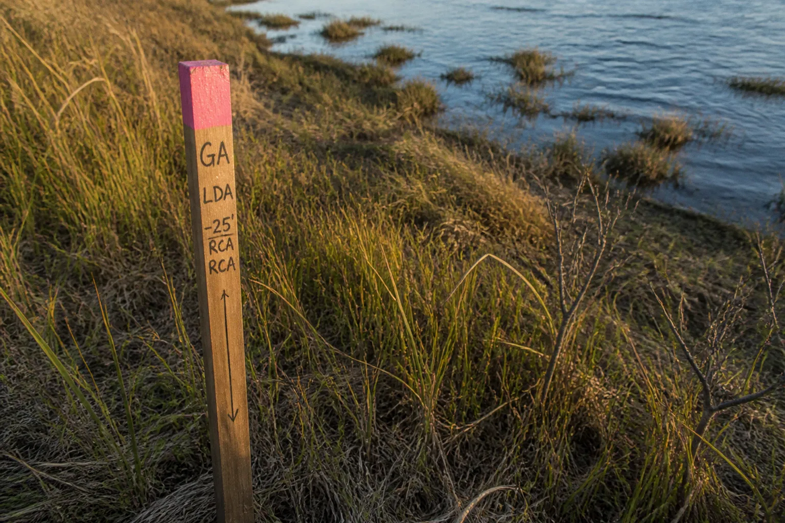
The phrase "growth allocation" appears, followed by a list of acronyms that look like alphabet soup. If you've ever wondered what any of this actually means for the place where you live, you're not alone. Across Somerset County and the rest of Maryland's Eastern Shore, growth allocation is one of those civic processes that quietly shapes whether a wooded lot stays a woodland, a farm field keeps its viewshed, or a piece of land near the bay gets rezoned for a new use. Let's walk through it together, in plain language, so the next time the topic comes up at a community meeting, you know exactly what's being decided and why it matters.
What Growth Allocation Actually Does
At its heart, Maryland's Critical Area growth allocation is a permission slip — a very specific one. It allows a local jurisdiction to change a property's land use classification within the Critical Area, which is the 1,000-foot band of land measured back from tidal waters, tidal wetlands, and the heads of tide. Every parcel inside that boundary sits in one of three designations: Resource Conservation Area (RCA), Limited Development Area (LDA), or Intensely Developed Area (IDA).
Growth allocation lets the county move a property up the intensity ladder. RCA land can be reclassified to LDA or IDA. LDA land can be reclassified to IDA. What it cannot do is reach backward — once a parcel is moved out of RCA, that move is permanent for that property. The reserve of growth allocation that a county has to work with is calculated as 5 percent of the total RCA lands it had within the Critical Area when its original program was approved, and that calculation excludes federal property and tidal wetlands. This isn't a rolling budget that refills; it's a finite pool, which is part of why every application gets close scrutiny.
Growth allocation doesn't add acreage to the Critical Area — it shifts how land already inside it is allowed to be used.
The three designations aren't interchangeable, and getting the difference straight at the start saves a lot of confusion later. Here's how the state framework generally distinguishes them:
| Designation | General character | Typical intensity |
|---|---|---|
| Resource Conservation Area (RCA) | Woodlands, farms, marshes, low-density open lands | Very low; agriculture, forestry, limited residential |
| Limited Development Area (LDA) | Areas with some existing homes or small uses, often on private wells and septic | Low-density residential; small-scale uses |
| Intensely Developed Area (IDA) | Already-served areas, frequently with public water and sewer | Higher density; commercial, industrial, mixed-use |
When someone tells you a parcel is being considered for growth allocation, they're almost always talking about a move from one of these rows to the row above it.
How Somerset County Runs the Process
Somerset County carries out growth allocation through a specific zoning tool: the Growth Allocation Floating Zone District, usually referred to as the GA district. A floating zone is a zoning category that exists in the ordinance but doesn't attach to any land automatically — it only "drops down" onto a parcel after a formal review and approval. That means a property owner can't just start using GA entitlements; the rezoning has to be granted, point by point, through the public process.
To keep the review consistent, the county uses a Growth Allocation Points Table. This is essentially a scoring rubric where a proposed project earns points for things like siting near existing development, providing water quality benefits, minimizing impacts to adjacent RCAs, and protecting habitat. There's a built-in incentive for larger conservation thinking: if an applicant retains a contiguous area of at least 20 acres as a permanent Resource Conservation Area, the project earns bonus points. It's a clever nudge toward keeping meaningful chunks of intact landscape rather than nibbling away at the edges.
The process itself works like a relay. An application comes in locally, gets reviewed by county planning staff and the planning commission, then moves through the County Commissioners, and finally requires approval from the state Critical Area Commission before any reclassification takes effect. Nothing about growth allocation happens unilaterally at the local level — the state has the final say, and that's by design.
Where New Development Can and Can't Go
The state guidelines spell out four location-based standards that every growth allocation project has to satisfy, and they're worth understanding because they're often where community conversations get stuck.
First, new development under growth allocation must be located within or adjacent to existing developed areas. Translation: it shouldn't leapfrog out into a pristine stretch of woods or open field. Second, the project has to optimize water quality benefits — think better stormwater handling, less impervious surface, more natural filtration. Third, it must minimize impacts to adjacent Resource Conservation Areas, which means the boundary between the new use and any protected land should be thoughtfully designed. And fourth, the project has to sit at least 300 feet back from the landward edge of tidal waters and tidal wetlands.
That 300-foot setback is one of the more concrete numbers in the rulebook, and it shows up in plenty of neighborly disagreements about where a project line should fall on a survey. It's not a suggestion, and it can't be waived casually. Reducing it requires a formal variance or an approved buffer management plan, both of which carry their own evidentiary burden.
The 2024 Climate and Equity Update
In 2024, the Maryland General Assembly pushed a meaningful update into the Critical Area law, and the changes ripple straight down into how growth allocation decisions get made. Two ideas sit at the center of the update.
The first is equitable distribution. The law now requires the Critical Area Commission to ensure an equitable distribution of the burdens and benefits of development, mitigation, restoration, conservation, and climate change adaptation. In practice, this asks counties to look beyond a single project on a single parcel and consider who bears the environmental costs and who reaps the rewards. A community that has historically hosted a wastewater plant, a substandard road, or a flood-prone intersection, for instance, shouldn't be the default next stop for every difficult land use decision.
The second is climate and coastal-hazard integration. The 2024 update folded climate considerations directly into growth allocation criteria. Sea level rise projections, storm surge modeling, marsh migration, and shoreline erosion rates — these used to live mostly in long-range plans. Now they're supposed to be part of the conversation at the application stage, especially for any parcel near the water. For Somerset County, where so much of the Critical Area boundary hugs the Chesapeake and Tangier Sound, this isn't an abstract concern. It's the land your kids will inherit.
The 2024 update didn't change the basic mechanics of growth allocation — it changed what "responsible" means when we use that tool.
What's Changing on the Ground in Somerset County
If you've watched local meeting agendas over the last year or so, you've seen the regulatory machinery working in real time. A few milestones are worth naming because they change what you'll see proposed and where.
In June 2024, the Critical Area Commission approved Somerset County's Critical Area boundary map update, which resulted in a net loss of 227 acres of Critical Area — made up of 1,844 acres of gains and 2,071 acres of losses as the boundary was redrawn against current conditions. Boundary redrawing isn't the same as reclassifying land, but it shifts which parcels fall inside the 1,000-foot band and therefore which ones are subject to these rules at all.
In February 2026, the Somerset County Commission approved Ordinance 1220, a text amendment to the county's RCA provisions, and the Critical Area Commission signed off on it in April 2026. The headline change: Restaurants and Retreats became permitted uses in the RCA, subject to strict conditions. The lot coverage cap is set at 15 percent, and the ordinance explicitly prohibits any encroachment into the Critical Area Buffer or Habitat Protection Areas. This is the kind of nuanced outcome that often gets flattened into "they're building a restaurant in the wetlands" headlines — the reality is more careful than that, and the conditions are doing real work.
Meanwhile, in July 2026, the Town of Princess Anne wrapped up its comprehensive Critical Area program review and adopted the state Commission's model ordinance, bringing the town's local code into alignment with current state regulations. For residents inside town limits, that's a quietly significant update — it means the rules they read about in county-level discussions now apply to their own jurisdiction's review of new projects.
Reading the Points Table Like a Neighbor
One practical thing worth doing, if you're weighing in on a growth allocation application, is to ask for the points table summary at the public hearing. County planning staff typically walks through it, but it's your right to request a copy. Look for the four location-based standards first: is the project adjacent to an existing developed area, what water quality features are proposed, how does the design handle the boundary with any adjacent RCA, and where exactly does the project sit relative to the 300-foot tidal setback. Then look for the bonus category — was a 20-acre contiguous RCA preserved as part of the deal.
That sequence isn't bureaucratic box-checking. It's the framework the decision is built on, and when you can read it, the conversation at the meeting makes a different kind of sense. You're no longer watching acronyms wash over you; you're tracking how the proposal earns, or doesn't earn, its path through the rules. Over time, you'll start to recognize the patterns — which arguments tend to carry weight with the planning commission, which conditions get negotiated down, and which design features consistently win bonus points. That kind of literacy is what turns a public hearing from a spectator sport into actual civic participation.
What This Means for Your Block
Here's the honest part. Growth allocation is a tool — a careful, deliberate, double-checked tool — for letting some kinds of change happen inside a part of the state that was set aside forty years ago to protect the Chesapeake Bay. The 1984 Critical Area Law created the boundary because the evidence was already clear: what happens within 1,000 feet of the water ends up in the water. Every reclassification decision is, at some level, a vote on whether a particular acre of Somerset County will be asked to do more than it has been doing.
For most of us, the work isn't memorizing the ordinance. It's showing up to the meeting where a project is being discussed, asking the four location questions out loud, and trusting that the process — state Commission included — is built to catch the proposals that don't measure up. The community fabric of the Eastern Shore has always been woven from people who paid attention to what was happening on the next property over. Growth allocation just gives that instinct a more formal name and a clearer set of rails to run on.