Somerset County Tax Ditch Easements: A Landowner Checklist
A tax ditch easement can be easy to miss until you want to place a shed, fence, driveway, pond, septic feature, or landscaping project near a drainage channel.
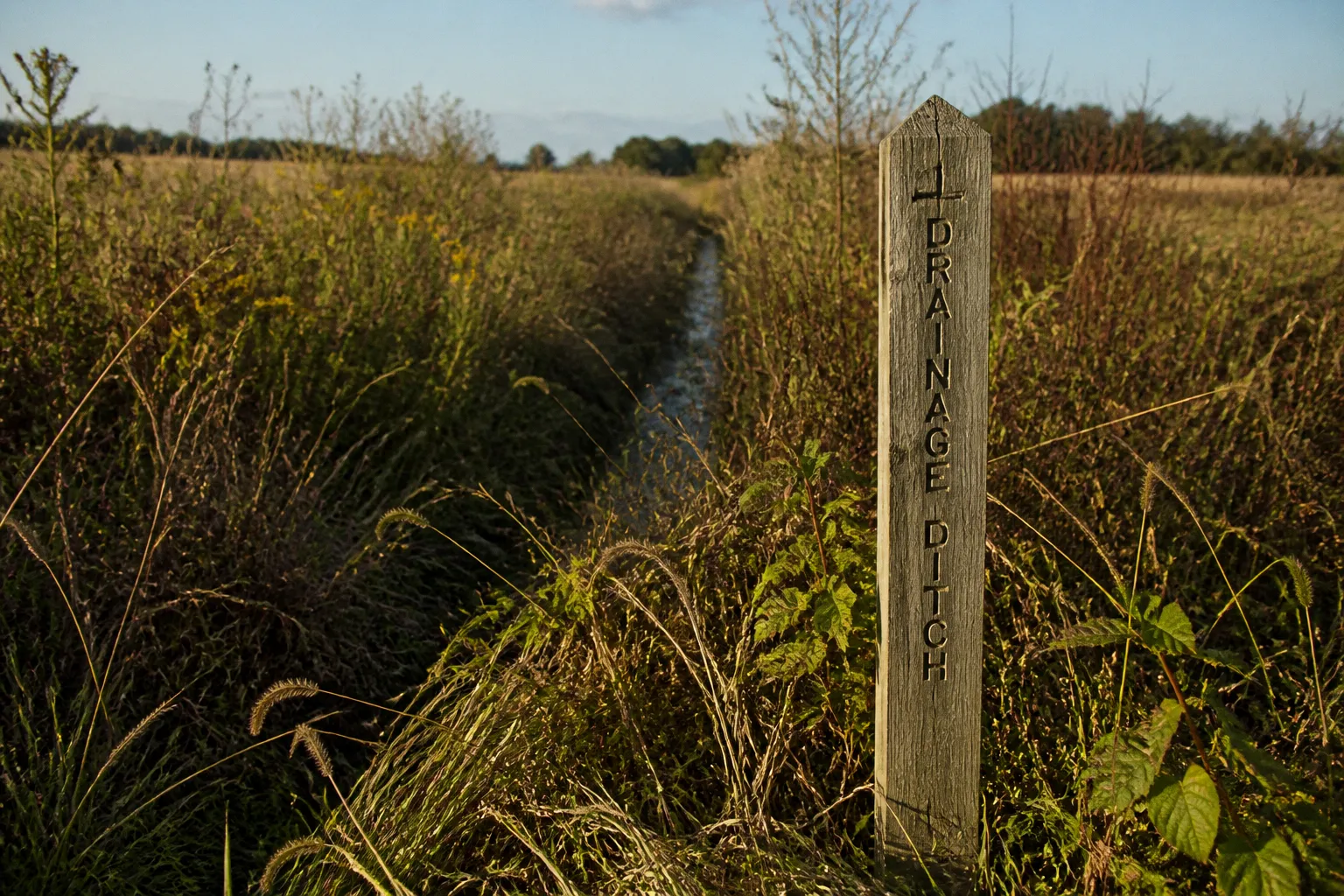
Then a routine property question becomes more complicated: who controls the ditch, where does the easement begin and end, who pays for maintenance, and what can you build without interfering with the system?
For landowners in Somerset County, the answers usually involve more than the visible ditch itself. Public drainage systems are supported by legal rights-of-way, maintenance plans, assessments, and access requirements. This Somerset County tax ditch easement checklist is designed to help you move through those questions in the right order, without treating a general map, a neighbor’s recollection, or the current appearance of the ditch as the final word.
Why tax ditch easements matter in Somerset County
Across Maryland’s Eastern Shore, public drainage systems help move water away from cropland, wooded areas, roads, and developed properties. The network is substantial: approximately 821 miles of ditches are maintained across 101 Public Drainage Associations and four Public Watershed Associations in Caroline, Queen Anne’s, Somerset, Wicomico, and Worcester counties. Together, those systems drain roughly 183,000 acres.
That scale explains why an individual ditch can affect more than one parcel. A drainage channel may look like a narrow feature behind a property, but its legal maintenance area can extend beyond the water itself. Crews may need room to enter, remove sediment or vegetation, repair banks, and keep the system operating according to its approved design.
A Public Drainage Association, commonly called a PDA, is an independent government entity with legal rights-of-way and easements for ditch construction and maintenance. Public Watershed Associations, or PWAs, operate in a similar public drainage framework. If your land falls within one of these systems, the relevant rights are not simply informal arrangements between adjoining owners.
The ditch you can see is only part of the system; the easement is the legal space needed to keep that system working.
For your block, this means a drainage easement can influence ordinary property decisions even when no maintenance work is scheduled. The issue may arise when you apply for permits, sell the property, refinance, divide a parcel, or investigate recurring standing water.
Start with the record, not the appearance of the land
The first step in a Somerset County tax ditch easement checklist is to establish whether your parcel is served by a public drainage association and to identify the recorded maintenance area.
A ditch may be overgrown, dry during part of the year, or difficult to distinguish from a natural swale. None of those conditions necessarily removes the underlying easement. Conversely, a visible depression or channel is not automatically proof of a particular recorded width. The legal description controls.
Maryland law requires the board of managers of each drainage association to submit an easement record to the clerk of the circuit court. The record identifies maintenance easements or rights-of-way according to the original design specifications or, where applicable, an area of not less than 20 feet. That 20-foot figure is an important statewide reference point, but it should not be treated as the exact width for every Somerset County parcel. The original specifications and the parcel’s recorded information may define something different.
When reviewing your property file, look for:
- The name of the Public Drainage Association or Public Watershed Association serving the parcel.
- The recorded easement or right-of-way description.
- Any survey, plat, deed reference, or other document that identifies the ditch corridor.
- The relationship between the easement record and the visible channel.
- Notes about access, maintenance, construction, or the association’s operating area.
- Whether the parcel is classified as cropland, woodland, residential, commercial, or another land category for assessment purposes.
A county property map can help you orient yourself, but it may not show the full legal maintenance area. If the location matters for a construction project or a boundary question, the safest path is to compare the public record with the deed, plat, and—where necessary—a survey prepared for the specific parcel.
A practical document trail
You do not need to understand every drainage document before you begin. Work through the file in a sequence that answers one question at a time:
1. Identify the drainage association.
Find out whether the parcel lies within a PDA or PWA service area and determine the association’s name.
2. Locate the easement record.
The circuit court clerk’s records are central because Maryland law requires each association’s maintenance easements or rights-of-way to be recorded there.
3. Compare the legal description with your deed and plat.
Look for references to ditches, drainage rights-of-way, maintenance corridors, or older subdivision documents.
4. Review the association’s Operation and Maintenance Plan.
Every Maryland public drainage association is required to maintain a current plan approved by the Maryland Secretary of Agriculture. The plan is intended to support functioning drainage while minimizing environmental impacts.
5. Mark the area on a current property sketch.
This does not replace a survey, but it can make the practical relationship between the home, driveway, outbuildings, trees, and ditch easier to understand.
6. Ask for parcel-specific confirmation before disturbing the area.
If your proposed work could limit equipment access or alter drainage, obtain guidance from the appropriate association or public agency before construction begins.
The goal is not to create a paper exercise. It is to understand what the association must be able to do in the future and how that affects what you want to do today.
What the easement allows—and what it does not mean
Many landowners first encounter a tax ditch easement as a restriction. That is understandable, especially when the area has been part of a yard for years. But an easement is better understood as a continuing operational right connected to the drainage system.
The association’s legal rights generally support construction, inspection, access, and ongoing maintenance of the public ditch. The land itself may remain privately owned, but ownership does not automatically give the owner exclusive freedom to place structures or make changes inside the maintenance corridor.
This distinction matters for several common projects:
| Proposed change | Why the easement may matter | Safer way to approach it |
|---|---|---|
| Fence or gate | It may obstruct equipment access or narrow the maintenance route. | Confirm the recorded corridor and ask how access must be preserved before installation. |
| Shed, garage, or addition | A permanent structure can interfere with future ditch work and may be difficult to remove later. | Review the easement and applicable local approvals before choosing a building location. |
| Driveway or parking area | Fill, grading, or paving can change water movement and limit access. | Discuss the design early, especially where a crossing over the ditch is involved. |
| Trees or deep-rooted plantings | Roots and mature growth can complicate maintenance and affect ditch banks. | Select planting locations outside the operational area unless the responsible authority approves otherwise. |
| Pond, berm, or grading project | Earthwork can redirect runoff, reduce drainage capacity, or destabilize banks. | Obtain technical guidance before moving soil or changing elevations. |
| Septic, utility, or underground installation | Excavation may damage the channel or conflict with future maintenance. | Coordinate the proposed route with the easement record and relevant permitting authorities. |
The key question is not simply whether a project sits directly on top of the ditch. Ask whether it could restrict access, change water flow, damage the ditch, or make the approved maintenance work impractical.
That is also why a previous owner’s improvement does not necessarily establish permission for a new project. A fence that has stood for decades may still be a poor model for where to place your new fence. A neighbor’s approval, informal understanding, or lack of past enforcement is not the same as written confirmation from the entity with the legal maintenance interest.
The Operation and Maintenance Plan is part of the picture
The legal easement tells us where the association’s rights exist. The Operation and Maintenance Plan helps explain how the drainage system is intended to function.
Maryland requires public drainage associations to maintain a current plan approved by the Maryland Secretary of Agriculture. The purpose is not only to keep water moving. The plan also addresses the need to minimize environmental impacts while maintaining a working drainage system.
That balance is particularly relevant in Somerset County, where drainage decisions connect to agricultural land, wetlands, coastal conditions, tributaries, and the broader Chesapeake Bay watershed. A change that seems minor at the edge of one property can have consequences downstream if it increases sediment, redirects runoff, blocks a channel, or changes the timing of water movement.
When you review or ask about the plan, focus on practical questions:
- What portion of the ditch serves your parcel?
- How is access expected to occur?
- Are there recurring maintenance activities that require a clear corridor?
- Does the proposed project involve grading, fill, excavation, or a crossing?
- Could the work affect an outlet, culvert, bank, or adjacent parcel?
- Are there environmental or permitting concerns beyond the easement itself?
- Is the plan current, and who is responsible for answering parcel-specific questions?
The plan should not be treated as a substitute for a property survey or a permit review. It is one piece of the decision-making record, and it helps connect the legal right-of-way to the physical work required to maintain the drainage network.
A maintenance easement is not an abandoned strip of yard; it is reserved working space for a public drainage system.
How assessments fit into landownership
Public drainage associations are funded in part through assessments on benefited landowners. These assessments are based on land classifications such as cropland, woodland, residential, or commercial land. The exact amount is not a single Somerset County rate that applies uniformly to every parcel. Individual PDA budgets, service areas, and land classifications can affect what a landowner pays.
That makes it useful to separate two questions:
1. Does the parcel benefit from the public drainage system?
2. What assessment applies to this particular parcel?
A property owner may be responsible for an assessment even if the ditch is not immediately adjacent to the house. The system is organized around the drainage area it serves, not simply the portion visible from a backyard.
Before assuming that a tax ditch charge is incorrect, confirm:
- The parcel’s drainage association.
- The land classification used for the assessment.
- Whether the parcel has changed use or been divided.
- Whether the assessment relates to the current association budget.
- Whether the charge is connected to a public drainage or watershed association rather than a separate county, municipal, or property-service fee.
Because rates vary by association and classification, a general online estimate can be misleading. The association or responsible public office is the appropriate place to ask about the current assessment for a specific parcel.
A landowner checklist for projects near a ditch
If you are considering work near a drainage channel, use the following checklist before signing a construction contract or ordering materials.
1. Describe the project clearly
Write down what you want to build or change, including approximate dimensions and location. “Improve the backyard” is too vague to evaluate. “Install a six-foot fence along the rear boundary, with a gate on the west side” gives the reviewing office something useful to work with.
Include:
- The type of improvement.
- Its approximate footprint.
- Whether it requires excavation or fill.
- Whether it changes grading or runoff.
- Whether vehicles or equipment must cross the ditch.
- Whether the project could affect access from a neighboring property.
2. Find the recorded easement
Do not rely on the ditch’s visible edge. Locate the easement record and compare it with the deed, plat, and property layout. If the record refers to original design specifications, those specifications may be important in determining the operational width.
The statutory minimum reference of 20 feet is not a shortcut to a parcel-specific answer. It is a reminder that the maintenance area may be substantially wider than the channel itself.
3. Identify the responsible association
A PDA or PWA may have its own board of managers and maintenance responsibilities. Identify the entity connected to the parcel before directing questions to the wrong department.
Ask who can confirm:
- The maintenance corridor.
- Access expectations.
- The current Operation and Maintenance Plan.
- Whether the proposed work requires written approval or coordination.
- How maintenance equipment reaches the site.
4. Check other approvals separately
An easement review does not replace local land-use, building, grading, stormwater, environmental, or access approvals. Depending on the project and location, other agencies or programs may also be involved.
This is especially important for projects that touch wetlands, waterways, coastal areas, or stormwater routes. A project can be acceptable from one standpoint and still require changes under another review.
5. Keep a written record
Save copies of the easement documents, maps, plans, emails, approvals, and project drawings. If someone gives guidance by phone, make a brief note of the date, office, person contacted, and substance of the conversation, then ask whether the guidance can be confirmed in writing.
Clear records help everyone later: you, the association, a contractor, a future buyer, and the county or state office reviewing a related application.
6. Tell the contractor before work begins
A contractor who sees only the physical site may not know about the recorded drainage rights. Provide the easement information and explain that the area must remain accessible and functional.
Do not let a contractor make the final call based on statements such as “the ditch is dry” or “the fence will be close enough.” The project design should respond to the recorded rights and the association’s maintenance needs.
Common mistakes that create avoidable trouble
The same misunderstandings appear repeatedly in property conversations about drainage easements. They are understandable, but they can be expensive to correct.
Treating the ditch as a private landscaping feature
A landowner may mow, plant, or maintain the area for years and begin to view it as part of the ordinary yard. That personal use does not eliminate the public drainage function. The association may still need access for maintenance.
Assuming the watercourse is the easement boundary
The legal corridor may extend beyond the visible water. In some seasons, the ditch may be nearly invisible; after a storm, water may spread beyond it. Neither condition establishes the recorded boundary.
Using a neighbor’s project as permission
A nearby fence or shed may have been built under different conditions, before a parcel division, or without a complete review. It is evidence of what exists—not proof that your proposed project is allowed.
Waiting until construction is underway
Moving a fence, foundation, driveway, or utility line after installation is far more disruptive than adjusting a plan on paper. Early questions are not an obstacle to progress; they are how we protect the project from a preventable redesign.
Confusing ownership with unrestricted use
Private ownership and public maintenance rights can exist on the same land. The question is not whether you own the parcel. The question is what rights have been recorded over it and how those rights affect the proposed use.
Assuming every drainage issue is a tax ditch issue
Somerset County properties can be affected by several different drainage conditions, including roadside drainage, private ditches, stormwater facilities, natural waterways, and public drainage associations. Identify the system before assuming that one set of rules answers every question.
When a boundary or project question needs professional help
Some questions can be resolved by reviewing the record and speaking with the association. Others call for a surveyor, engineer, attorney, or permitting specialist with experience in Maryland land and drainage matters.
Professional assistance becomes especially useful when:
- The easement description is difficult to locate on the ground.
- The deed, plat, and circuit court record do not appear to match.
- A proposed structure would sit near the possible easement line.
- The project includes substantial grading, fill, excavation, or a ditch crossing.
- A property division or sale depends on the location of the maintenance corridor.
- Neighboring owners disagree about access or the ditch boundary.
- The ditch has changed course, eroded, or become obstructed.
- You need a dependable location for a foundation, septic feature, utility, or permanent fence.
A survey can establish the relationship between the recorded easement and the physical parcel. An engineer can help evaluate drainage capacity, crossings, grading, and bank stability. An attorney can explain the legal effect of recorded rights when ownership, development, or a dispute is involved. The right professional depends on the question; the important part is not to ask a construction crew to solve a property-record problem.
The larger community fabric of tax ditch maintenance
It is tempting to see an easement as a narrow private inconvenience. In practice, public drainage is shared infrastructure. A ditch may protect farmland, roads, homes, and neighboring parcels at the same time. When access is blocked or a channel is altered without coordination, the effect can travel through the watershed.
That does not mean every landowner must leave the entire property untouched. It means we need to plan improvements with the drainage system in view. A well-placed fence, properly designed crossing, or carefully located outbuilding can often coexist with the public maintenance function. The earlier we identify the constraints, the more choices we usually have.
The history of Maryland’s public drainage system also helps explain why these arrangements remain part of present-day property records. Organized public drainage work in the state reaches back to the late eighteenth century, while the modern statutory framework for Public Drainage Associations was established in the twentieth century and later updated within Maryland’s Local Government provisions. These are not temporary arrangements created for one recent subdivision. They are long-running public systems built around shared land and water-management needs.
Final checklist before you alter the property
Before placing a structure, fence, driveway, planting, utility, or earthwork near a Somerset County drainage ditch, make sure you can answer these questions:
- Is the parcel within a Public Drainage Association or Public Watershed Association?
- Where is the recorded maintenance easement or right-of-way?
- Does the record identify an original design width or another specific dimension?
- Have you reviewed the current Operation and Maintenance Plan?
- Could the project block access, change drainage, or interfere with ditch maintenance?
- Have you identified the association or public office responsible for parcel-specific guidance?
- Do local, state, environmental, stormwater, or building approvals also apply?
- Have you given the contractor the easement information before work begins?
- Do you have written records of the guidance and approvals you received?
The most useful way to approach a Somerset County tax ditch easement is as a coordination question, not a confrontation. You own your land, and the public drainage association has defined rights needed to maintain the system. Once those rights are identified in the record, you can plan around them with far more confidence—and protect both your project and the community infrastructure that keeps our Eastern Shore landscape working.