Planning workshops in Somerset: choosing the right format
Maryland Land Use Code §3-203 requires a local planning commission to hold at least one formal public hearing before recommending adoption of a comprehensive plan. That hearing is part of the statutory adoption process.
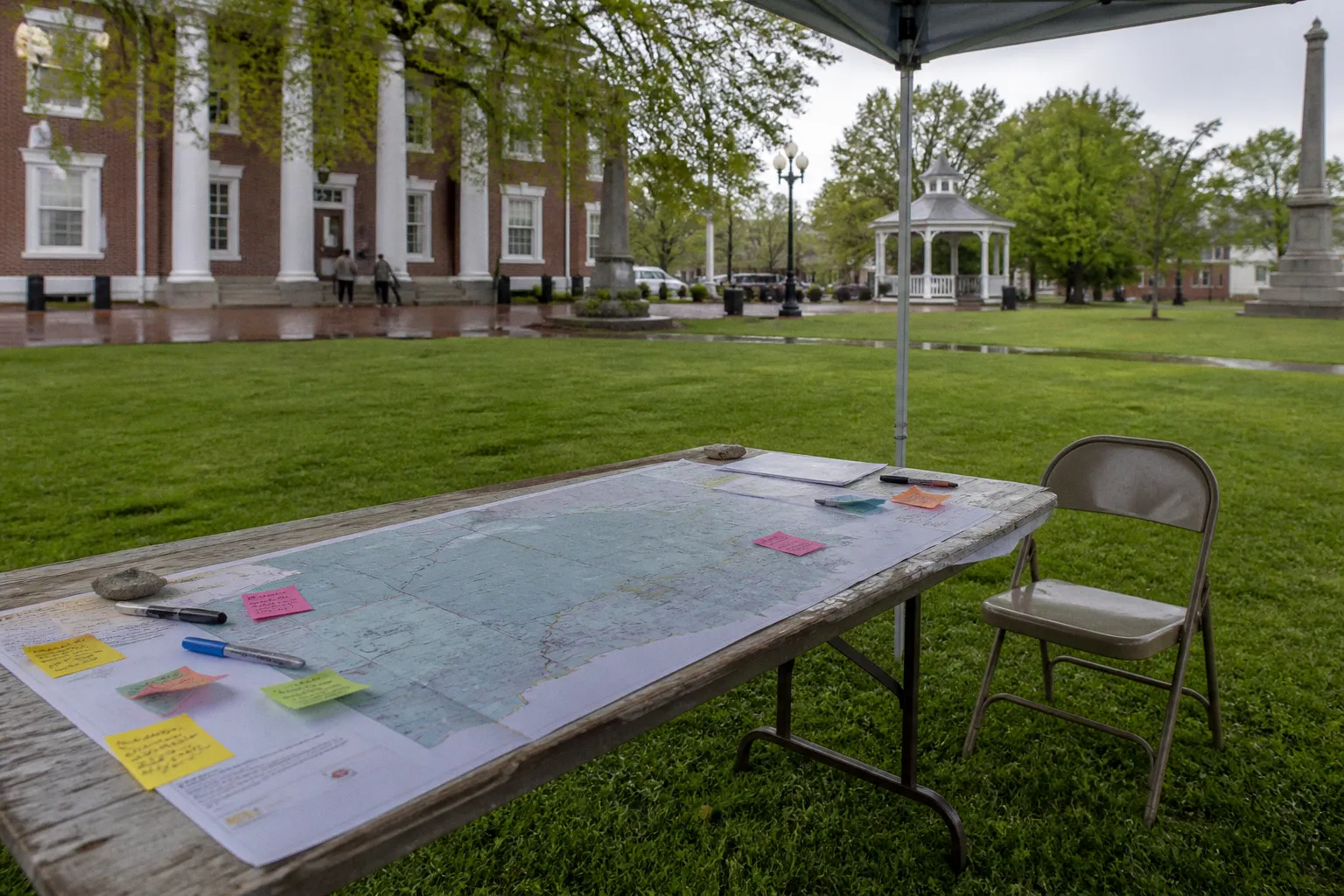
A planning workshop is not.
The distinction determines how Somerset County should collect public input, how staff should structure technical review, and how residents should interpret the status of their comments. Informal workshops can test priorities, identify mapping problems, and improve draft policies. They do not replace a properly noticed public hearing, create sworn testimony, or authorize the Planning Commission to take binding action.
The 2025 Somerset County Comprehensive Plan update used several engagement formats during the community input phase from 2024 through early 2025. These included an online public survey, a broad Visioning Workshop, and Technical Committee workshops. The survey generated more than 360 responses against a target of 300. The workshops then provided different methods for interpreting those responses and translating them into plan elements.
The correct approach to Somerset planning workshops choosing a format is therefore procedural. The format must match the planning question, the stage of the plan, the type of evidence required, and the legal status of the meeting.
Distinguishing informal workshops from formal public hearings
A workshop is an informal planning session. Somerset County is not legally required to convene one for every plan amendment or comprehensive plan update. An informal workshop also does not require the same procedural steps that apply to a formal public hearing.
The distinction has several operational consequences:
- A workshop has no statutory requirement for a 60-day advance notification to adjoining jurisdictions.
- A workshop does not require a court reporter transcription.
- The Somerset County Planning Commission does not take binding votes during a workshop.
- The session does not involve sworn testimony.
- Workshop comments are not automatically part of the official evidentiary record used for plan adoption.
- Formal decisions and official records are reserved for properly noticed public hearings and the subsequent adoption process.
This does not make workshops administratively irrelevant. It defines their function. They are development-stage instruments. They allow staff, consultants, committee members, and residents to identify issues before the county commits a proposal to the formal hearing track.
A public hearing has a different purpose. Under §3-203, the planning commission must conduct at least one formal public hearing before it recommends adoption of a comprehensive plan. A recommended plan must also be distributed to adjoining jurisdictions and the Maryland Department of Planning for a 60-day period before the formal hearing process is completed.
The sequence can be summarized as follows:
1. Preliminary research and community input establish baseline conditions and priorities.
2. Informal workshops test policy concepts, maps, and technical assumptions.
3. Draft plan preparation consolidates the working material into proposed plan elements.
4. Distribution and statutory review begin the required 60-day period for the recommended plan.
5. Formal public hearing creates the legally recognized public record for the recommendation.
6. Planning Commission recommendation is forwarded to the Board of County Commissioners.
7. Board adoption occurs through the county’s governing authority, not through the Planning Commission alone.
The legal status of the meeting must be communicated clearly. A resident attending a Visioning Workshop is providing planning input. A resident appearing at a formal public hearing is participating in a statutory proceeding. Treating those settings as interchangeable produces inaccurate expectations about what the county must record, answer, or incorporate.
A workshop develops the plan. A public hearing establishes the formal record for recommending it.
The physical location also reflects this distinction. Formal Planning Commission public hearings are held in Room 111 of the Somerset County Office Complex, according to the available county planning information. An informal workshop may use a different room, format, or facilitation method. Its location does not determine its legal status. Notice, agenda language, and the governing procedure do.
Visioning Workshops: converting broad priorities into policy frameworks
A Visioning Workshop is the appropriate format when the county needs broad participation before policy language and map boundaries are fixed. It is not designed to resolve a single easement delineation or approve a specific service-area expansion. Its function is to move from general public priorities to an organized policy framework.
The 2025 comprehensive planning process used the Visioning Workshop after the initial survey phase. That order is logical. A survey produces quantitative baseline data. A facilitated workshop allows participants to test what those responses mean spatially and institutionally.
For example, a survey may identify strong public support for:
- protecting agricultural land;
- improving transportation connections;
- expanding water and sewer access;
- directing growth toward existing service areas;
- preserving sensitive environmental resources;
- improving housing choice or neighborhood conditions.
Those results remain too broad to function as a comprehensive plan. A Visioning Workshop can place the themes against preliminary maps and draft priority statements. Participants can then assess whether the proposed policy direction corresponds with actual land conditions, infrastructure limitations, municipal boundaries, and environmental constraints.
A properly designed Visioning Workshop generally performs five tasks:
1. Defines the policy vocabulary.
Participants review terms such as growth area, rural preservation, service area, priority corridor, environmental constraint, and development capacity. Misunderstood terms can produce defective feedback. The workshop should establish a common working definition before asking for preferences.
2. Tests preliminary spatial assumptions.
Draft maps are placed before participants for review. The purpose is not to produce a final zoning map. It is to identify obvious conflicts, omitted areas, inaccurate assumptions, and locations where a policy statement has a direct land-use consequence.
3. Translates survey findings into policy categories.
Survey responses show relative support. They do not explain the implementation mechanism. Workshop discussion can distinguish between a transportation objective, a capital investment priority, a zoning issue, and a development review standard.
4. Identifies conflicts among priorities.
Growth near infrastructure may reduce extension costs but increase development pressure. Agricultural preservation may limit the land available for new residential capacity. Environmental protection may restrict the location of public facilities. A broad workshop should expose those conflicts before the plan language becomes fixed.
5. Creates a preliminary framework for technical review.
The result should be a set of policy directions and map questions that technical staff can examine in later sessions.
The format should remain interactive but controlled. Open-ended discussion alone produces uneven participation and difficult-to-code notes. A structured process is more useful:
- present the survey baseline;
- define the planning terms;
- display the preliminary maps;
- divide participants by plan element or geographic area;
- record comments against a defined map or statement;
- identify areas of agreement, disagreement, and insufficient data;
- send unresolved issues to technical review.
The output is not a vote on the plan. It is a documented set of planning questions. Statements such as “protect the coastline” or “improve transportation” require conversion into measurable or mappable policy issues. The staff record should therefore capture the location, affected plan element, asserted problem, proposed response, and information needed for verification.
When the Visioning format is appropriate
A Visioning Workshop is generally suitable when:
- the plan is in an early or intermediate drafting stage;
- the county needs geographically broad participation;
- survey results require interpretation;
- multiple plan elements interact;
- draft maps are available but not final;
- the county needs to identify priorities before technical alternatives are narrowed.
It is less suitable when the agenda concerns a single engineering standard, a narrowly defined water and sewer service boundary, or a parcel-specific compliance issue. Those subjects require a more specialized process.
Technical Committee workshops: isolating plan components
Technical Committee workshops address specific plan components. They are narrower than Visioning Workshops and should be organized around a defined technical question.
In Somerset County’s 2025 update, technical sessions addressed subjects such as:
- water and sewer service areas;
- transportation corridors;
- environmental constraints mapping.
These subjects require different evidence from broad community visioning. A water and sewer discussion may depend on existing capacity, planned extensions, treatment limitations, service boundaries, and capital programming. A transportation corridor review may require right-of-way conditions, functional classification, traffic patterns, access management, and development pressure. Environmental constraints mapping may involve wetlands, flood exposure, protected resources, steep slopes, agricultural soils, or other mapped limitations.
The workshop format should prevent these subjects from being collapsed into general preference statements. A technical session needs a defined scope and a controlled record.
A workable structure includes:
1. Issue definition
State the precise planning component under review. “Review transportation” is too broad. “Evaluate the proposed priority corridor map and identify missing connections or incompatible classifications” is operational.
2. Data inventory
Identify the maps, datasets, engineering memoranda, service-area boundaries, adopted policies, and statutory constraints being used. Participants should know whether a line on a map represents an existing condition, a proposed facility, a planning concept, or a regulatory boundary.
3. Constraint identification
Separate physical constraints from policy choices. An existing treatment-capacity limit is not the same as a county decision to restrict an extension. A mapped environmental feature is not automatically a development prohibition. The workshop record must preserve those distinctions.
4. Alternative comparison
Where more than one policy or map option exists, present the alternatives using the same criteria. These may include infrastructure cost, service efficiency, land-use compatibility, environmental impact, transportation access, and statutory compliance.
5. Action assignment
Each unresolved issue should be assigned to a responsible staff unit, consultant, agency, or committee member for follow-up. A workshop that only accumulates comments without assigning technical work does not advance the plan.
6. Drafting instruction
The final output should state whether the issue requires a map revision, policy-language revision, additional analysis, coordination with another agency, or no change.
Technical workshops should not be treated as smaller public hearings. Their value comes from specialization. A participant may provide useful local knowledge about a road connection or drainage condition, but that observation still requires verification before it becomes a plan recommendation.
The same principle applies to easement delineations and infrastructure boundaries. A map correction can be identified during a workshop. It cannot be treated as legally established merely because several participants agree with it. The county must verify the source information, determine the applicable authority, and incorporate the correction through the proper drafting and review process.
Broad engagement versus technical review
The two formats are complementary rather than interchangeable.
| Planning need | Visioning Workshop | Technical Committee Workshop |
|---|---|---|
| Primary purpose | Establish broad priorities and policy direction | Resolve defined plan-component questions |
| Typical participants | Residents, community organizations, municipal representatives, and general stakeholders | Technical staff, subject-matter contributors, agencies, committee members, and affected stakeholders |
| Working material | Preliminary maps, survey themes, draft priority statements | Detailed maps, infrastructure data, corridor analysis, environmental constraint layers |
| Geographic scope | Countywide or multi-community | Defined system, corridor, service area, or mapped resource |
| Expected output | Policy themes, priority statements, map questions | Verified issues, technical assignments, revisions, or recommendations |
| Decision status | Informal input; no binding vote | Informal technical input; no binding vote |
| Best planning stage | Early or intermediate framework development | Intermediate or late-stage refinement of specific components |
A countywide plan update normally requires both. Visioning establishes the policy framework. Technical workshops test whether that framework can be applied to actual land, infrastructure, and regulatory conditions.
Selecting a format through community workshop selection criteria
Format selection should be based on the information required, not on the label applied to the meeting. A workshop called a “town hall” can still be too broad for a service-area problem. A session called a “technical committee meeting” can still require wider public outreach if the issue affects a large number of residents.
The following criteria provide a practical selection sequence.
1. Define the decision stage
At the beginning of a planning cycle, the county is identifying conditions and priorities. A survey and Visioning Workshop are suitable. At the drafting stage, staff must test maps, policy language, and implementation mechanisms. Technical sessions become more useful. Near the hearing stage, the county must shift from exploratory engagement to formal notice, distribution, and record-building.
The same subject may require different formats at different stages. Water and sewer service areas may first be discussed in a broad workshop as a growth-management issue, then reviewed by a technical committee using capacity and infrastructure data, and finally presented in a formal hearing as part of the recommended plan.
2. Identify the required participant knowledge
A session about general community priorities can support broad participation without requiring specialized preparation. A session about transportation corridors requires participants who can interpret functional classifications, access patterns, right-of-way constraints, and planned improvements.
This does not mean technical workshops should exclude residents. It means the agenda must specify the evidence and terminology so that participation is meaningful. The county should provide maps, definitions, and a clear explanation of what feedback can change.
3. Determine whether the issue is geographic or system-based
Geographic issues concern a defined area, municipality, corridor, neighborhood, or service boundary. System-based issues concern networks or countywide resources, such as transportation, water and sewer, environmental constraints, or agricultural preservation.
The format should match the geography:
- countywide policy questions require broad representation;
- corridor questions require affected property owners, transportation staff, and municipal or state coordination;
- service-area questions require utility and capital-planning data;
- environmental mapping questions require source-data verification and technical review;
- neighborhood-scale concerns may require a focused community session followed by staff analysis.
4. Separate preference from verification
Public engagement is strong at identifying perceived problems, local conditions, and community priorities. It is not a substitute for engineering, legal, or environmental verification.
A workshop may reveal that residents believe a road is unsafe, a sewer boundary is inaccurate, or a wetland layer omits a resource. The next step depends on the claim:
- safety concerns may require transportation data or field review;
- a service-boundary concern may require utility records and adopted maps;
- a mapping concern may require comparison with authoritative source data;
- a property-rights concern may require review of recorded instruments and easement delineations.
The engagement format should make that division explicit. Otherwise, participants may assume that recording a statement equals accepting it as fact.
5. Establish the required record
If the county needs exploratory information, an informal workshop may be sufficient. If the county needs testimony for a recommendation, it must use the formal public hearing process. Meeting notes, sign-in sheets, maps marked by participants, and survey data may support plan development, but they do not automatically substitute for a statutory record.
The county should state in the notice and at the beginning of each meeting:
- whether the session is informal;
- whether the Planning Commission will vote;
- whether testimony is sworn;
- how comments will be documented;
- where formal comments must be submitted;
- when the statutory public hearing will occur, if already scheduled.
This is a transparency requirement in practice, even where the informal meeting itself has no separate statutory notice requirement.
Combining surveys, mapping, and public sessions
Maryland Department of Planning guidance recommends using mixed engagement methods. The rationale is methodological. No single format captures the full range of participation patterns.
A survey can produce a measurable baseline. A visual preference exercise can test reactions to development forms, streetscapes, housing types, or landscape conditions. Crowdsourced mapping can identify local issues by location. A public workshop can expose conflicts among priorities. A “Meeting in a Box” toolkit can extend participation beyond residents who attend county meetings.
Somerset County’s 2025 process demonstrates the value of sequencing these methods. More than 360 survey responses exceeded the county’s 300-response target. That dataset provided a quantitative starting point. The Visioning Workshop then allowed participants to interpret broad themes through preliminary maps and priority statements. Technical Committee workshops addressed the components that required specialized review.
The methods should not be treated as interchangeable data sources. Each has a different evidentiary limitation.
| Engagement method | Strength | Primary limitation | Appropriate use |
|---|---|---|---|
| Online public survey | Produces measurable response patterns and priority rankings | May overrepresent residents with internet access or strong interest | Establish baseline priorities |
| Visioning Workshop | Connects community priorities to draft maps and policy frameworks | Discussion can be uneven without structured facilitation | Develop broad policy direction |
| Technical Committee Workshop | Tests specific infrastructure, transportation, and environmental assumptions | Requires technical preparation and defined scope | Refine plan components |
| Crowdsourced mapping | Locates perceived hazards, assets, and missing facilities | Entries require verification before use in a plan | Identify issues for staff review |
| Visual preference survey | Tests reactions to physical forms and design alternatives | Preferences do not establish feasibility or regulatory authority | Compare design and development concepts |
| Meeting in a Box | Extends participation to groups unable to attend scheduled meetings | Responses may be less consistent across facilitators | Expand Eastern Shore community outreach sessions |
The data should also be coded consistently. A comment about “more growth” may refer to housing supply, economic development, municipal expansion, or infrastructure investment. A comment about “protecting farmland” may refer to zoning, purchase of development rights, tax policy, subdivision review, or conservation funding. Staff should assign each comment to a plan element and record whether it is:
- a policy preference;
- a factual assertion;
- a map correction;
- a request for public investment;
- a statutory or regulatory concern;
- a request for additional analysis.
That classification prevents raw participation counts from being mistaken for policy conclusions.
Designing a usable workshop record
An informal session should still generate a disciplined administrative record for plan development. The record need not be a court transcript. It should allow staff to determine what was raised and what action followed.
A useful workshop record contains:
- meeting date, format, and planning stage;
- agenda and stated purpose;
- maps or draft statements presented;
- participant categories or organizations represented;
- comments organized by plan element;
- locations associated with geographic comments;
- conflicts or unresolved issues;
- assigned follow-up actions;
- revisions made to the draft plan;
- reasons for retaining or rejecting disputed concepts.
The final item requires care. A workshop does not require the county to adopt every preference. The plan should show how input was considered, not imply that every comment created a legal obligation.
Navigating thresholds: when workshops are not enough
Some proposals require a separate regulatory pathway. The most direct example in the available Somerset County planning material is a Solar Energy Facility generating more than 2 megawatts.
Solar Energy Facilities above that threshold bypass a workshop-only input model and trigger a separate dual-hearing track before both the Planning Commission and the Board of County Commissioners. The issue is no longer limited to choosing between a Visioning Workshop and a Technical Committee Workshop. The proposal enters a process requiring formal consideration by two decision-making bodies.
This distinction matters because a workshop can be useful for early information gathering without satisfying the hearing requirements associated with the project. It also prevents a common procedural error: assuming that community discussion, even when extensive, is equivalent to statutory review.
For projects or plan elements that may trigger a special process, staff should identify the regulatory threshold before setting the engagement calendar. The analysis should address:
- project type and capacity;
- applicable zoning district or floating-zone provisions;
- whether the proposal requires a conditional use, special exception, floating-zone approval, or plan amendment;
- which public bodies must hold hearings;
- whether adjoining jurisdictions or state agencies must receive materials;
- whether the proposal involves separate environmental, infrastructure, or utility review;
- whether the public input gathered in a workshop can be incorporated into the formal record.
The answer should be documented in the meeting notice and staff report. A general planning workshop should not be advertised in a way that suggests it is the approval hearing for a regulated facility.
The same principle applies to major map changes, service-area revisions, and amendments that affect multiple municipalities. Informal engagement can identify impacts and reduce drafting errors. It cannot waive statutory compliance, alter the authority of the Planning Commission, or transfer adoption authority from the Board of County Commissioners.
A procedural model for Somerset County planning workshops
For a comprehensive plan update, a defensible engagement sequence is a controlled progression from broad input to technical review and then to formal action.
Stage 1: Establish the baseline
Use an online survey and existing county data to identify community priorities, perceived deficiencies, and areas of disagreement. Set a response target before the survey opens. The 2025 process used a target of 300 responses and collected more than 360.
The survey instrument should distinguish between:
- countywide priorities;
- municipality-specific concerns;
- infrastructure needs;
- land-use preferences;
- environmental and agricultural issues;
- transportation concerns;
- housing and economic-development objectives.
A single undifferentiated question produces data that are difficult to translate into a plan.
Stage 2: Convene a Visioning Workshop
Present survey themes, preliminary maps, and draft priority statements. Do not present the material as a final plan. The purpose is to identify whether the themes can be organized into workable policy frameworks.
The facilitation record should capture geographic references and conflicts. A participant statement that a growth priority is incompatible with a particular service boundary should be recorded as a plan question, not immediately accepted as a conclusion.
Stage 3: Assign technical questions
After the Visioning Workshop, separate broad policy direction from technical verification. Create a work program for water and sewer service areas, transportation corridors, environmental constraints mapping, agricultural preservation, and other identified components.
Each work item should state:
- the issue;
- the relevant map or dataset;
- the responsible reviewer;
- the expected output;
- the deadline for draft-plan integration.
Stage 4: Convene Technical Committee Workshops
Use focused sessions to review the assigned work items. Keep the agenda limited. A workshop addressing service areas, transportation corridors, and environmental constraints simultaneously may become too broad for reliable analysis unless the agenda is divided into defined segments.
Record disagreements with their underlying basis. “Opposed” is not sufficient. The record should indicate whether the objection concerns data accuracy, infrastructure capacity, land-use compatibility, statutory authority, cost, environmental impact, or distributional effects.
Stage 5: Draft and distribute the recommended plan
Once the policy framework and technical revisions are consolidated, prepare the recommended plan for statutory distribution. Maryland Land Use Code §3-203 requires the 60-day distribution period to adjoining jurisdictions and the Maryland Department of Planning before the formal recommendation process proceeds.
This stage is not another informal workshop. The county may continue outreach, but the documents must be controlled. Changes to maps or policy language should be tracked so that participants and reviewing jurisdictions can identify what is being considered.
Stage 6: Conduct the formal public hearing
The Planning Commission must hold at least one formal public hearing before recommending adoption. The hearing is the legally significant opportunity for testimony on the recommended plan. It should be clearly distinguished from earlier workshops in the notice, agenda, staff report, and meeting record.
The Planning Commission recommends. The Board of County Commissioners adopts. Confusing those authorities produces an inaccurate account of the plan’s legal status.
Common procedural errors
Several failures recur when counties treat every public meeting as the same type of engagement.
Calling an informal workshop a hearing
This creates false expectations about testimony, transcription, and decision authority. The meeting title and opening statement should identify whether it is a workshop or a formal public hearing.
Treating workshop comments as automatically binding
Informal comments can shape draft policies and trigger technical review. They do not automatically enter the evidentiary record for adoption and do not compel a particular plan outcome.
Using a broad workshop for a specialized technical issue
A general discussion may identify concern about sewer capacity, but it cannot replace utility analysis. A broad preference for a new road corridor cannot replace transportation engineering, right-of-way review, or coordination with the responsible agency.
Using technical sessions without public translation
Technical work must be explained in terms that residents can evaluate. A service-area map should identify what the boundary means, what it does not mean, and which infrastructure assumptions support it. Technical terminology should clarify the issue rather than conceal it.
Omitting follow-up
A workshop without an action log becomes a collection of unverified statements. Every material issue should receive a disposition: revise, verify, defer, reject with reason, or carry forward for formal consideration.
Treating response volume as representativeness
The 2025 survey exceeded its numerical target. That establishes a stronger baseline than a very small response set, but it does not prove that every demographic group or municipality participated at the same rate. The county should examine response distribution and use other engagement methods to address gaps.
Failing to identify a separate regulatory track
A project exceeding a defined threshold, such as a Solar Energy Facility above 2 megawatts, may require hearings before both the Planning Commission and the Board of County Commissioners. An informal workshop cannot replace that process.
The correct workshop is determined by the evidence required, not by the meeting title.
Final position
Somerset County planning workshops should be selected according to function and legal status.
A Visioning Workshop is the correct instrument for broad participation, preliminary maps, survey interpretation, and policy-framework development. A Technical Committee Workshop is the correct instrument for defined questions involving water and sewer service areas, transportation corridors, environmental constraints mapping, and related plan components. Neither format is a formal public hearing.
The 2025 comprehensive planning process provides a workable model: establish a quantitative baseline, use broad engagement to define priorities, apply technical workshops to verify plan components, and then move the resulting draft through the statutory distribution and hearing process. The 60-day distribution requirement and the hearing mandate under Maryland Land Use Code §3-203 remain separate from informal community outreach.
The Planning Commission recommends. The Board of County Commissioners adopts. Workshop participation informs the draft. Formal hearings establish the record. Any engagement schedule that preserves those distinctions provides a more accurate basis for public participation planning and statutory compliance in Somerset County.