Maryland Watershed Implementation Plans: A Simple Guide
A notice about a septic upgrade, a wetland project near Crisfield, or a new Chesapeake Bay restoration effort can feel like three separate stories.
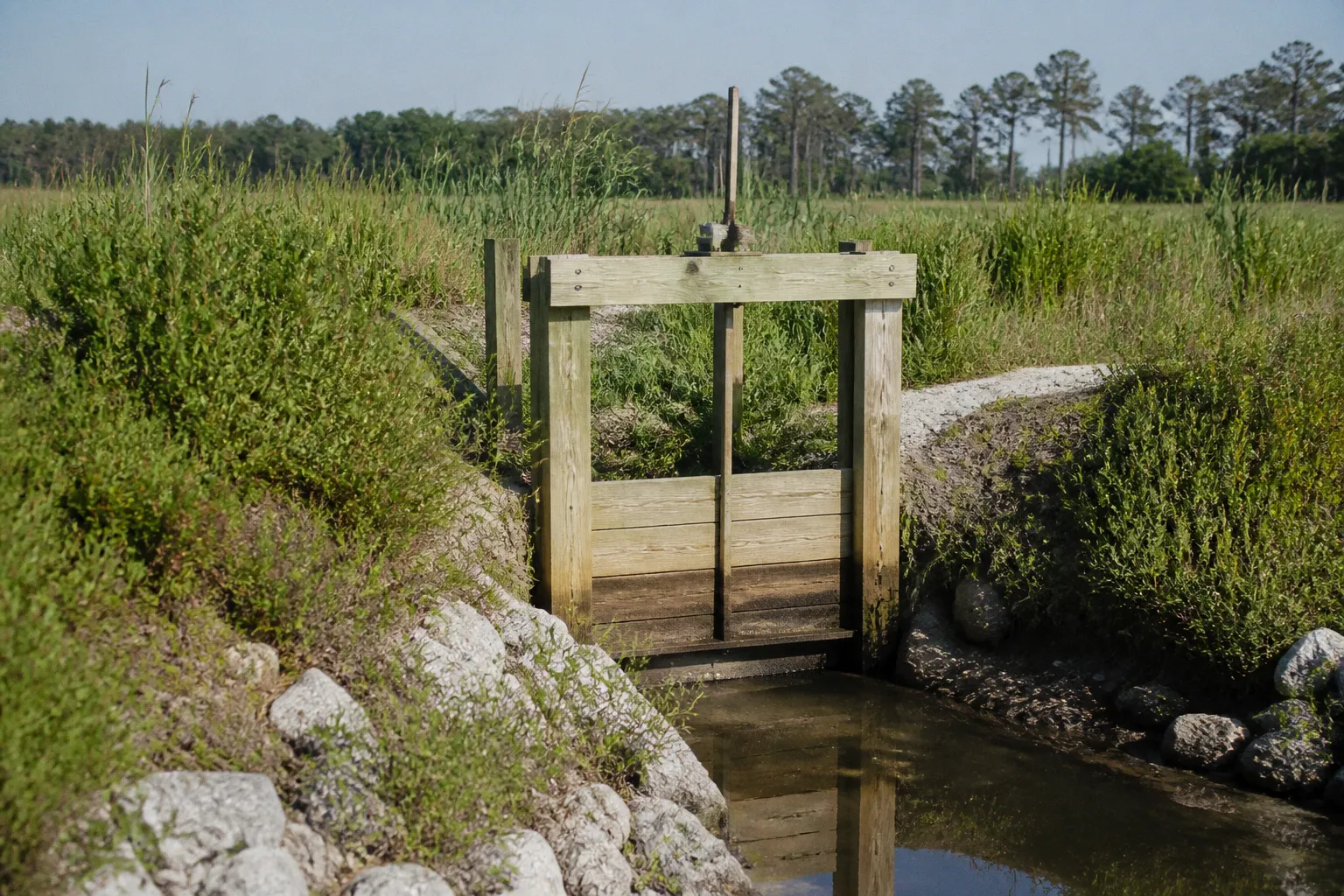
In Somerset County, they are often parts of the same larger plan: reduce pollution entering local waterways, protect communities from flooding, and keep working landscapes and coastal neighborhoods connected to the Bay.
That larger framework is the Maryland Watershed Implementation Plan, or WIP. For Somerset County, the plan is not an abstract state document. It reaches into the places where we live—our septic fields, roadside drainage, tidal wetlands, oyster grounds, public works budgets, and transportation routes. Understanding the plan helps us see what a statewide clean-water requirement means for our block, our property, and our community fabric.
What a Watershed Implementation Plan does
The Chesapeake Bay is shared by six states and the District of Columbia, which means pollution moving through a creek in Somerset County eventually becomes part of a much larger regional problem. Nitrogen, phosphorus, and sediment can travel from fields, streets, wastewater systems, and failing septic systems into tributaries and then into the Bay.
In 2010, the U.S. Environmental Protection Agency established the Chesapeake Bay Total Maximum Daily Load, commonly called the Bay TMDL. The TMDL set pollution limits for the watershed and required the states to create strategies for reaching them. Maryland organized its response through a three-phase Watershed Implementation Plan:
1. Phase I, begun in 2010, established the first statewide strategy for meeting the Bay’s pollution limits.
2. Phase II, submitted in 2012, assigned more detailed responsibilities to counties, municipalities, and individual sectors.
3. Phase III, published in 2019, refined the remaining work and established the goal of having all planned cleanup practices in place by 2025.
The phrase “all practices in place” matters. A WIP is not simply a statement that Maryland would like cleaner water someday. It identifies specific pollution sources, expected reductions, implementation methods, and the local partners responsible for carrying out the work.
For Somerset County, septic systems have been one of the most significant pieces of that puzzle. In 2009, septic systems in the county were estimated to contribute 54,247 pounds of nitrogen to the Chesapeake Bay watershed. The county’s WIP targets called for reducing that figure to 41,481 pounds by 2017 and 32,970 pounds by 2025.
Those numbers give us a useful way to understand the local WIP goals in Maryland. The objective is not to eliminate every septic system or treat private property as a problem. It is to reduce the amount of nitrogen that reaches groundwater, streams, marshes, and the Bay while preserving safe and practical ways for rural and lower-density communities to function.
A watershed plan becomes real when a regional pollution target changes what happens beneath a homeowner’s yard, along a drainage ditch, or at the edge of a tidal creek.
Why septic systems are central to Somerset County’s plan
Somerset County has many properties that are not connected to a public sewer system. Instead, wastewater is treated through individual septic systems. A properly maintained conventional septic system can serve a home safely, but it does not remove nitrogen as effectively as a system using Best Available Technology, or BAT.
BAT septic systems are designed to provide an additional level of nitrogen treatment before wastewater is released into the soil. That difference is especially important in sensitive areas where shallow groundwater, nearby streams, tidal waters, and wetland systems create a direct pathway toward the Chesapeake Bay.
The county’s planning framework divided its septic systems into three broad groups:
| Somerset County septic category | Number of systems | WIP treatment target |
|---|---|---|
| Within the Chesapeake Bay Critical Area | 2,332 | 100% upgraded to BAT |
| Outside the Critical Area but within 1,000 feet of a perennial stream | 533 | 25% upgraded to BAT |
| Outside the Critical Area and not within 1,000 feet of a perennial stream | 2,588 | 50% upgraded to BAT |
| Total | 5,453 | Targets varied by location |
The Chesapeake Bay Critical Area generally covers land near tidal waters and tidal wetlands. Because these places are especially connected to the Bay, pollution released there can move into sensitive waters quickly. That is why the county strategy placed the strongest BAT expectation on septic systems inside the Critical Area.
This does not mean BAT is automatically required for every property throughout Maryland. The requirement depends on location, applicable state and local rules, permits, funding programs, and the circumstances of a particular system. A resident trying to understand an upgrade should start with the county or state office responsible for septic permitting rather than assume that a general WIP target tells the whole story for one parcel.
What BAT changes for a homeowner
A BAT upgrade can involve more than replacing a tank. Depending on the property and the existing system, the work may include treatment equipment, electrical connections, controls, alarms, monitoring, and changes to the drainfield or other components. The right design depends on soil conditions, lot size, the age and type of the existing system, and the home’s location relative to regulated waters.
For a homeowner, the practical questions usually look like this:
- Is the property inside the Critical Area or near a perennial stream?
- Is the existing septic system functioning properly, or is there a repair issue that must be addressed first?
- Does the property qualify for financial assistance through a state or local program?
- Who will maintain and service the BAT equipment after installation?
- Will the upgrade affect electric service, landscaping, access, or future construction plans?
These are not minor details. A BAT system is a long-term piece of public-health and water-quality infrastructure located on private land. The installation decision must work for both the watershed and the household that will operate it.
The estimated cost of meeting Somerset County’s septic targets was substantial: approximately $27 million for the 2017 target and $45 million for the 2025 target. Those figures help explain why the Bay Restoration Fund and other assistance programs matter. Without public financing, many households would struggle to absorb the full cost of advanced treatment.
There was also a proposed septic pumping program on a three-year schedule, estimated at approximately $960,000 by 2017 and $1.4 million by 2025. Regular pumping is not a substitute for nitrogen treatment, but it is part of a broader maintenance strategy. A neglected septic system can create backups, surface failures, groundwater contamination, and costly emergency repairs even when no BAT upgrade is required.
The maintenance side of clean-water planning
When we talk about watershed management, the conversation often turns to construction: a new treatment unit, a restored reef, or a wetland project. Maintenance is less visible, but it determines whether those investments keep working.
For septic owners, that can mean scheduling inspections, pumping at appropriate intervals, responding to alarms, keeping heavy vehicles away from the drainfield, and avoiding the disposal of grease, harsh chemicals, or non-degradable products through the system. A countywide pollution target depends on thousands of ordinary household decisions repeated over time.
That is what this means for your block: the condition of one system may not seem large in isolation, but the combined effect of 5,453 systems is significant. The WIP treats those individual systems as part of a connected network because the groundwater and waterways do not stop at property lines.
Oyster restoration in the Manokin River
Septic upgrades are only one part of Somerset MD watershed management. The health of the Bay also depends on living systems that can filter water, provide habitat, and support working waterfronts. Oyster restoration in the Manokin River is one of the county’s most visible Chesapeake Bay restoration projects.
The Manokin River Sanctuary was designated in 2019 as the fifth and final tributary selected for large-scale oyster restoration under the Chesapeake Bay Watershed Agreement. The project was completed in August 2025, with 455 acres of reef restored and more than 1.39 billion hatchery-set oysters placed in the sanctuary.
Oysters are not a magic solution for every water-quality problem, and a restored reef cannot replace pollution reduction at its source. But a healthy oyster population can contribute to the Bay in several important ways. Oysters filter water as they feed, create three-dimensional habitat for other species, and help support the ecological and economic relationships that have long shaped the Eastern Shore.
The Manokin project also shows why infrastructure and environment cannot be treated as separate subjects. A watershed plan is not only about pipes and treatment systems. It is also about rebuilding the natural systems that make waterways more resilient and productive.
For our community, the project raises practical questions beyond the number of oysters placed on the reef:
1. How will the reef be monitored over time? Restoration requires follow-up observation, not only an installation date.
2. How does changing water quality affect nearby fisheries and waterfront businesses? Ecological improvements can have economic and cultural effects.
3. How do land-based pollution reductions support restoration in the river? Oyster reefs can perform better when excess nitrogen and sediment are reduced upstream.
4. How do residents learn about restricted areas or project activity? Clear communication helps protect both the restoration work and the people who use the water.
That last point is easy to underestimate. Community participation is not an optional public-relations step added after the technical work is complete. People who fish, work, travel, and live near the river often notice changes that do not appear in a planning document. Navigating the board, reviewing a public notice, or asking a question at a meeting can help connect official plans with conditions on the ground.
Flood mitigation and wetland resilience in Crisfield
Water-quality planning and flood protection overlap most clearly in Crisfield, where tidal flooding, drainage, storms, and sea-level rise shape everyday decisions. A road that floods can interrupt emergency access and commuting. A drainage ditch that cannot move water efficiently can damage homes or public infrastructure. A wetland that is restored and maintained can slow, store, and filter stormwater while providing habitat.
The City of Crisfield’s Southern Crisfield Flood Mitigation Project was restructured after the FEMA Building Resilient Infrastructure and Communities program was terminated in 2025. The city launched Phase I in 2026, focusing on the design, permitting, and construction of a 4.5-acre Gerald’s Ditch wetland restoration project.
Phase I received $3,294,990 from four funding sources. The project is intended to improve flood mitigation through wetland restoration rather than relying only on conventional hard infrastructure. That approach can be especially valuable in low-lying coastal communities, where walls, pipes, pumps, roads, and drainage structures all face pressure from heavier rainfall, high tides, storm surge, and changing water levels.
It is important to be precise about what is known and what remains open. Phase I focuses on Gerald’s Ditch and the associated wetland work. The exact schedule and funding details for a later roadway-elevation phase have not been established in the available information. We should not assume that a future phase is already funded simply because it appears in a long-term flood mitigation concept.
Why wetlands belong in an infrastructure conversation
A wetland restoration project may look different from a road replacement or a sewer extension, but it performs infrastructure work. Wetlands can:
- Hold and slow stormwater during heavy rain.
- Reduce the amount of runoff reaching nearby waterways all at once.
- Provide space for water to spread without immediately damaging roads or buildings.
- Filter sediment and pollutants before they reach tidal waters.
- Support habitat that contributes to a healthier coastal ecosystem.
That does not mean a restored wetland can solve every flooding problem. It cannot replace a needed drainage repair, elevate a vulnerable roadway by itself, or guarantee protection from a major storm. The strength of this approach comes from combining natural systems with carefully designed public works.
When you are reviewing a local flood project, look for that combination. Ask whether the plan addresses drainage, road access, emergency response, property impacts, maintenance, and future conditions—not only whether it creates a new pond or restores a ditch.
Resilience is not one project with a finish line; it is the habit of designing our roads, wetlands, homes, and public works for the water conditions we are already experiencing.
How state funding turns WIP goals into local work
The Bay Restoration Fund, often called the BRF, is one of the main tools Maryland uses to finance wastewater and septic improvements. As of June 30, 2025, the fund had supported 17,184 BAT septic upgrades statewide, including 10,550 in Critical Areas, and had helped connect 1,677 homes to public sewers.
Those statewide numbers do not tell us the exact number of BAT systems installed specifically in Somerset County. That local figure should not be guessed or borrowed from the state total. It does, however, show the scale of the funding mechanism and why residents may encounter BRF-related applications, eligibility rules, inspections, and construction schedules.
Funding programs also shape which projects move first. A household may be located in a high-priority environmental area but still face a wait for design, permitting, contractor availability, or available funds. A municipality may have an important flood project but need to assemble several grants before construction can begin.
For residents, the process is easier to follow when we separate three questions:
1. What is the environmental goal?
This might be a reduction in nitrogen, improved oyster habitat, fewer flooded streets, or protection of a wetland corridor.
2. What is the local project or practice?
The goal may be addressed through a BAT septic upgrade, a sewer connection, reef restoration, ditch improvements, wetland restoration, or stormwater management.
3. Who controls the next decision?
The responsible party could be a homeowner, county department, municipality, state agency, engineering consultant, contractor, or funding administrator. Knowing who owns the next step prevents a common frustration: directing a good question to the wrong office and assuming that no one is responding.
Maryland was reported to be 83% of the way toward its 2025 nitrogen reduction goal as of late 2024, with approximately 2 million additional pounds of nitrogen reduction still needed. At the same time, the state had already met its 2025 phosphorus and sediment goals. This is a useful reminder that progress is not uniform across every pollutant or every county.
A state can meet one category of target while continuing to work on another. Somerset County can complete one local project while still facing unresolved septic, transportation, or drainage needs. The clean-water picture is cumulative, and the work continues even after a target year passes.
How to participate without becoming a policy expert
You do not need to memorize the Bay TMDL or understand every engineering term to take part in local planning. A useful resident starts with the specific decision in front of them.
If you receive a notice about a septic upgrade, flood project, wetland restoration, or waterway activity, use this simple sequence:
1. Identify the location. Find out whether the property or project is in the Chesapeake Bay Critical Area, near a perennial stream, within a flood-prone area, or connected to a particular watershed.
2. Name the decision. Is the notice about funding, design, permitting, construction, maintenance, or a change in land use? These stages allow different kinds of public input.
3. Ask what problem the project is designed to solve. A nitrogen-reduction project and a road-elevation project may be located close to one another but have different goals and performance measures.
4. Look for the household or neighborhood effect. Consider access, construction timing, drainage, electric service, property boundaries, odors, noise, landscaping, and long-term maintenance.
5. Write down the next contact and deadline. Public meetings and comment periods are much easier to navigate when we know exactly where a question should go and when a response is needed.
6. Return to the project after approval. A plan on paper is not the same as a functioning system. Follow-up helps reveal whether maintenance, monitoring, and promised protections are actually happening.
The most effective public participation is often specific and grounded. “How will this affect drainage at the intersection?” is more useful than a general expression of concern. “Who maintains the BAT equipment after installation?” opens a practical conversation. “Will this wetland project change emergency access during construction?” identifies a need that the design team can address.
This is how we protect the community fabric while still making room for necessary infrastructure. Participation does not have to be adversarial to be meaningful. We can ask firm questions, request clear information, and expect public investments to be explained in language residents can use.
The larger picture for Somerset County
The Maryland watershed implementation plan for Somerset County connects several kinds of work that are easy to overlook when they appear in separate notices. Septic upgrades reduce nitrogen at the household level. Oyster restoration rebuilds ecological capacity in the Manokin River. Wetland restoration in Crisfield addresses flooding while supporting water-quality and habitat goals. State funding helps convert these priorities into projects that can be designed, permitted, built, and maintained.
The county’s progress should be measured honestly. The available information does not establish the exact number of BAT upgrades completed in Somerset County as of 2026, nor does it confirm whether the county fully met its local 2025 septic nitrogen target. Those questions deserve current local reporting rather than assumptions based on statewide figures.
What we can say is that Somerset County’s environmental future will be shaped by decisions that are both highly technical and deeply personal: where a septic system is installed, how a drainage ditch is restored, whether a road remains passable during a storm, and whether a river has enough healthy habitat to support life and livelihoods.
A watershed plan works best when residents can see that connection. The target may be measured in pounds of nitrogen or acres of reef, but the result is experienced as clearer water, safer access, healthier wetlands, and neighborhoods better prepared for the next storm. That is the practical promise of Somerset County watershed management: not a document sitting on a shelf, but a shared order of work for protecting the places we call home.