Critical area buffer violations: common Somerset mistakes
One hundred feet. That's how close you can build, clear, or disturb land next to tidal water in Somerset County without running into a stack of state and county regulations that can easily triple the cost of your project — or shut it down entirely.
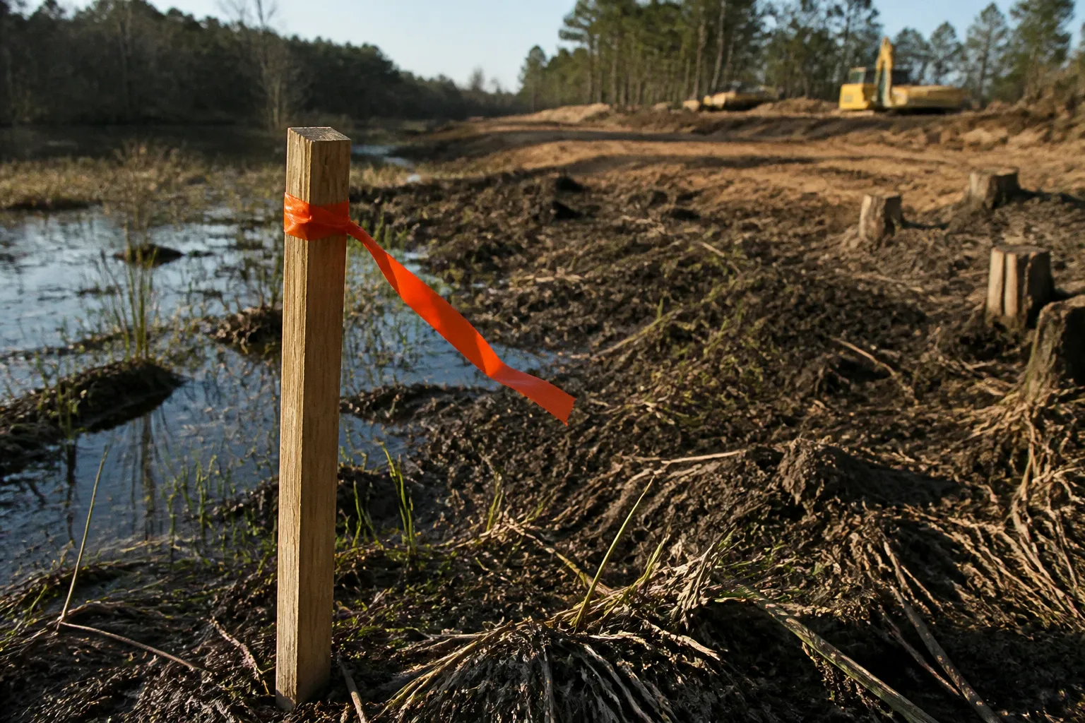
The Chesapeake Bay Critical Area Commission and Somerset County Planning and Zoning don't negotiate on buffer violations after the fact, and the property owners and contractors who learn the rules after the bulldozer has already done its work find out exactly how steep the mitigation ratios climb.
Understanding the 1,000-Foot Critical Area and Buffer Mandates
The Critical Area isn't an abstract environmental concept — it's a mapped legal boundary stretching 1,000 feet inland from the mean high water line of every tidal water, tidal wetland, and tributary stream touching Somerset County. That entire 1,000-foot envelope falls under Maryland's Critical Area Act, enacted in 1984 and codified in Natural Resources Article §8-1801 through §8-1817 and COMAR Title 27.
Here's where most property owners get tangled up: the Critical Area is the planning zone. The buffer is the regulated strip inside that zone, and the buffer is what actually controls where you can and cannot dig. The default buffer width is 100 feet of land adjacent to tidal waters, tidal wetlands, and tributary streams. On flat ground with no special features, that's a manageable setback. The problem is that 100-foot figure is a floor, not a ceiling. Steep slopes, sensitive soils, or contiguous wetlands can expand the required buffer up to 300 feet under local Critical Area ordinance.
Somerset County's coastal plain is exactly the kind of ground that triggers those expansions: low-relief drainage swales, sloped banks along the Wicomico and Manokin rivers, and adjacent tidal marsh. If your parcel sits anywhere near tidal influence, don't assume the 100-foot number applies to you without checking the county's Critical Area overlay.
The buffer is the regulated strip. The 1,000 feet is the planning envelope. Confusing the two is where most violations start.
Common Pitfalls: Unpermitted Clearing and Vegetation Removal
These aren't edge cases. They account for the overwhelming majority of buffer violations that land in front of Somerset County Planning and Zoning, and they're almost entirely preventable.
1. Bush-hogging or clearing the buffer "to clean up the lot." The brush looks overgrown, you fire up the mower or hire a guy with a tractor, and a chunk of natural vegetation disappears. If there's no approved Buffer Management Plan on file, that work is an unpermitted impact. The county doesn't care whether you knew the rule or not.
2. Building accessory structures inside the buffer. Sheds, gazebos, decks, pavilions, even small footings or pads. Anything new within the 100-foot (or expanded 300-foot) zone without prior written authorization is a violation, regardless of size.
3. Earthwork and shoreline disturbance. Grading, filling, excavation, rip-rap placement, or bank stabilization performed without an approved permit and mitigation plan. This category carries the highest mitigation multipliers because the ecological damage — sediment loading, loss of shoreline vegetation, destabilized banks — is the hardest to reverse.
4. Skipping the Buffer Management Plan because the project "isn't really development." If your action alters vegetation cover, impervious surface, or topography inside the buffer, the county treats it as development activity. Landscaping, invasive species removal for replanting, new garden beds, even trail installation can all trigger the requirement.
5. Assuming an existing lawn or grandfathered structure exempts the property. It doesn't. Current rules apply to any new site modification, regardless of what was historically on the lot. A cleared lawn from 1985 doesn't give you a free pass to expand the cleared area in 2024.
The Role of Buffer Management Plans in Site Development
A Buffer Management Plan is Somerset County's mechanism for tracking any regulated activity inside the buffer. It's submitted by the property owner, reviewed against the local Critical Area ordinance, and either approved, denied, or approved with conditions. The plan documents what's being disturbed, what mitigation is proposed, and how the buffer's water quality function will be maintained or improved.
You need one for nearly any meaningful site work in the buffer: clearing, grading, new construction, shoreline stabilization, expansion of impervious area, significant replanting, or removal of invasive species for replacement. The threshold for triggering the requirement is low — if you're moving soil or removing existing vegetation inside the buffer, the county expects a plan.
Here's the trap: failure to implement an approved Buffer Management Plan is itself a violation, and that violation prevents the issuance of any subsequent development activity permits for the property. Translation — until you resolve the open buffer violation, Somerset County won't issue you anything else. No building permits, no grading permits, no accessory structure approvals, no electrical or plumbing permits tied to the parcel. The county uses permit holds aggressively, and the hold doesn't lift until the buffer issue is closed out.
The practical move is to submit the plan early, well before any earth moves. Verbal assurances from contractors or neighbors that "it should be fine" carry zero weight when a code enforcement officer or planner pulls the parcel up on the Critical Area map.
Consequences of Non-Compliance: Mitigation Ratios and Penalties
This is where the numbers get painful, and where unpermitted work stops being a paperwork problem and becomes a financial one.
For permitted buffer impacts with an approved Buffer Management Plan, the standard mitigation ratio in Somerset County runs at 1:1. Disturb one acre, replant or restore one acre. Manageable. Predictable. Built into the project budget.
Unpermitted impacts — meaning the work was done without an approved plan first — get hit with steeper ratios. The Critical Area ordinance typically applies a 3:1 mitigation ratio for unauthorized buffer clearing, and that ratio climbs to 4:1 for significant unauthorized disturbance involving earthwork or shoreline modification. Disturb a quarter acre without a permit, and you may now be on the hook for replanting or restoring three-quarters of an acre to a full acre of buffer. The county calculates the required mitigation area based on the actual impact, not the property owner's estimate.
| Impact Type | Standard Ratio | Unpermitted Ratio |
|---|---|---|
| Authorized clearing with approved BMP | 1:1 | — |
| Unauthorized clearing (no BMP submitted) | — | 3:1 |
| Significant unauthorized disturbance (earthwork, shoreline) | — | 4:1 |
| Approved plan, but plan not implemented | — | Permit hold + retroactive compliance |
On top of the mitigation obligation, unpermitted buffer violations typically trigger civil penalties under the local ordinance, required retroactive Buffer Management Plan submissions, and in some cases restoration to pre-disturbance conditions before any replanting credit is even granted. The exact dollar amounts of individual civil citations vary by case and jurisdiction, but the structural cost — multiplied mitigation acreage plus consultant fees plus legal exposure — consistently dwarfs what the original permitted project would have cost.
The cheapest permit is the one you pull before the work starts. The most expensive mistake is the one that triggers a 4:1 mitigation requirement.
Navigating Expanded Buffer Zones for Steep Slopes and Wetlands
The 100-foot buffer is the baseline. Where the ground itself pushes back, the buffer expands.
If your parcel contains steep slopes (generally defined as areas with significant grade change within the buffer), erodible or hydric soils, or is contiguous to tidal wetlands or other sensitive habitats, Somerset County's Critical Area ordinance can require the buffer to extend up to 300 feet from the mean high water line. The expansion isn't discretionary for the property owner — it's triggered by mapped soil types, topographic data, and the county's Critical Area mapping. A site walk doesn't override it.
For new subdivisions in Resource Conservation Areas — one of the three land-use designations under the Critical Area — state regulations updated by HB 1253 in 2008 require a 200-foot setback from tidal waters and tidal wetlands. That's a development-wide setback applied at the subdivision layout stage, distinct from the per-lot buffer, but it interacts with everything else when roads, lots, utilities, and stormwater facilities are being sited. Get the subdivision setback wrong and the entire plat has to be redrawn.
The practical implication for anyone holding a parcel near tidal water in Somerset County: pull the Critical Area overlay map before you finalize a site plan, before you retain a contractor, and certainly before closing on the lot if you're still in due diligence. The maps are public, the county planning office can confirm the actual buffer width on a specific parcel, and the answer is in writing if you ask for it. A ten-minute phone call before site work begins can save a five-figure mitigation bill.
What to Do Before You Touch the Buffer
Five steps, in order. None of them are optional, and all of them run through Somerset County Planning and Zoning.
1. Confirm the Critical Area status of your parcel. Pull the county's Critical Area map or call the planning office. Find out whether your lot sits inside the 1,000-foot envelope and what land-use designation applies.
2. Measure the actual buffer width on the ground. Default is 100 feet, but confirm whether steep slopes, sensitive soils, or adjacent wetlands trigger an expansion to 300 feet. Use the county's mapped data, not visual estimates.
3. Submit a Buffer Management Plan for any project touching the buffer. Clearing, grading, building, shoreline work, even significant replanting. Submit before any earth moves, not after.
4. Wait for written approval. Verbal "should be fine" from a contractor, neighbor, or realtor is not authorization. The county's written sign-off is what protects you.
5. If work has already been done without a permit, get ahead of it. Retain an environmental consultant, prepare a retroactive Buffer Management Plan, and contact Somerset County Planning and Zoning before enforcement finds you. Mitigation ratios compound fast and don't go away on their own.
The buffer exists because runoff from Somerset's developed lots flows directly into the Chesapeake Bay, carrying sediment, nitrogen, and phosphorus with it. The state mandated it in 1984, the county enforces it through permit holds and mitigation ratios, and the cost of getting it wrong falls entirely on the property owner. None of this is hidden — it's mapped, codified in state and local law, and administered by planners who answer the phone during business hours. Use them.