Somerset County site plan review: a step-by-step guide
Section 8.15b(3) of the Somerset County Zoning Code mandates site plan approval for every new commercial development within the unincorporated areas of the county. No exceptions. No shortcuts.
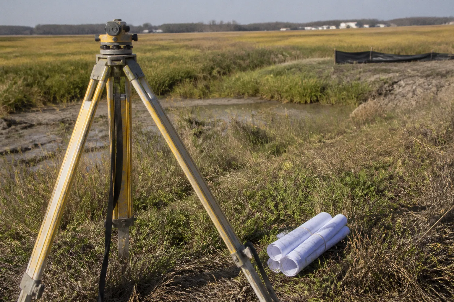
Whether the project is a 1,200-square-foot retail buildout or a multi-acre warehouse complex, the process begins at the same administrative entry point and ends with formal action by the Planning Commission. Misunderstanding the sequence — or skipping a required submittal — is one of the most common sources of delay in Somerset County, and the cost of that delay compounds with every missed review cycle.
The Somerset County site plan review process is not a single checkpoint. It is a multi-agency workflow administered by the Department of Technical and Community Services (DTCS), evaluated by the Technical Advisory Committee (TAC), and finalized by the Planning Commission. Each stage carries its own submission requirements, technical questions, and compliance standards. A project can be well designed in architectural terms and still be returned because the application package is incomplete, the stormwater assumptions are not supported, or the landscape plan does not respond to the actual zoning district and surrounding uses.
The practical task is therefore not simply to “submit a site plan.” It is to move the project through a sequence in the correct order, while keeping the county, municipal officials, engineers, health reviewers, and consultants working from the same version of the plan.
Navigating the DTCS and Technical Advisory Committee Workflow
All site plan submissions enter the county system through the Somerset County DTCS. The department functions as the administrative intake point: it receives the plan, verifies whether the application package is complete, and distributes the materials to the relevant members of the Technical Advisory Committee.
That first screening is more important than it may appear. Completeness review is not the same as a technical approval. The DTCS is determining whether the county has the drawings, forms, studies, and supporting materials needed to begin its review. If a required element is missing, the application can be returned before it ever reaches the TAC review queue.
The TAC is not a single decision-maker. It is a multi-departmental review body comprising representatives from public works, engineering, health, environmental programs, and other county divisions relevant to the scope of the project. Each member reviews the site plan from a different regulatory perspective and sends written comments back to the DTCS.
That division of responsibility explains why a plan may receive comments that appear unrelated to the building itself. The engineering reviewer may focus on drainage and access. The health reviewer may be concerned with wastewater or well separation distances. Environmental reviewers may examine disturbance and sediment controls. Public works may look at roads, entrances, utilities, or infrastructure that the applicant treated as a secondary issue. These are not separate optional consultations; they are part of the county’s coordinated review.
The DTCS consolidates the comments and transmits them to the applicant. The applicant then revises the site plan and supporting documents. If the changes are substantive, the revised plan is resubmitted for another review cycle. Only after the relevant TAC members confirm that their concerns have been addressed does the DTCS forward the plan to the Planning Commission for formal action.
The Planning Commission may approve the site plan as submitted, approve it with conditions, or deny it. Conditions frequently address performance guarantees, bonding for infrastructure improvements, landscape installation, stormwater facilities, or stipulated timelines for construction commencement. Approval is not necessarily the end of the applicant’s obligations. It is often the point at which those obligations become specific, enforceable conditions of moving forward.
The working sequence is straightforward, but each step has consequences:
1. Completeness review — DTCS screens the initial submission for required documents, drawings, and supporting studies before distributing it to the TAC. An incomplete package is returned without entering the review queue.
2. TAC comment consolidation — Departmental comments are aggregated into a single response transmitted to the applicant, rather than requiring the applicant to contact each reviewing agency independently.
3. Revision and resubmission — Applicants should respond to every comment point by point. A partial response or an unexplained deviation from a TAC requirement usually creates another round of questions.
4. Technical clearance — The plan moves forward only when the relevant TAC members have confirmed that their departmental concerns are resolved.
5. Planning Commission action — The Commission considers the cleared plan and may approve it, approve it with conditions, or deny it.
A useful internal discipline is to maintain a response matrix even though the county’s process is not a checklist exercise. The applicant should be able to identify the sheet, note, calculation, or revised detail that answers each comment. That makes the next submission easier for reviewers to evaluate and reduces the risk that a response is buried in a narrative letter without appearing on the plan itself.
A complete submittal package on the first attempt is the single most effective way to compress the review timeline. Incomplete applications do not enter the TAC queue — they sit on a shelf until corrected.
The same principle applies to plan revisions. Changing the parking layout can affect buffers, grading, stormwater, and sight distance. Moving a building can affect septic reserve areas, utility runs, or drainage patterns. Treating each revision as an isolated drafting change is how inconsistencies appear between the civil plan, landscape plan, wastewater plan, and application forms.
Stormwater Management and Environmental Compliance Thresholds
Somerset County applies a clear disturbance threshold that triggers enhanced environmental review. Any project resulting in greater than 5,000 square feet of land disturbance requires a stormwater management plan approved by the County Engineer. This is a hard threshold, not a general design suggestion.
The calculation applies to cumulative disturbance across all project phases on a given parcel. Grading, excavation, installation of impervious surfaces, and utility trenching all contribute to the total disturbed area. A project cannot avoid the requirement simply by dividing the work into smaller construction phases if the aggregate disturbance exceeds the threshold.
That matters particularly for projects that begin with a modest building pad and later add parking, drive aisles, utility extensions, storage areas, or accessory structures. The first phase may appear to sit below the threshold when viewed alone, while the complete development clearly does not. The county’s review is concerned with the actual scope and cumulative effect of the development, not only with the first construction contract.
Projects exceeding the disturbance threshold must also secure sediment and erosion control review through the Soil Conservation Office. This is a separate approval stream operating in parallel with the stormwater review. The two processes address related but distinct concerns: stormwater management focuses on runoff quantity and quality after development, while erosion and sediment controls govern the protection of soil and nearby resources during construction.
Both approvals must be cleared before the site plan receives final Planning Commission endorsement. A site plan that has a complete building layout but lacks an acceptable stormwater or sediment-control path is not ready for final action.
The stormwater management plan must demonstrate compliance with Maryland Department of the Environment standards for quantity and quality control. Depending on the project, the technical package may include:
- Hydrologic calculations comparing pre-development and post-development runoff across the applicable storm events.
- Structural Best Management Practices, such as bioretention cells, dry ponds, infiltration trenches, or other engineered systems sized to the calculated runoff differential.
- Drainage and grading information showing how water moves through the site, where it is detained or treated, and how the proposed facilities connect to existing conditions.
- Maintenance agreements identifying the responsible party for long-term BMP upkeep and establishing the obligation against the property.
- As-built certifications required at completion to verify that constructed stormwater infrastructure matches the approved design.
The Soil Conservation Office evaluates sediment-control measures independently. The applicant must submit a sediment and erosion control plan prepared in accordance with the Maryland Standards and Specifications for Soil Erosion and Sediment Control. The plan typically addresses perimeter controls, construction-phase stabilization, construction entrances, stockpiles, drainage diversions, and the sequencing of earth disturbance.
Sequencing is not a minor drafting detail. The plan should connect the beginning of earthwork to the installation of temporary controls and should explain when permanent vegetation or impervious cover will stabilize disturbed areas. If the erosion-control measures are shown only as symbols on a plan without a workable construction sequence, the reviewer has little assurance that the site can remain compliant between clearing and final stabilization.
Failure to maintain an active sediment-control permit during construction is a citable offense. Somerset County coordinates enforcement with state-level compliance programs, and violations can result in stop-work orders independent of the status of the site plan approval. In other words, an approved site plan does not authorize uncontrolled construction activity. The approved environmental controls remain active obligations during the work.
The cleanest approach is to coordinate the civil engineer’s drainage design, the erosion-control plan, and the construction sequence before the first DTCS submission. When those materials are prepared separately and reconciled only after comments arrive, the applicant may discover that a proposed basin conflicts with a buffer, that a utility trench crosses a treatment area, or that the construction sequence depends on a facility that cannot be built until another part of the site is stabilized.
Zoning Code Mandates for Commercial Landscaping and Buffers
Section 8.9(c) of the Somerset County Zoning Code establishes landscaping standards that apply to commercial developments requiring site plan approval. These are not aspirational design suggestions. They are enforceable conditions tied directly to the approval certificate.
The central requirement is the landscape buffer. Commercial developments must install landscape buffers along the front and sides of the lot. The specifications — including width, plant material, density, and mature-height requirements — vary by zoning district and by the use or zoning classification adjoining the property. A commercial parcel next to a residential district may face a wider or more substantial screening obligation than a parcel facing another commercial use or a public road.
The buffer must be designed from the actual property conditions, not copied from a generic commercial template. The applicant needs to account for the right-of-way line, property boundaries, adjacent zoning, driveways, utility easements, drainage facilities, parking stalls, and sight triangles. Each of those elements can affect where planting may be installed and whether the proposed planting can survive and remain compliant.
| Buffer element | Typical standard | Practical implication |
|---|---|---|
| Front buffer width | Determined by the applicable zoning district schedule | Measure from the right-of-way line, not simply from the edge of pavement |
| Side buffer at commercial-to-residential adjacency | Typically wider than a standard commercial side treatment | The adjoining zoning and use can reduce the buildable envelope |
| Plant material | Combination of canopy trees, understory trees, and evergreen shrubs | Minimum caliper, spacing, density, and species requirements may apply |
| Mature height | Minimum height specified at maturity | Screening must function over time rather than only at installation |
| Replacement obligation | Dead or removed plants must be replaced within one growing season | Landscape compliance continues after approval and construction |
Landscape plans must be prepared by a licensed landscape architect or other qualified professional and submitted as part of the site plan package. The DTCS and TAC reviewers evaluate the landscape plan during the standard review cycle; it is not a separate optional filing.
The plan should show more than circles representing trees. It should make clear how the buffer is measured, what type of plant material is proposed, how spacing is calculated, and how the planting interacts with sidewalks, lighting, utilities, stormwater facilities, and maintenance access. A tree that occupies the same area as a drainage structure is not a workable solution, even if the symbols do not overlap on a small-scale drawing.
Additional site design standards that intersect with landscaping include parking-lot shade tree requirements, screening for mechanical equipment and refuse storage, and sight-triangle clearances at driveway intersections. The zoning code specifies minimum visibility distances that must remain free of obstructions, including vegetation above a specified height. A buffer cannot be used to justify a planting arrangement that blocks a driver’s view at an entrance.
Commercial site plans fail landscaping review more often than any other zoning compliance category. The reason is consistent: applicants submit generic landscape templates without accounting for lot-specific buffer widths, adjacency triggers, and sight-triangle clearances.
Developers working on tight lot configurations — particularly in the older commercial corridors along Route 13 and near Princess Anne — should pay close attention to the interaction between parking layout, required buffer widths, and the buildable area. A compliant landscape buffer can consume 15 to 25 feet of depth along a side property line. On a shallow commercial parcel, that strip may significantly reduce the available footprint for the primary structure and parking.
This is why landscaping should be resolved during site layout, not added after the building, parking, and loading areas have consumed the available land. The landscape requirement is not decorative space left over at the edge of the plan. It is part of the zoning envelope and can determine whether the proposed arrangement works at all.
Special Approval Pathways for Utility-Scale Solar Facilities
Utility-scale solar energy facilities (SEFs) generating more than 2 megawatts (MW) operate under a distinct approval pathway that precedes the standard site plan review. Before a covered project enters the DTCS system, the project sponsor must first obtain Floating Zone approval from the Board of County Commissioners.
The threshold is greater than 2 MW. A facility designed to generate exactly 2 MW is not covered by this particular more-than-2-MW Floating Zone requirement. The distinction should be made at the beginning of project planning, because a capacity estimate that falls on one side or the other of the threshold can change the entitlement sequence.
The Floating Zone mechanism effectively requires the Board to rezone or conditionally authorize the specific parcel for solar energy use at the utility scale. This is a legislative action, not an ordinary administrative site-plan decision. The applicant presents the project to the Board, typically through a public hearing process, and the Board decides whether to grant the Floating Zone designation.
Only after the Floating Zone is approved does a qualifying utility-scale solar project become eligible for standard site plan review through DTCS and the TAC. The later site plan must still demonstrate compliance with all applicable zoning and development requirements, including:
- Setback requirements specific to the SEF zoning classification.
- Fencing and screening standards, including perimeter fencing and vegetative screening along public road frontages or next to residential properties where required.
- Decommissioning plans and financial assurance for removal of solar infrastructure at the end of its operational life, including panel disposal, foundation removal, and site restoration.
- Glare and visual-impact information where the project’s location makes those issues relevant, including proximity to residential areas, airports, or designated scenic corridors.
- Access and internal circulation sufficient for construction, maintenance, emergency response, and eventual decommissioning.
The two-step sequence — Floating Zone first, site plan second — means that utility-scale solar developers should budget substantially more time for project entitlement than standard commercial applicants. The Floating Zone hearing may require multiple Board sessions, and the subsequent site plan review adds its own technical cycle through DTCS and the TAC.
Projects generating less than 2 MW are not required to pursue the Floating Zone pathway described above and enter directly into the standard site plan review process, subject to all other applicable zoning, environmental, access, and construction requirements. A project generating exactly 2 MW is also outside this particular “more than 2 MW” trigger; it should not be placed in the same category as a facility exceeding the threshold merely because the numbers are close.
| Project classification | Floating Zone required under the >2 MW threshold? | Entry point |
|---|---|---|
| Utility-scale SEF generating more than 2 MW | Yes — Board of County Commissioners | Board hearing, then DTCS site plan review |
| SEF generating exactly 2 MW | No, not under this particular threshold | DTCS site plan review directly, subject to other applicable requirements |
| SEF generating less than 2 MW | No | DTCS site plan review directly |
| Standard commercial development | No | DTCS site plan review directly |
The distinction between these categories is operationally significant. A 1.9 MW installation, a 2 MW installation, and a 2.1 MW installation should not be treated as interchangeable for purposes of the Floating Zone requirement. Developers should confirm the projected generating capacity with their engineering consultants before initiating a county filing and should use the same capacity definition consistently across the application, plans, studies, and public presentation.
Capacity is also tied to the physical design. Expanding the panel field, adding associated equipment, or revising the project after the initial entitlement may change the project’s classification or require additional review. The applicant should therefore avoid treating the threshold as a number that can be adjusted informally after the application is underway.
Health Department Standards for On-Site Wastewater Planning
Properties that rely on on-site sewage disposal rather than a municipal or county sewer system face an additional regulatory layer through the Somerset County Health Department (SCHD). The department requires a detailed wastewater site plan prepared by an MDE-registered On-Site Wastewater Professional as part of its review.
This requirement applies when any portion of the proposed development relies on septic systems, mound systems, or other on-site disposal technologies. The plan must depict the proposed system layout, reserve areas for replacement systems, well setback distances, and applicable separation distances from property lines, waterways, structures, and other site features.
The wastewater plan also needs to work with the rest of the development plan. A disposal field cannot be placed where a future parking expansion is shown. A reserve area cannot disappear beneath a stormwater facility. A proposed building location may need to shift if the soil conditions or required separation distances make the original wastewater layout infeasible. These conflicts are much less expensive to resolve before the architectural and civil plans are finalized.
The SCHD does not accept AI-generated drawings or site plans. Plans must bear the professional seal and signature of the registered wastewater designer. This is not a procedural technicality. It is an enforceable standard of professional accountability: the registered designer assumes responsibility for the adequacy of the system design, and that professional responsibility is part of how the county evaluates whether the proposed system is credible and approvable.
Health Department review operates on its own timeline, parallel to but independent of the DTCS/TAC site plan review. The applicant should not assume that submission to DTCS automatically satisfies the health department’s separate requirements. The wastewater component must be coordinated with SCHD, and a project cannot receive final site plan approval from the Planning Commission until the wastewater issues have been resolved.
For developments in areas with central sewer service, this step is eliminated. In Somerset County’s rural zones, however, on-site disposal is often the controlling design issue rather than a late-stage technical detail. Soil conditions, groundwater levels, reserve-area requirements, and lot geometry can constrain the feasible location of the disposal field and, in turn, constrain the buildable area for the entire project.
The timing of the wastewater investigation matters. Engaging an MDE-registered professional after the building footprint, parking, and stormwater facilities have been fixed can force a redesign. Engaging that professional early allows the applicant to understand the site’s limitations before the plan begins accumulating expensive dependencies.
Coordinating Municipal Submissions Within Princess Anne
Developers proposing projects within the municipal limits of Princess Anne face a preliminary filing step that does not exist in the same form for the unincorporated county process. Before submitting minor or major site plans to the county DTCS, the applicant must first file a Request for Services Form with the Town of Princess Anne.
The Request for Services Form is the Town’s mechanism for asserting jurisdiction over development within its boundaries. It triggers the Town’s review of the project against local ordinances, land-use plans, and infrastructure capacity. Only after the Town has processed the Request for Services and the applicant has satisfied any Town-level conditions does the project move forward to county-level site plan review through DTCS and the TAC.
This creates a sequencing obligation. The county DTCS will not accept a site plan submission for a Princess Anne property that has not cleared the Town’s Request for Services process. Attempting to bypass the municipal step and filing directly with the county results in a returned submission, adding delay without advancing the technical review.
The Town’s review may impose requirements that are more restrictive than the county baseline. Municipal overlay districts, downtown design standards, local access requirements, or infrastructure-adequacy conditions can add obligations that the county zoning code alone would not trigger. Applicants should obtain the Town’s complete set of applicable standards before finalizing the site design, not after the county has already identified conflicts.
The distinction between municipal and county review should also be reflected in the plan set. A drawing that satisfies a county buffer requirement may still need changes to address a municipal streetscape or design standard. Likewise, a Town condition affecting access or utilities may require revisions to the civil plans that will later be reviewed by county agencies.
In Princess Anne, the site plan review sequence is municipal first, county second. Reversing that order is the most common filing error made by developers unfamiliar with Somerset County’s dual-jurisdiction framework.
The coordination challenge is compounded by the fact that the Town and the county operate on independent review schedules. A project that clears the Town’s review in one cycle may arrive at the county DTCS at a point that requires waiting for the next available TAC meeting. Conversely, county comments may require plan changes that send the applicant back to the Town for confirmation that municipal conditions remain satisfied.
The safest approach is to treat the municipal approval as an active part of the project file rather than as a preliminary formality. Keep the Town’s conditions, correspondence, and approved materials aligned with the county submission. If the county plan differs from the plan reviewed by Princess Anne, explain the difference and confirm whether another municipal review is needed. A silent change between jurisdictions creates avoidable uncertainty for everyone reviewing the application.
Keeping the Sequence Intact
The Somerset County land development steps are manageable when they are treated as an integrated workflow rather than a series of unrelated approvals. The DTCS completeness review determines whether the package can enter the TAC process. TAC comments determine what must be revised before the Planning Commission can act. Stormwater, erosion control, landscaping, wastewater, and municipal conditions can each change the site layout, so none should be left to the end simply because it appears narrower than the building design.
The order is especially important in the situations that carry an additional approval path:
- A commercial project in the unincorporated county begins with a complete DTCS submission and proceeds through TAC review before Planning Commission action.
- A project disturbing more than 5,000 square feet must coordinate stormwater management and sediment and erosion control review.
- A commercial site must account for zoning-required buffers, planting, screening, and sight-triangle limitations in the initial layout.
- A solar facility generating more than 2 MW must obtain Floating Zone approval from the Board of County Commissioners before entering standard site plan review. A facility generating exactly 2 MW does not fall within that specific greater-than-2-MW requirement.
- A project using on-site wastewater disposal must coordinate with the Somerset County Health Department and use plans prepared and signed by an MDE-registered professional.
- A project within Princess Anne must clear the Town’s Request for Services process before the county will accept the site plan.
The strongest submissions are not necessarily the most elaborate. They are the ones in which the drawings, calculations, agency forms, landscape details, wastewater layout, and construction assumptions describe the same project. When the plan changes, every affected discipline needs to change with it.
That is the real logic behind the Somerset County site plan review process. The county is not reviewing a building in isolation. It is reviewing how a proposed use occupies land, handles water, protects adjoining properties, provides access, manages infrastructure, and satisfies the jurisdiction in which it sits. Applicants who recognize that at the beginning can use each review stage to refine the project. Applicants who treat the stages as paperwork obstacles usually discover the same conflicts later, when revisions are slower, more expensive, and harder to explain.