Agricultural easement applications: a pre-filing checklist
If you're a Somerset County landowner considering selling an agricultural easement to the Maryland Agricultural Land Preservation Foundation, you've probably already had that moment when the paperwork feels heavier than the work itself.
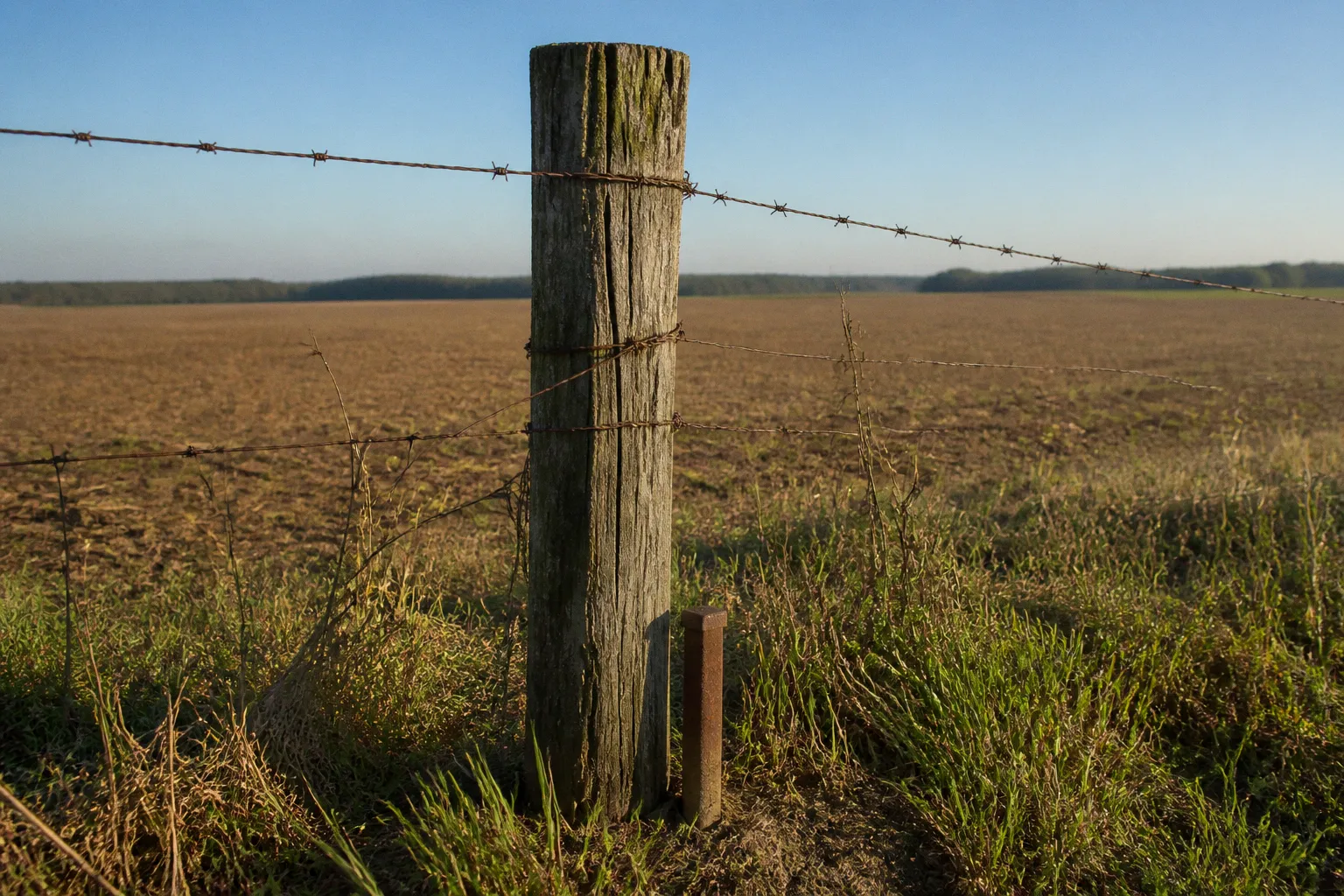
Maybe you heard about MALPF from a neighbor at the feed store, or maybe you've watched fields around you get converted to something else and started wondering whether there's a way to keep your land in farming — permanently. Whatever brought you here, the truth is this: the program is generous in what it offers, but it is meticulous in what it asks of you. The good news is that every requirement on the checklist exists for a reason, and once you understand the why, the what starts to make sense.
This is the guide we wish someone had handed us before our first easement conversation. Think of it as sitting across the kitchen table with a neighbor who's been through it — what to check before you ever set foot in the Planning and Zoning office, what to have in your hands when you walk in, and how the local review process actually moves here in Somerset County.
An agricultural easement is not simply a sale of development rights followed by a file being closed. It is a permanent land-use decision. The farm remains privately owned, but the easement changes what can happen on the property in the future, including after the land passes to a child, cousin, business partner, or another buyer. That is why the pre-filing work matters. The application is where the physical boundaries, ownership interests, future building plans, and agricultural value of the property are put into one record.
What MALPF is actually asking of your land
Before you fill out a single form, the program needs your property to clear two big thresholds: size and soil. These aren't hoops; they're the foundation of the whole preservation bargain.
The headline number is 50 contiguous acres. That's the baseline most parcels need to meet to qualify. There's a smaller-property path, too — if your land sits adjacent to an existing MALPF easement or fits specific small-property criteria the state has carved out — but for most applicants, 50 acres is the gate.
“Contiguous” deserves attention. It is not enough to add up every acre your family owns in the county if those acres are separated by another ownership, a public road, or a distinctly separate tract in a way that affects how the property is treated. Start with the parent tract described in the deed and then compare that description with the tax map, survey, and the ground as it exists today. If the acreage seems to change depending on which document you are reading, do not wait until the application is nearly complete to resolve it.
Then there's the soil test, and this is where a lot of applications quietly stumble. At least 50% of your property needs to fall into USDA Soil Capability Classes I, II, or III, or into Woodland Groups 1 and 2. That's not a guess you make from the cab of a tractor; it's a documented productivity rating. If you've got a soil conservation district map for your farm already, pull it out. If you don't, this is the moment to get one.
The soil capability requirement is not a formality. It is the evidence that the land has the agricultural productivity the program is intended to preserve. A farm can look productive from the road and still need a more careful map review. Conversely, woodland acreage is not automatically irrelevant if it falls within the qualifying woodland groups. The point is to document the character of the property rather than rely on a general description such as “good farm ground.”
There is one more eligibility wrinkle that catches people off guard: if your property sits inside a planned 10-year water and sewer service district, it's generally excluded from MALPF. The reasoning is straightforward — the state has already decided that land is destined for development, so locking it into farming would work against local growth plans. There are narrow exceptions for very large or exceptionally productive parcels, but they're rare. Worth checking with the Planning and Zoning office before you invest weeks in paperwork.
That check should happen early, especially if the property lies near a town, a growth area, or a corridor where service boundaries may have changed since the last time your family reviewed its land records. A parcel can be actively farmed and still raise a planning question because MALPF is looking at the long-term land-use picture, not only the current crop rotation.
| Threshold | What MALPF requires |
|---|---|
| Minimum size | 50 contiguous acres, subject to a small-property exception in qualifying circumstances |
| Soil productivity | At least 50% in USDA Soil Capability Classes I, II, or III, or Woodland Groups 1 and 2 |
| Service district status | Generally not within a planned 10-year water and sewer service district, subject to limited exceptions |
| Ownership | Every titled landowner must be identified and sign; entity members, partners, trustees, and shareholders must be listed when applicable |
A checklist isn't bureaucracy — it's a map. The more of it you have in your hands before you start, the fewer surprises you meet at the hearing.
The table is a starting point, not a substitute for confirming the current application materials. MALPF rules and county procedures can change, and a parcel that falls near one of these thresholds deserves a direct conversation with county staff rather than a yes-or-no conclusion drawn from a map at home.
Mapping what's in and what's withheld
Once you know your land may qualify, the next thing MALPF asks you to do is draw a very honest picture of it. The easement isn't just about what you sell; it's about what you keep the right to build on, and the state wants that documented down to the acre.
You'll need to map and disclose every piece of withheld acreage — the portions carved out of the easement boundary. You'll also need to identify any designated building envelopes: areas inside the easement where a home or farm structure is permitted but unpaid for under the easement terms. Other unpaid areas that overlap with your property must be shown as well, including existing forest conservation easements or Conservation Reserve Enhancement Program, or CREP, enrollments.
These categories are easy to blur together in a conversation. They are not interchangeable on a map. A withheld area is outside the easement boundary. A building envelope may be within the overall property and identified as an area where specified construction can occur. An existing unpaid easement or program enrollment may impose its own restrictions and needs to be recognized so the state can evaluate the property accurately.
This is the part of the process where precision pays off twice. First, because anything you leave off the map can come back as a discrepancy at review. Second, because the way you define these areas now shapes what your family can and can't do on the land for the rest of its agricultural life.
Before you draw anything, sit down with the people who will inherit this land and talk about the future homes, the next-generation barns, the roads that might get widened, and the pieces of the property that someone may reasonably expect to use for a nonagricultural purpose. You do not need to predict every possible change over several generations. You do need to identify the foreseeable ones while the application is still being designed.
A common mistake is treating the building envelope as a blank check. It is not. Its location and terms still matter, and a future owner cannot assume that any structure can be placed anywhere simply because an envelope appears on the plan. The same caution applies to withheld acreage: if an area is left out to preserve a future option, its size and location should reflect a real planning decision rather than a rough mark made to get the application moving.
A second mistake is waiting until the survey is finished to talk about the map. Mapping should be a conversation between the landowner, the county, and the professionals preparing the supporting documents. If the first time anyone asks about a future residence or farm structure is during formal review, the application may be carrying a problem that could have been solved much earlier.
If you're using GIS acreage instead of deed acreage to describe any portion of your property, the Somerset County Administrator has to provide written justification for that substitution. That's a small line item with big consequences — it tells the state you've formally reconciled the way modern mapping describes your land with the way the original deed does.
The practical lesson is simple: use one working map throughout the process. Mark the parent tract, the proposed easement boundary, withheld areas, building envelopes, overlapping unpaid easements, access points, and any other feature that affects the permanent land-use picture. Then compare that map against the deed and plat before the packet leaves your hands.
The map should answer uncomfortable questions
A useful pre-filing map should make it possible to answer questions such as:
- Does the proposed easement boundary follow a legally identifiable tract?
- Are all existing homes, farm buildings, access drives, and other improvements shown?
- Is a future residence being considered, and if so, is its location reflected in the proposed building envelope?
- Does a wooded area have a designation that affects whether it contributes to the qualifying acreage?
- Does another conservation program or easement already affect part of the property?
- Does the map use the same acreage and boundary assumptions as the deed and plat?
You do not need to turn the first sketch into a final survey. You do need to use it to expose decisions that cannot be postponed indefinitely. A family that has not agreed on where a future home might go is not merely missing a drawing; it may be missing a land-use decision that belongs in the application before the easement becomes permanent.
The paper trail: deeds, plats, and proving who owns what
If the mapping work is the heart of the application, the documentation is its spine. This is also where most applications either come together or fall apart.
The pre-filing packet calls for all deeds, surveys, and plats that describe the parent tract — every transfer, every boundary adjustment, and every historical division that led to the parcel you're standing on today. County land records are your friend here, but if your family has held the land for generations, expect to spend time tracing the chain of title. A current tax bill is useful, but it does not replace the underlying deed history.
The goal is to answer a question that sounds easier than it is: what exactly is the property being offered, and who has the legal authority to offer it? A deed that describes one tract, a survey that depicts another boundary, and a tax record using a different acreage figure do not necessarily mean the land cannot qualify. They do mean the discrepancy needs to be understood and documented before review.
Pull together:
- The current deed or deeds for the parent tract
- Earlier deeds that explain transfers, divisions, or boundary changes
- Surveys and plats that describe the property or establish relevant boundaries
- Documents relating to ownership changes, including transfers into or out of an entity
- Any material that helps reconcile deed acreage with a current GIS or survey calculation
Then comes ownership verification, and this is where the paperwork gets personal. MALPF requires you to list every titled landowner of record, and every titled landowner must sign the application. That requirement applies whether the ownership is straightforward or spread across several family members.
If the property is owned by a partnership, LLC, trust, or corporation, you'll also need to list every applicable member, partner, trustee, or shareholder. Those people must be identified in the application, but the requirement to sign belongs to the titled landowners whose names appear on the property ownership record. In other words, do not confuse “listed” with “required to sign.” Entity documents may still be relevant to confirming authority, and the county or state may need clarification about who can act for the owner, but the checklist should not be treated as requiring every person connected to an entity to execute the application personally.
That distinction is worth resolving before the final packet is assembled. Families often use “owner,” “member,” “trustee,” and “manager” interchangeably in conversation, even though those roles have different legal meanings. The application should use the names and capacities reflected in the actual ownership documents.
The state is not being difficult for the sake of it. It is making sure that the people with a legal claim on the land are accounted for and that the easement cannot later be challenged because a titled owner was overlooked. At the same time, accurate listing protects the application from an unnecessary signature hunt involving people who are not titled owners.
A practical note from the folks who've been through it: start collecting ownership information before you think you need it. Cousins move. Siblings stop returning calls. Trustees change. An LLC may have amended its operating agreement without anyone thinking about a land-preservation application. The earlier you know who needs to sign and who needs to be listed, the less stressful the final weeks become.
Most of the families we've walked through this with say that the ownership conversation — who actually owns this, and what do they think about selling an easement on it — was the hardest and most valuable part of the whole process. That conversation can uncover disagreements about future homes, farm succession, timber, access, or the value of keeping development rights. Better to have it around a kitchen table than during a public review.
Here's a working list of what should be in your packet before you call the Planning and Zoning office:
- All deeds, surveys, and plats describing the parent tract, including historical transfers
- A current soil capability map documenting the qualifying acreage
- A map of withheld acreage, designated building envelopes, and any overlapping unpaid easements or program enrollments
- Written justification from the County Administrator if GIS acreage is substituted for deed acreage
- A complete list of every titled landowner
- A complete list of applicable entity members, partners, trustees, or shareholders
- Original signatures from every titled landowner
- Any ownership or entity documents needed to explain who has authority to act for the property owner
Do not wait for the application form to reveal that a document is missing. The office can tell you what it expects in a particular ownership situation, but it is much easier for staff to answer a focused question when you already have the deed, plat, and entity information in front of you.
How Somerset County reviews your application
Here's where the process becomes distinctly local, and where a lot of applicants tell us they wish they'd had a guide. MALPF is a state program, but the front door is right here in Princess Anne.
Somerset County's MALPF program is administered locally by Catherine Skeeter at the Somerset County Planning and Zoning office, located at the Somerset County Office Complex. Because staff assignments and contact details can change, confirm the current contact before sending records or making a trip. The Planning and Zoning team is there to help you understand exactly how Somerset handles the state's checklist — because while the rules come from Annapolis, the way an application is assembled and moves through the county has its own rhythm.
Call before submitting a nearly finished packet if you have a question about acreage, mapping, ownership, or service-district status. A pre-filing conversation is not a substitute for meeting the formal requirements, but it can keep you from spending time on the wrong version of the application. It can also clarify whether the county wants a particular map, explanation, or supporting record before the filing is considered complete.
Once you've submitted a complete application, it doesn't go straight to the state. It goes through a layered local review. The Somerset County Planning Commission reviews the application and makes a recommendation. The local Agricultural Land Preservation Advisory Board — composed of farmers, soil conservation experts, and community members who understand this land — reviews it again from an agricultural productivity lens. Only after both bodies weigh in does the application move up to the County Commissioners for final local approval, and then on to the state for ranking and funding.
That sequence matters because an application can be strong on paper and still need clarification at more than one stage. The Planning Commission may focus on land-use consistency and the county's broader planning framework. The Agricultural Land Preservation Advisory Board brings a closer agricultural perspective. The County Commissioners consider the local recommendation before the application moves forward. Each review is easier when the same boundaries, acreage figures, ownership names, and future-use assumptions appear consistently throughout the packet.
Do not assume that a request for clarification means the application is in trouble. It may simply mean that one body is reading the property from a different angle. Treat each question as an opportunity to make the permanent record more precise. Answer in writing when requested, keep copies of everything submitted, and make sure a revised map does not quietly create a new conflict with the deed or an earlier version of the packet.
What applicants should not assume about ranking
The state review includes ranking and funding decisions, but applicants should be cautious about relying on informal descriptions of how those decisions are made. The exact current ranking methodology, scoring categories, and weighting should be confirmed with Somerset County and MALPF for the applicable application cycle.
It is not safe to assume that a particular parcel will receive priority because it is large, has productive soils, adjoins preserved land, or supports active commercial farming. Those characteristics may be relevant to program evaluation, but unless the county or MALPF confirms that they are part of the current published process, they should not be presented as a guaranteed formula or used to predict an application's position.
That distinction matters strategically. You can control whether your acreage is accurately documented, whether the soil information is complete, whether the ownership record is clean, and whether the application reflects a realistic long-term plan. You cannot control the state's available funding, the number of applications in a cycle, or the current method used to compare eligible properties.
Ask the county for the current ranking information rather than relying on a neighbor's experience from an earlier cycle. A farmer who applied years ago may remember a different set of priorities, a different form, or a different way the local and state reviews interacted. The only useful ranking guidance is the guidance that applies to the cycle in which you intend to file.
Prepare the application around facts you can prove, not around a ranking theory you heard secondhand.
Timing the application instead of chasing the deadline
MALPF applications move through a cycle, and that makes timing part of the landowner's work. A property may be eligible today but still need months of preparation before the county can review it properly. Deeds have to be located, family decisions have to be made, maps have to be reconciled, and signatures have to be obtained from people who may not live nearby.
Start by asking Somerset County which application cycle is open or expected next, what the filing deadline is, and whether the county has preliminary submission requirements. Confirm whether forms have been updated. Ask how the county wants maps and supporting documents delivered, whether staff will review an incomplete draft, and which issues should be resolved before formal submission.
A sensible preparation sequence looks like this:
1. Confirm the program fit. Review the acreage, soil, service-district, and ownership questions with county staff before commissioning work that may not be necessary.
2. Assemble the title record. Collect the current deed, earlier deeds, surveys, plats, and entity documents. Note every inconsistency instead of hoping it disappears in the final packet.
3. Build the working map. Use a single map to show the parent tract, proposed easement boundary, withheld areas, building envelopes, existing structures, access, and overlapping programs.
4. Discuss the future with the family. Decide whether the land may need a residence, barn, access route, or other reserved area. Put those decisions on the map while changes are still possible.
5. Document the soils. Obtain and review the soil capability information used to support the qualifying acreage. Make sure the acreage calculation matches the property being offered.
6. Verify signatures and authority. Identify every titled owner, determine who must sign, and gather any entity or trust documentation needed to explain authority.
7. Ask for cycle-specific guidance. Confirm current forms, deadlines, local review steps, and ranking information directly with Somerset County and MALPF.
8. Submit a consistent packet. Before filing, compare every acreage figure, owner name, boundary, and map label across the documents.
This order is not mandatory, but it reflects the way problems tend to surface. If you begin with a form and only later investigate the title, you may end up redrawing the map. If you draw the map before discussing future homes, you may create a family dispute after the application has taken shape. If you wait to call the county until the deadline is close, a small question can become a missed cycle.
There is also a financial and practical side to timing. An easement is permanent, while farming operations, family relationships, financing needs, and plans for the property can change. Do not let the existence of an application cycle push you into a decision the family has not understood. The goal is not simply to file quickly. It is to file with a clear view of what the easement will preserve and what it will limit.
Planning for the land after approval
The strongest pre-filing conversation is not only about getting through review. It is about living with the easement afterward.
Ask what the property needs to look like in the next generation. Will the farm remain under one ownership, or might it pass through several family branches? Is there a likely site for a family residence? Will an agricultural operation need additional buildings, access, or working areas? Are there wooded portions whose treatment matters to the family's long-term plans? These questions do not all have simple answers, but leaving them unasked does not make them go away.
The easement will travel with the land. A future buyer or heir will need to understand the boundary, the reserved areas, and the restrictions that attach to the property. Keep a permanent file with the recorded easement documents, approved maps, surveys, correspondence, and any explanations that clarify how the property was configured. The people who negotiated the application may not be the people farming the land decades later.
It is also worth separating two ideas that are often mixed together: preserving the farm and preserving every possible future use. Those are not the same thing. The application should protect the agricultural operation and the land's long-term value as farmland, but it should also state clearly which limited nonagricultural needs have been considered and reserved. A vague hope that “we can work it out later” is not a land-use plan.
The same care applies to a sale. A future purchaser may understand that the land is preserved but not appreciate how a building envelope, withheld area, access route, or overlapping conservation restriction affects the property. Accurate records and a clear explanation protect both the seller and the next owner. They also reduce the chance that a future request is based on a boundary assumption that was never part of the approved easement.
The last conversation before filing
Before you deliver the application, sit down with the entire packet and read it as if you were a county reviewer who has never seen the farm.
Can that reviewer identify the parent tract? Do the deed, plat, survey, soil map, and application use compatible acreage figures? Is every titled owner listed and accounted for? Are entity roles described accurately? Can someone looking at the map tell what is inside the easement, what is withheld, and where construction may occur? Have overlapping programs and existing restrictions been disclosed? Is the service-district question answered with current information?
Then ask the harder question: does the packet describe the land the family actually intends to preserve?
If the answer is no, stop and resolve the problem before filing. A clean application is not one with the most polished cover page. It is one in which the legal record, the physical property, the family's plans, and the program requirements tell the same story.
That is the real purpose of a Somerset County MALPF easement application checklist. It is not to make a farmer become a land-use attorney or a cartographer. It is to bring the right questions forward while there is still time to answer them. Start with eligibility, draw the boundaries honestly, trace ownership all the way through, ask the county for current process and ranking information, and make sure everyone who will live with the easement understands what is being offered.
The paperwork may still feel heavy. But when the map is accurate, the signatures are clear, and the family has made its future plans before the application reaches review, the weight is doing useful work.